Glaciers and Caribou
We left Delta Junction at 5am, headed to the same spot on the road where we had left. Given how hard it was to hitchhike on the road, we arranged a ride with Larry, who was driving into work. That’s why we left so early!
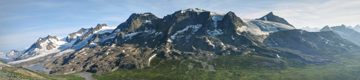
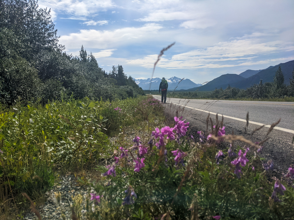
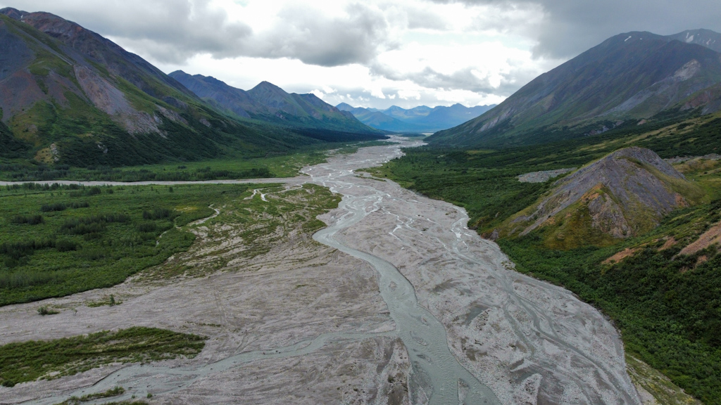
In this section, we would travel on the south side of the Alaska Range, so we walked on the road 32 miles to get to it from where we finished the previous section. The oil pipeline coming from the Arctic runs parallel to the road, and we walked at times on its service road. It was an interesting feeling walking next to millions of dollars worth of oil flowing in the same direction as us. The road walking was boring, but at least it was pretty with many glaciers in sight and not much traffic. We listened to podcasts and kept walking until our feet hurt.
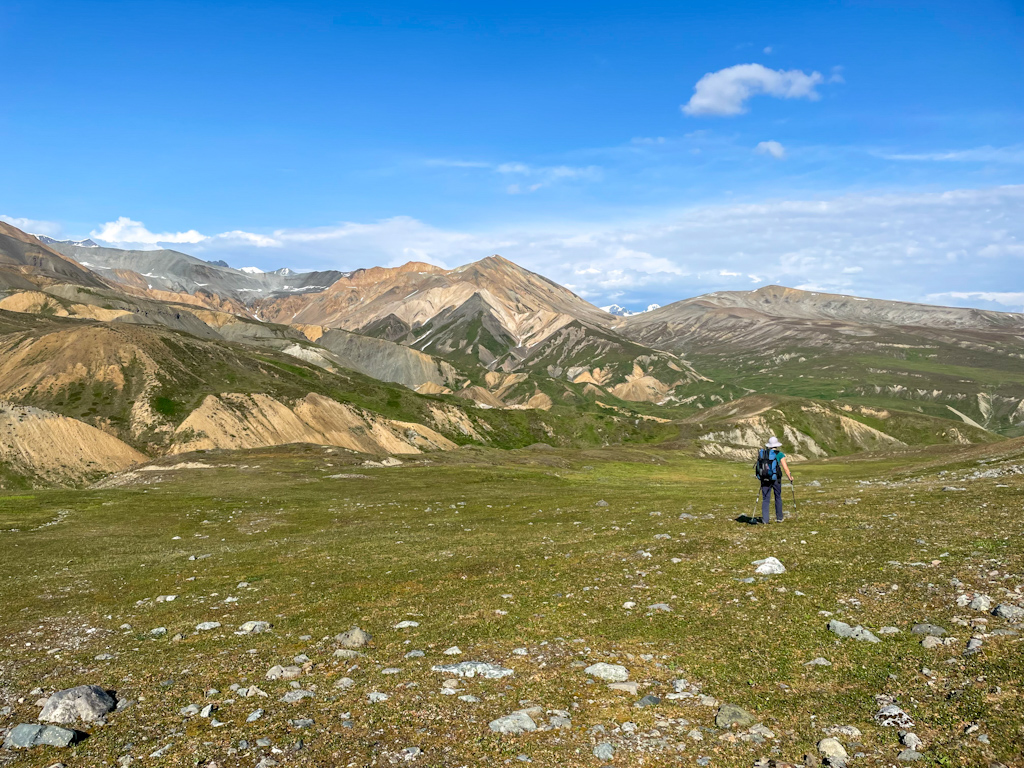
After a day and a half of road walking, we finally got the trailhead by Phelan Creek. As usual in Alaska, there were some ATV tracks going up the mountain, making it easier to walk. We saw a lot of trash left behind, from beer cans to broken car parts, even a snowmobile (!). The landscapes also had changed, and we camped in front of colorful hills that were devoid of vegetation.
We woke up to light rain and a low cloud ceiling. We waited for the worst rain to stop and then set off to first walk the 5 remaining miles to the Gakona Glacier and then cross this same glacier. Walking on the soft grass felt great, our battered and blistered feet finally stopped hurting. The landscape reminded us of Iceland, which we crossed 5 years ago, our first backpacking trip together of which we have very fond memories. The little streams that we had to cross were bordered with bright green moss, little wild flowers grew in the dark rocks, and even some of the hills were covered in multicolored rocks, just like in Iceland. Only the caribou reminded us that we were still in Alaska. We saw a herd of 14 individuals as we crossed a river and later saw 7 more of these beautiful animals.
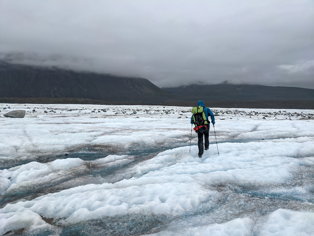
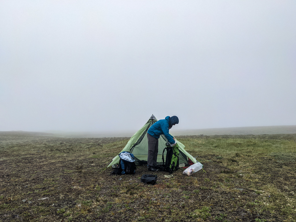
We had decided not to bring microspikes, despite the fact that we had to cross two glaciers with significant amounts of bare ice. In the previous section, we crossed the glaciers much lower, where the ice was mostly covered moraine. Although it made us a bit nervous, the ice was grippy and not steep, enough that no microspikes were necessary. Nevertheless we walked very carefully. The difficulties started as we got to the first medial moraine, and the stream of meltwater running on the surface of the glacier next to it. The stream had carved a deep canyon and there were no ice bridges across. We started hiking upstream until we found a questionable crossing, where we had to climb from a large boulder in the middle of the stream to the ice. We were not very comfortable with it, so we flew the drone further upstream looking for a safe crossing or, even better, an ice bridge. We didn’t see anything promising so we went with the crossing we had found. It ended up being safer than we thought. Luckily the rest of the glacier was easier and we crossed all the remaining glacier lobes and their crumbly moraines. It had started to rain again and we could not wait to be in our warm sleeping bag. We hiked until we found a grassy spot next to a small stream. Salomé set up the tent and Ricardo cooked away from the tent. While we have only seen very few signs that there are bears, either prints or scat, we tried not to let our guard down too much, you never know. Cooking and eating in the rain is not particularly relaxing and enjoyable though.
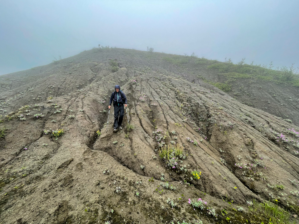
It rained the whole night and there was dense fog in the morning. There was no point in starting the day early as the weather should improve in the afternoon. We started hiking at 10 am in dense fog, and found our way down a steep clay slope only thanks to the GPS track we were following. The clay stuck to our shoes so that at times we were more sliding than walking downhill. At the bottom it should get easier, we thought, just follow a stream down to the West Fork of the Chistochina River. But we had to cross its icy, fast flowing water often reaching our knees at least 20 times. This and the now strong rain made us feel increasingly cold. Suddenly we saw a light brown shape running away from us. Was this a lynx? Yes, it definitely had its characteristics, pointy ears, a short tail and the right size. We were amazed to see this shy animal. What a treat!
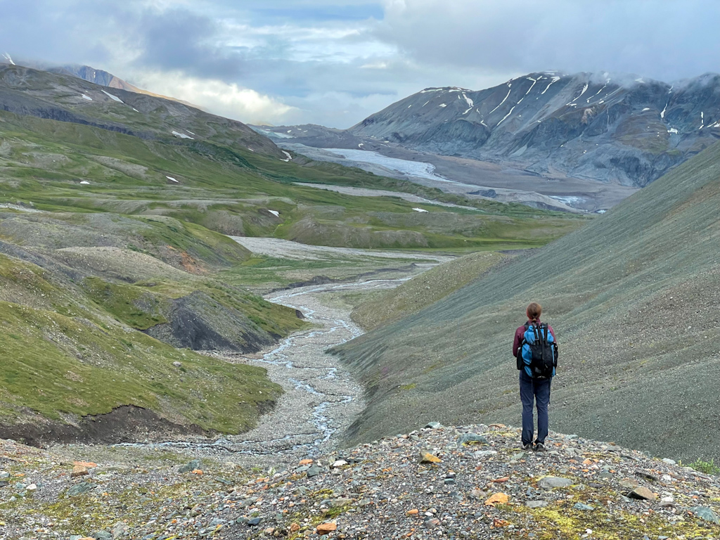
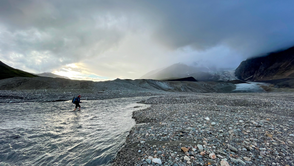
We saw a house on the other side of the West Fork of the Chistochina River. Could we eat lunch there sheltered from the rain? We finally got to the river but realized that it was flowing too fast and deep to ford it, and that there also weren’t any good put in and take out places to boat across it. We ate in the rain (again) and started walking upstream in search of a better crossing. The clear weather finally came and we were able to dry out before finding a spot close to the glacier terminus where the different outlet streams were meeting and we could cross them one by one. We still needed the packraft as the water was deep and got pretty wet in the crossing as there were no good eddies to set off and land, forcing us to get into the boat in a rushed way, gushing water into it. The important thing however was that we were across and we’d dry quickly in the now better weather walking up to a pass. We walked up the wide alpine valley with a braided river, and watched two caribou with their calves close to the pass. The scenery was beautiful and impressive. On the other side of the pass we had an equally beautiful view on our next valley to cross. The mountains in this valley ranged from black to blue to green and to orange. No wonder that there are a couple of mines close by. We enjoyed the dry weather by having dinner at a creek and then found a perfect spot for our tent not too far away. A curious caribou came to check twice who had entered its territory and left with a snort.
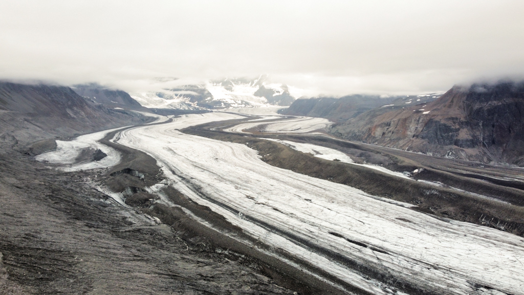
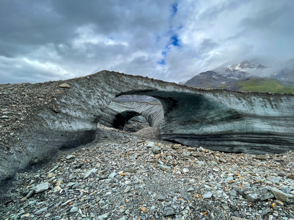
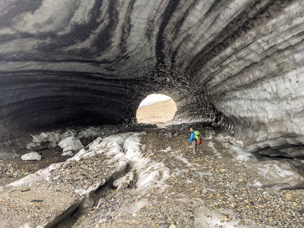
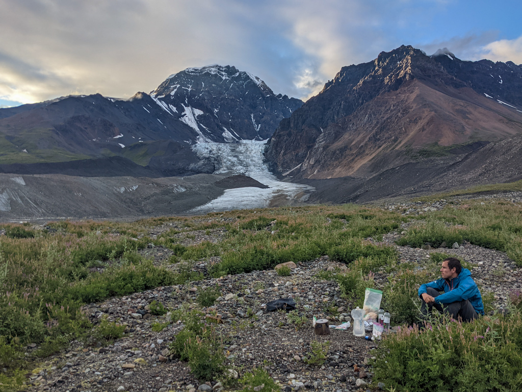
The Chistochina Glacier was the second large hurdle in this section. It flows first towards the south and divides into a glacier going towards the west and another one towards the east, the glacier having roughly an inverted “T” shape. Our crossing took us across its top bar, first up and then down the glacier. This glacier turned out to be relatively easy, every time we came across a hurdle, such as a stream, we found a bridge across. The hardest was the weather. After an hour walking on the glacier, heavy rain set in and within a couple of hours, we started to soak through our rain gear and started getting cold. As soon as we got off the glacier and found a place to set up our tent, we crawled in and waited out the weather. After 4 hours, the sun came back and we had mostly dried inside the tent. We were then treated to the most beautiful scenery of this section, the dark blue lake at the end of the glacier was reflecting the bright green mountains. We were surrounded by fireweed with its beautiful pink flowers. We packed up and started walking again at 6 pm. At the mouth of the glacier we found three spectacular ice tunnels. It was so beautiful, we spent a while exploring while being very careful not staying at their edges where they occasionally drop small stones as the ice melts. We set up camp next to another much smaller glacier. What a day!
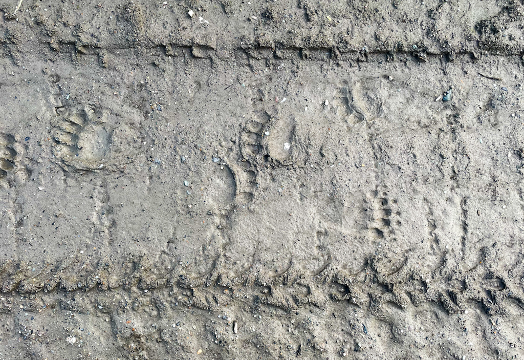
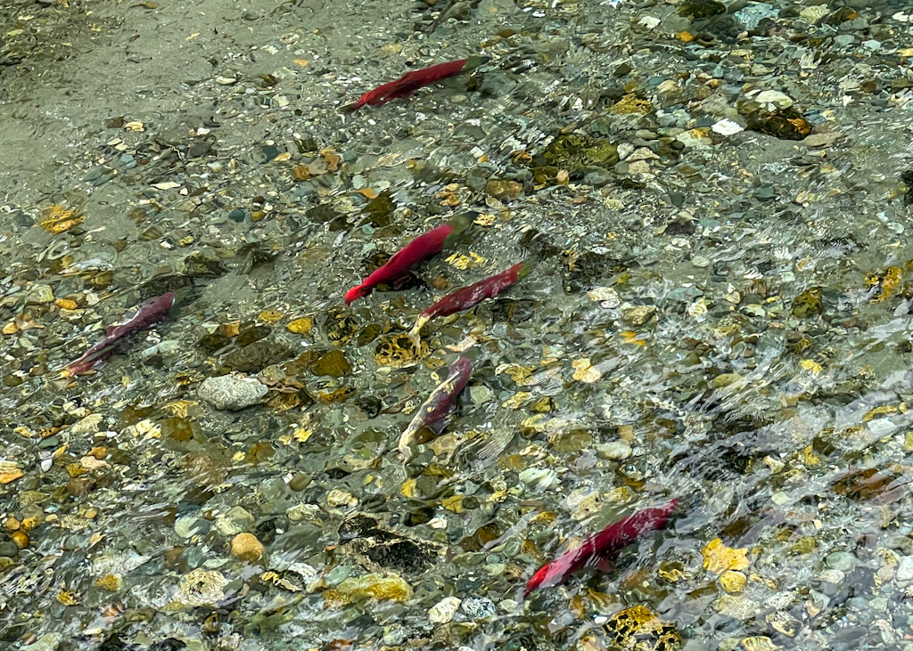
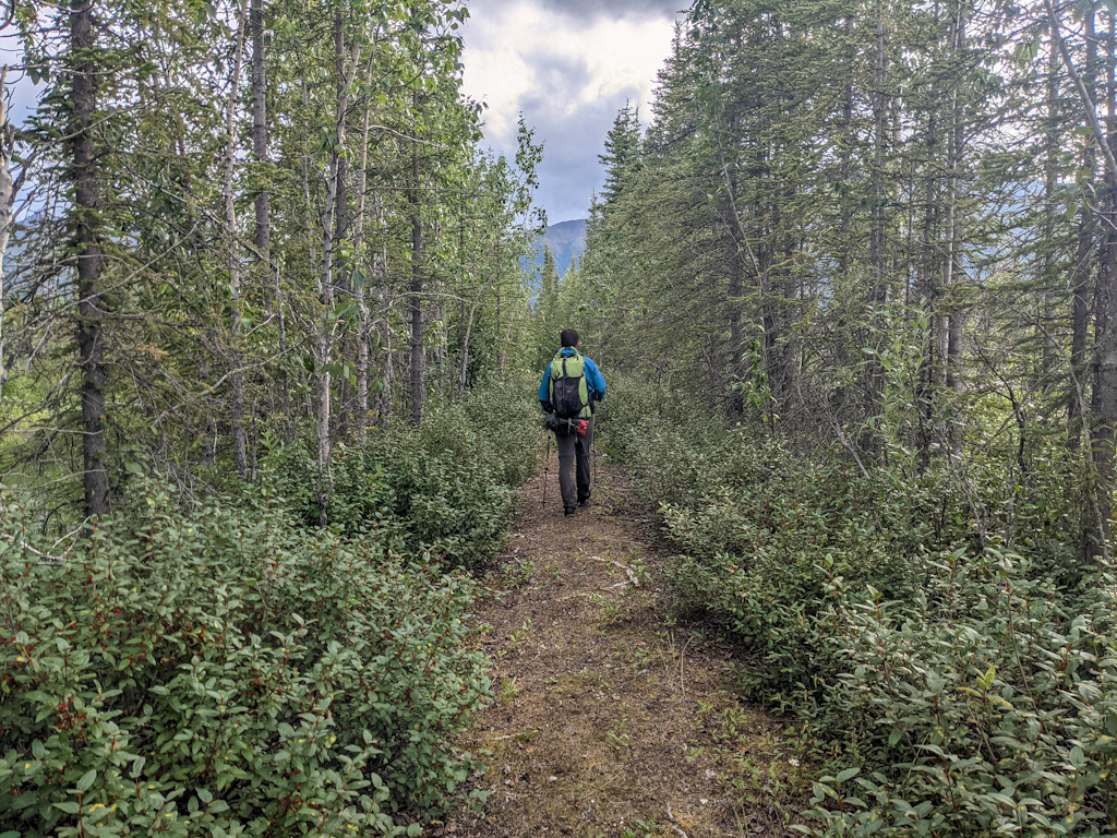
We knew that from there we were pretty close to mining roads and therefore easier travel. But we first had to bushwhack though dense, tall and wet brush and then walk down a dry stream bed. The mining road allowed for mostly easy walking up a valley and down the Slana river that we followed nearly until getting to Slana. The only difficulties were the occasional deep glacial river crossings. The wide valley cut by a glacier a long time ago was stunning. As we walked down in the river bed of the now braided Slana River, we started seeing bear and wolf prints. We decided to cook next to a clear stream (the Slana river is mostly glacial feed, its water is therefore silty) and made a fire to keep the mosquitoes away. It was getting late and we started looking for a good campsite. The numerous bear prints made us nervous and as we found a good spot to set up the tent, we ran into a black bear. It was as surprised as us and ran away immediately. We decided to walk another 15 minutes downstream before setting up the tent. We did not sleep too well, seeing a bear made us nervous. Also the large number of bald eagles and seagulls made a lot of noise the whole night. The next morning we understood why they were all there. In a quiet arm of the Slana river we saw dozens of salmon that had come to spawn.
After some bushwhacking, walking on bear trails and crossing some of the braids of the Slana river, we finally made it into an ATV track, easy walking but relatively boring. We spotted our first ripe blueberries and ate several handfuls of the delicious berries before finally reaching Mentasta Lake, a very small native village. We were hoping to find a small store for some ice cream, but had no such luck. We followed the town out on ATV trails towards the lake, where we watched more salmon and two juvenile bald eagles while having a second lunch (hiker hunger is starting to set in). We had to cross the now much bigger Slana river for the last time and were unsure whether it was doable. If not, it meant turning around and walking a large detour mostly on roads. We were elated when we made it across safely, the water nearly reached our hips but did not flow too fast, making a crossing possible. According to our maps, the ATV trail was supposed to continue on the other side of the river. No one has come though there in a while though, the trail was heavily overgrown and at times submerged in a swamp, created by beavers. Apart from the clouds of mosquitoes that followed us, we enjoyed these challenges. We then reached the eagle trail marked in our maps. We hoped that the trail really existed, otherwise it meant turning around and we were longing for dry feet, a shower and a bed in town. Not only did the trail exit, it was better than the road we had just walked on apart from moments where the trail turned into a stream. On the last day we had rain, fog and nice views on lakes. We walked the last 14.5 miles into town in record time, and made it to the post office in time before it closed at 1 pm.
We are now enjoying a day off. Our feet suffered on this stretch, being constantly wet slowly destroyed them. We use lots of cream to give them the best treatment before setting off on Friday towards McCarthy. The weather forecast looks great and we look forward to McCarthy of which we have very fond memories. We spent 2 nights there on our first Alaska trip 2 years ago.
Comments
Jeff Erickson
I love reading about your trip! You are doing things that make me have good dreams. I go over your pictures from the very beginning and I’m longing to be at some of those remote places. It’s another beautiful day here and I’m heading to the lighthouse with someone who I staying there for five weeks. On our way to pull crab pots then Seattle for a celebration of life. Best of luck to both of you. Jeff