Over the Wrangells
We left Slana much later than we had planned. Our food box arrived in the morning but multiple ziplock bags had opened, spilling nuts, M&Ms, and sticky butter powder all over the box. We spent an hour wiping down cereal bars and zip lock bags, and washing the spare socks we had shipped ourselves.
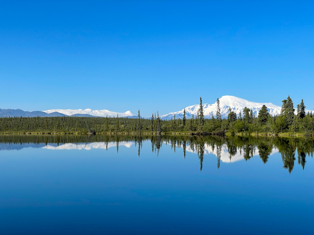
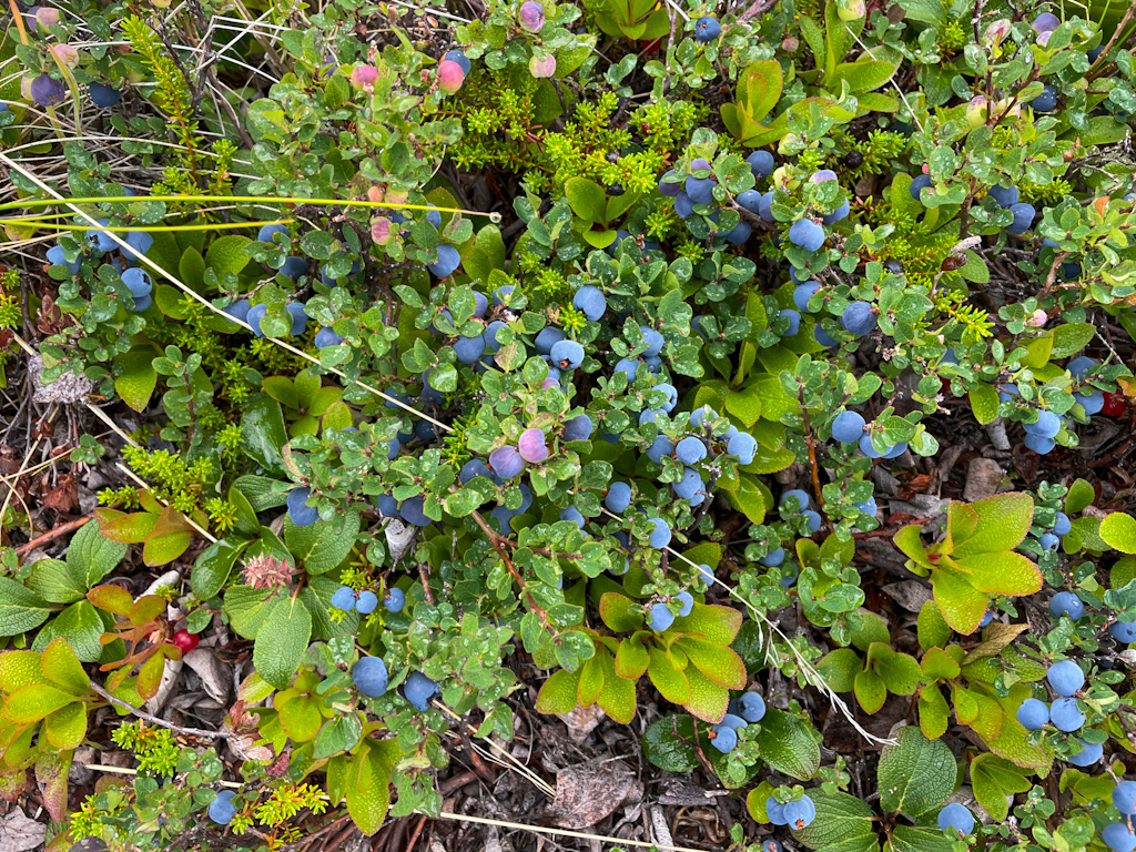
The first part of the next stretch (Slana to McCarthy) started with a 41 miles road walk to Nabesna. Walking on a road gets boring quite quickly, and much too often our thoughts drift to our sore shoulders, to our heavy backpacks, and to our feet that get sore much quicker on the hard surface. But for us, it’s often the only way to connect the beautiful, wild, and interesting parts of our adventure. The stretch from Slana to Nabesna was not short on beautiful views and brought us through forests and along lakes. We saw the tall and impressive Mount Sanford, and stuffed ourselves with blueberries growing just along the road.
In Nabesna we stayed at Devil’s Mountain Lodge, run by the Ellis family that includes multiple generations of pilots and flight mechanics. The lodge is a pretty wooden building next to a grassy landing strip with great views on many snow capped mountains. The place and its owners were so welcoming that we wished we could stay for another day - but the weather was supposed to be great the next day so we resisted the temptation.
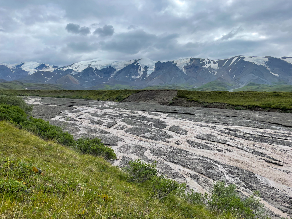
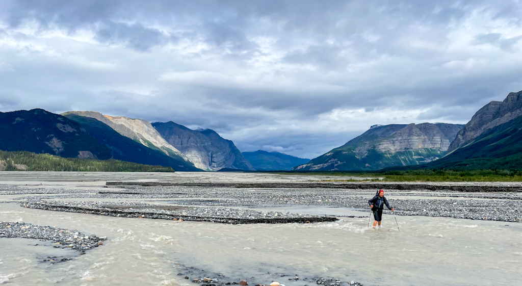
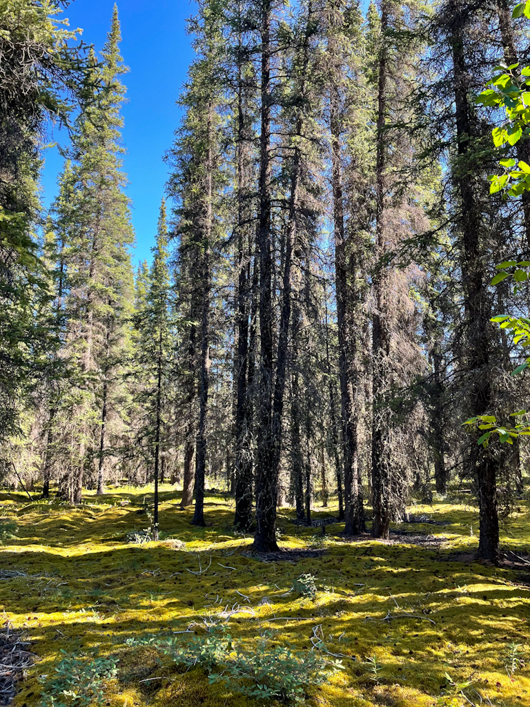
The weather on the third was perfect, sunshine, blue skies and even hot. For the first 5 miles we followed a trail that brought us through mossy forests to the Nabesna river. We knew that crossing the Nabesna was one of the biggest challenges of this stretch, especially as we had only one packraft for the two of us. The river flows from the 50 mile long Nabesna glacier and is braided and almost a mile wide. We were able to ford a few braids, the cold water often reaching our knees and numbing our feet. Five of the braids however were too deep and raging and required ferrying our packs and ourselves across with our single packraft, requiring Ricardo to paddle across these braids 5 times, a trip for each backpack and one to bring Salomé across. Between paddling Ricardo always had to walk upstream to find a good launch spot to get back to Salomé where she could help him launch again. Once we finally got across, we were astonished when we realized it had taken us more than 4 hours to cross the river! We didn’t even take a break throughout the crossing! We took a much overdue lunch break, dried our dripping wet pants, socks, and shoes and then started walking downstream towards Cooper Creek, where we would start heading East towards the community of Chisana.
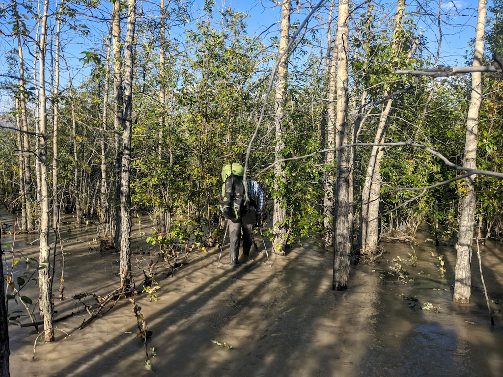
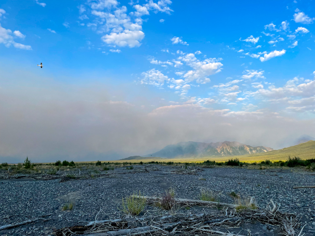
That’s when we first saw a large plume of smoke downriver. It looked as if there was a forest fire just on the other side of the mountains. It still looked far away and while worrying us, it felt safe to continue. We were first able to walk on easy terrain before reaching a very densely forested area where beavers had built a dam and the river was cutting into the forest, flooding it. Large trees had already fallen into the river. Walking up to our knees in icy cold water in the forest, often having to battle with brush at the same time was very hard, frustrating, and felt claustrophobic. When we finally made it out to a less vegetated area, our shoes were filled with silt. Luckily with a bit of clear water, we cleaned them easily. And there we saw again the forest fire, which had grown considerably. A wall of smoke as high as the nearby mountains was moving towards us, and was about to reach our destination for the day, Cooper Creek. Was it safe to continue? The whole Nabesna valley was so dry, how fast would the fire move in it?
We texted the lodge owners on our Inreach (satellite communicator) and asked them if they knew about the fire. They immediately sent out AJ, one of the pilots at the lodge, to check out the fire. This area is very dry and as we later learned a fire is overdue. We decided to ask them to fly us out as the smoke was now also filling Cooper Creek. AJ and Kirk (the lodge owner) both flew over us in their bush planes to check out the fire and see if they could land close to us. There was no good landing spot where we were, and AJ ended up having to land 2 miles away downriver, where we could not see him. As we walked towards them, AJ would take off and fly over us and land back at the landing strip, guiding us to his location. We ended up reaching the airstrip a bit after 10 pm, just early enough so that he could still fly us out with daylight (thanks to Alaska long summer days!). He first flew out Ricardo in his two-seater plane, then Salomé who kept the tent and food in case AJ couldn’t come back.
The next morning the smoke had come up the valley all the way to the lodge. We decided to stay and wait at the lodge. In the afternoon the smoke cleared, and we went to explore the abandoned gold mine at the end of the road. That evening however the dense smoke was blown back again up the valley, reminding us of the worst smoke conditions we had seen in Seattle. We decided we would skip ahead to Chisana, about 30 miles away, in order to be farther away from the fire.
We flew to Chisana in AJ’s two-seater plane, so we had to do two trips again. We flew over the Nabesna and Copper Creek, following the route we had intended to walk. The smoke was better than the day before but it still seemed smart to do ahead. Ricardo came in second, and when he landed, the twice-a-week mail plane was about to arrive to Chisana and its residents had come out to the airstrip (Chisana is very small and only has a handful of part time residents, often no one stays there all year round). One of them was Arthur, a retired Swiss pilot that lives part of the year in remote Chisana. He quickly invited us to his cabin, and as the weather turned into rain, he extended the invitation for the night. We spent the day talking to him about Alaska and the history of Chisana, home to the last gold rush in Alaska. He fell in love with Alaska, brought a bush plane from Europe over the Atlantic and bought a cabin in Chisana more than 20 years ago. We even found out that Salomé and Arthur had common acquaintances back in Switzerland!
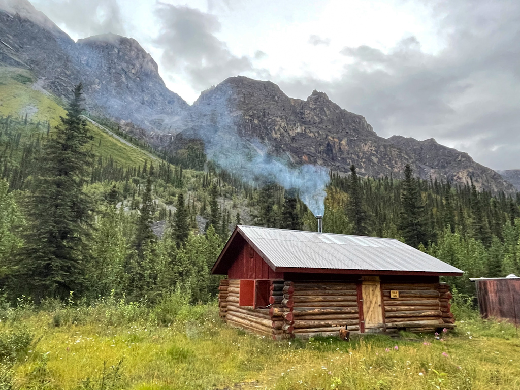
The next day we set off towards McCarthy, after enjoying a delicious breakfast with freshly baked bread that Arthur prepared. Our route would follow the land route to McCarthy that many of the gold miners in Chisana took in the 1910s. The railway used to connect McCarthy with the port town Cordova. We spent a day walking up Geohenda Creek, and finally connected to a trail over a grassy mountain pass that brought us to an emergency shelter cabin, built in the gold rush times. We spent the night at the cabin and enjoyed reading the logbook and scribbled walls containing many names of great Alaskan adventurers we recognized.
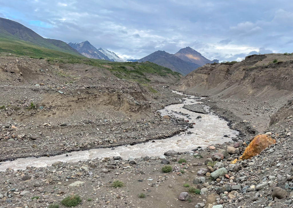
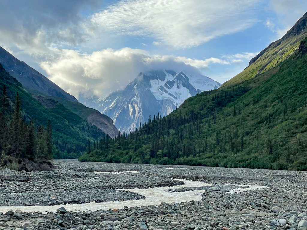
We continued due south and started hiking up the White River drainage towards the massive Russell Glacier. But before reaching the glacier, we had to cross two treacherous glacial creeks that carried enormous quantities of water for their size. We got to the first crossing in the early afternoon and thought we couldn’t cross it until the next day as the water was over hip deep and extremely fast. On a second try, we walked more than a mile downstream close to the White River, where the creek was more braided. One by one, we were able to cross the dozen or so braids of silty, ice-cold water. We decided to camp early and make sure to cross the second tricky creek very early in the morning.
We woke up at 5am and reached Flood Creek by 8am. Although it is fed by a much smaller glacier than the creek of the day before, Flood Creek runs in a small canyon, mostly in a single channel. The only braided spots were steep, with lots of whitewater. We were able to cross it, but had to do it together, where Ricardo stands in front of Salomé facing the current and she holds onto his backpack. The creek was almost hip-deep, and the splashing water got our t-shirts wet. We unfortunately don’t have photos of such hard crossings, as we store all electronics away, except for the satellite communicator, which we keep in a pocket in case we were to fall in the river and lose our packs.
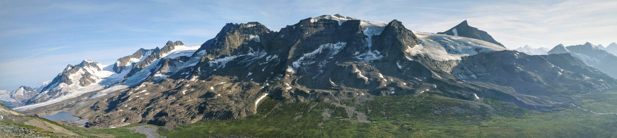
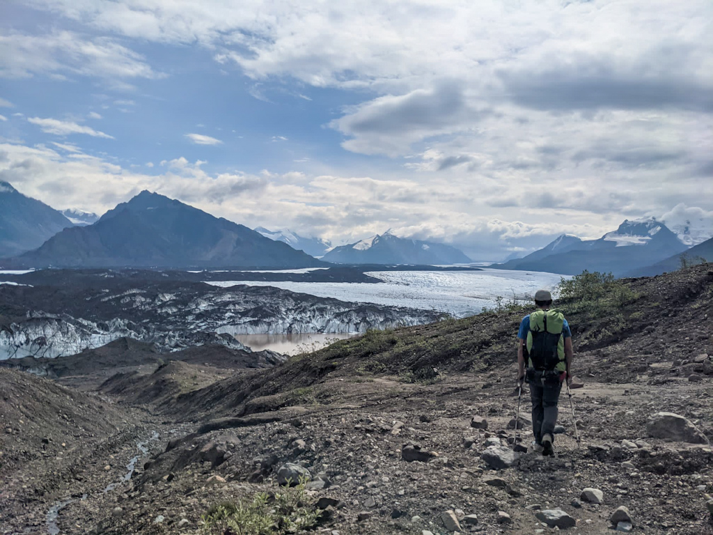
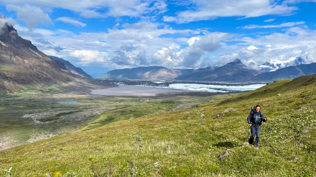
Already before Flood Creek, the route contours the glacier on its lateral moraine. A bit further up, a large lake with floating iceberg appeared between the glacier and the valley side. Going around the lake, we quickly realized that we had been standing on moraine covered ice, and as the ice got closer to the surface, some of the moraine became saturated with water and extremely muddy due to the large quantities of silt in it. We spent the rest of this stretch avoiding large mud pits while sneaking between the glacier and the steep valley walls. We saw a dozen sheep perched high up on the clouds above us. The going became easier as we reached Upper Skolai Lake, from which we could see far into the Russell Glacier valley.
We finally crossed Skolai Pass, and entered the Copper River watershed. Before that, both the Nabesna and White River flow to the Yukon River and end up in the Bering Sea. A nasty downpour forced us to put on our rain gear, but the skies opened up shortly after, the sun even came back out. We headed towards the Chitistone Pass, and climbed on steep grassy slopes until we got to a large bench, where we finally found the old miners trail. It followed the bench’s edge, providing superb views of Skolai Pass and Russell Glacier. We finally made it over the pass and camped early in the head of the Chitistone Valley, in anticipation of hard terrain ahead.
The next morning, we were a bit nervous, and the foggy weather reflected our mood. The trail ahead is called the goat trail, due to a section of steep scree slopes that it crosses to go around a massive gorge. The guidebook said that more than one person saw the goat trail and then turned around not wanting to do it because it is so exposed. Especially for Salomé, who has vertigo, it would not be an easy task. It also warned that the crossing of the Chitistone river, especially after the outlet of the large Chitistone glacier, would be tricky.
At least soon after we started walking we dropped below the clouds and it stayed dry the whole day. The first part was easy, on mellow grassy slopes along the Chitistone River fun where we observed 21 dall sheep on the ridge. The goat trail took us up multiple canyons on very steep and high scree slopes. The guidebook was indeed not exaggerating, the trail was so exposed that we did not enjoy parts of it. Luckily the hardest bit came at the end, when turning around did not seem like a good option anymore. Salomé started to suffer from vertigo. To help her, Ricardo took the lead allowing her to only focus on Ricardo’s feet, use the few steps he had to kick and not ever look up or down. We were so relieved when we were done. We hiked down an easy grassy slope to a stream where we stopped to collect some drinking water. After all these difficulties we needed a short break and got incredibly lucky seeing a wolf within 20 meters crossing the same stream we just crossed. We clearly saw his tongue hanging as he was walking by us. It is so rare to see these shy animals from so close!
The remainder of the goat trail was a beautiful and easy trail that brought us to a high plateau in front of the impressive Chitistone waterfall. From there, we had to bushwhack down to the Chististone glacier, first through willow, then alder and then finally through cottonwood trees. It was very disorienting, we were constantly in brush that was taller than us and were incredibly lucky to have chosen to follow a ravine that didn’t cliff out at the bottom. We headed upstream to where the Chitistone river and outlet of the Chitistone glacier meet, and where the glacier outlet is more braided and shallow. We managed to cross it without too many difficulties but the water was so cold, and we were hit by multiple chunks of ice floating in the river. We also waded a chest-deep hole, where there wasn’t hardly any current making it safe but just very cold. Once across our feet were numb and needed quite some time to warm up again.
We now started heading down the Chitistone river that would later merge with Nizina River which would take us to McCarthy. Crossing the supposedly hard Toby Creek turned out to be fairly easy. We hoped the much bigger Glacier Creek would be equally easier than our guidebook which said that it was basically not crossable. We knew however of multiple parties who had forded it, some even carrying mountain bikes. When we got there, we scouted for the easiest crossing, but the spot we chose didn’t work, it was just flowing too fast and too deep. We tried in a different spot up the river and failed again. We had taken off our pants to reduce friction to make the crossings easier, but now we were wet and our feet were ice-cold. Suddenly, a front of cold rain and strong winds hit us, and we started to shiver. The emergency shelter close by sounded tempting, we nearly gave up on crossing this creek. We tried to cross in one last spot, almost where the creek drains to the river and we finally managed it! Hiding from the rain behind a bush we quickly put back into our pants, added rain pants and warm layers and walked as fast as we could on the now easy terrain towards another public use cabin where we planned to have our second lunch sheltered from the rain. This cabin was rebuilt by the national park in the place and style of the roadhouse that used to be in this place. The roadhouse was a place where the miners could stay for the night and get a meal on their hike from McCarthy to the gold mine in Chisana. The cabin was so beautiful, clean and cozy that we knew instantly that it would be hard to leave. We sat down at the table and then found the surprise packet that Arthur, our Swiss friend from Chisana had flown in the day before (many public use cabins in the park have an airstrip nearby, and most people access them by plane). After enjoying a hot meal and the fruit, vegetables, beers an vs swiss chocolate from the care package by the stove that was now warming the hut, it was clear that we would not leave that day. The weather forecast also announced better weather for the next day. We spent the afternoon and evening reading the fascinating story of Martin and Augusta Radovan. The national park service had left two copies in the cabin, perfect for us! Martin, originally from today’s Croatia left his country and moved to the US, ending up in Alaska building the railway from Cordova to the copper mines at Kennicott. After the railway was built in 1913, Martin moved first to a settlement in Dan Creek, close to McCarthy, where he staked a couple of claims, and started looking for gold. He later staked copper claims in the Glacier Creek. He was able to climb up walls that nobody else had managed to climb and with his wife Augusta started building a trail to a promising prospect where he believed that there would be copper. He worked relentlessly, with mostly hand tools only to build mine shafts that during the winter filled completely with debris, making progress extremely slow. Unfortunately not much copper was ever found even though he persevered until the 1970s. He however seemed happy in the kind of life he led, creating deep bonds with the wildlife there, especially after his wife passed away in 1944. Reading this story we learned of the fate of most miners that came into this area, who worked hard and relentlessly and often did not find much copper or gold.
The next morning it wasn’t raining anymore, and we headed towards the Nizina River. We knew we had 2 bushwhacks ahead of us, where the river pinched the valley walls, forcing us to go around it in the dense, steep forest. The first bushwhack was hard, everything was wet from the rain, it was very steep, dense and slippery. We constantly had to climb over and under fallen trees and push through dense brush. When we finally made it out, walking on the easy river banks we made good progress. We crossed the easy Dan Creek and were delighted when we realized that the second bushwhack wasn’t as hard as we expected. The forest in most parts was not dense, we even found an old log cabin that was falling apart. Hundred years ago when the railway was still going to McCarthy, this area was much more populated than today. Only clouds of mosquitoes were hard to bear, and we moved as fast as possible to get away from them.
We realized at this moment that we could make it to McCarthy the same day, get a much needed shower and a good meal. But first, we had to cross the giant Nizina River. After being able to ford the first few braids and looking at the satellite imagery, it looked not too hard. What we did not know was that the main braids had moved to the far side where we were headed. We loaded all our gear inside the tubes of the single packraft we had, Ricardo sat in the back and paddled, Salomé sat in the front and pointed out possible hazards and shallow areas. The beginning went well but then we hit bigger waves and also a lot of wood in the water close to the shore. We paddled around them, and made it to the other shore. Now we just needed to find a place to stop the boat, usually an eddy behind a constriction where water is calmer. But we couldn’t find any. We bumped against the shore hoping it would stop the raft to no avail. Luckily, a willow grew close to the shore, with its thickets flattened due to earlier floods. We were able to grab the thickets, stop the boat and get on solid ground. We were soaked up to our belly, as a lot of water had entered the boat. We got naked, wrung out our clothes and put them back on, as we carry no spares. According to our satellite imagery, we’d be able now to cross a few small braids and reach the road. But again, the river had changed its course and instead we had to climb up a cliff following an animal trail. From there we followed a small road leading to the main road to McCarthy. Back in the day there was a bridge crossing the Nizina, which of course had been swept away many years ago. The rest of the way to McCarthy was easy, 9 miles on a muddy road. We raced hoping to get into town before the restaurant closed, which we managed!

Comments
Bea
I just want to say how much I enjoy reading your posts. Thank you for sharing a bit of your adventure with us!
Rick Szeliski
A wonderful read. I’d been meaning to read your blog since you started, but this was my first chance, so now I’ll have to go back and read from the start.