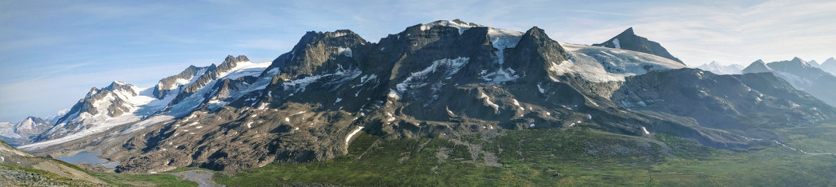
Beautiful Alaska Range
So far in our journey in Alaska we have been following Alaska’s coastal mountain range. There are two other main mountain ranges in Alaska: the Alaska Range and the Brooks Range. Mount Denali is without doubt the most known mountain in the Alaska range. The Brooks Range is located further to the north, north of the Arctic Circle.
Our plane departed Seattle around 9 pm, just as the sun started to set. We landed close to midnight in Fairbanks where the sun was still shining. The next morning we took the train to Denali national park, a beautiful ride where we were lucky to see Mount Denali. From there we headed to our comfortable and breakfast in Healy, had a last dinner at the brewery and enjoyed some last town comforts.
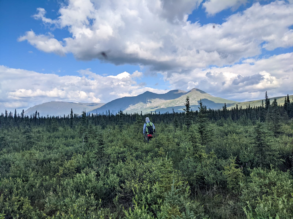
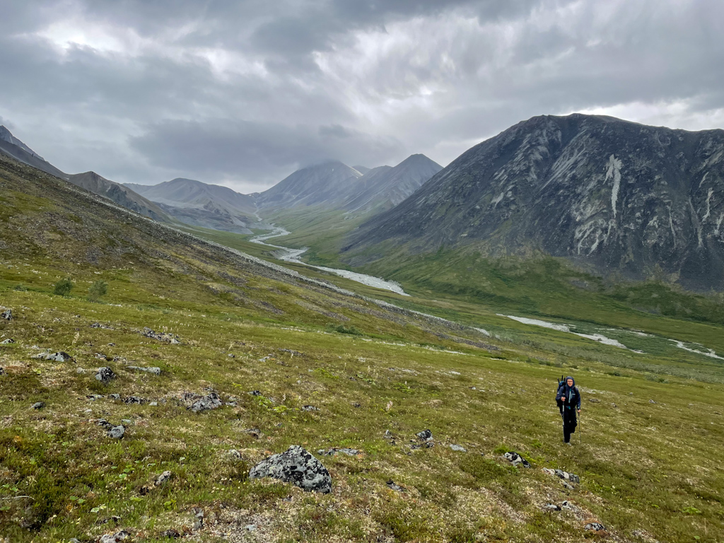
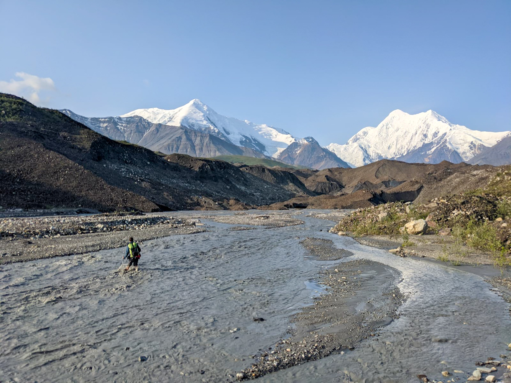
Our wonderful host drove us the next morning to the end of the paved road towards the Usibelli coal mine. The first 10 miles were easy walking on the gravel road after which we transitioned to walking in the river bed of the braided Wood River. Walking up this river was fairly easy but kept our feet wet as we kept crossing braids to find the best walking in the gravelly island left by the river. We kept finding 4-wheeler (that’s how Alaskans call quads or ATVs) tracks which provided for easy walking. Salomé felt tired pretty early, much sooner than normally. She felt pretty out of shape probably because she had been so sick and bed bound not long ago. Her back also started hurting pretty badly. We made camp early hoping that she’d feel better the next day. The sun was still shining onto our tent at 9 pm, we were roasting inside.
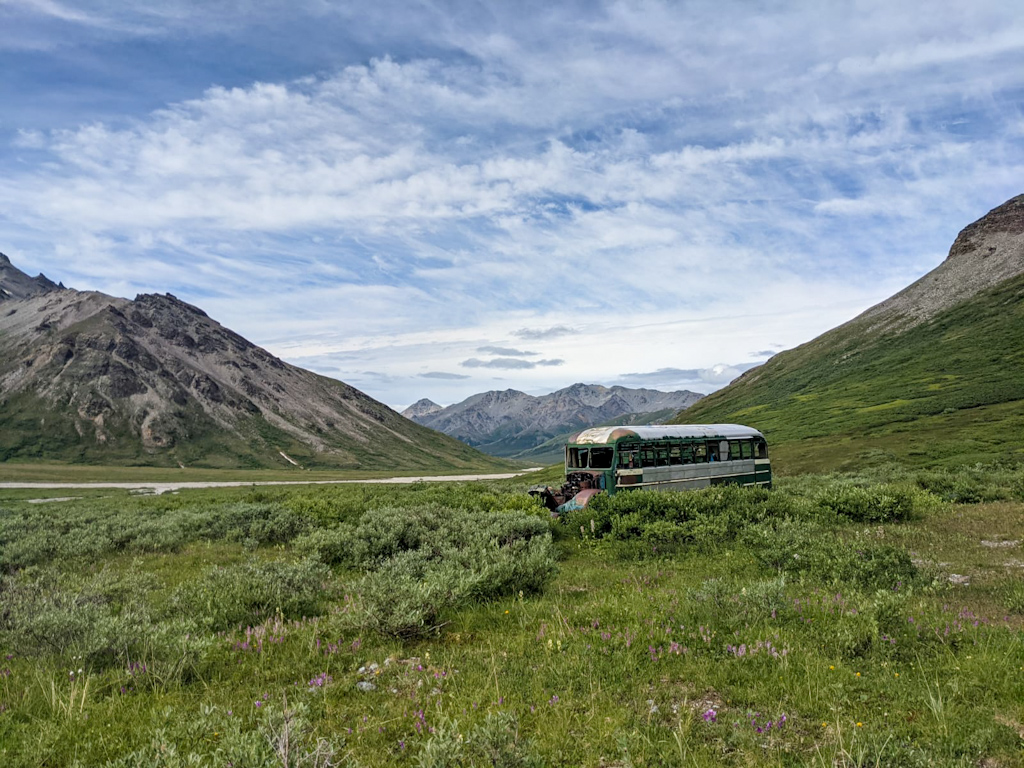
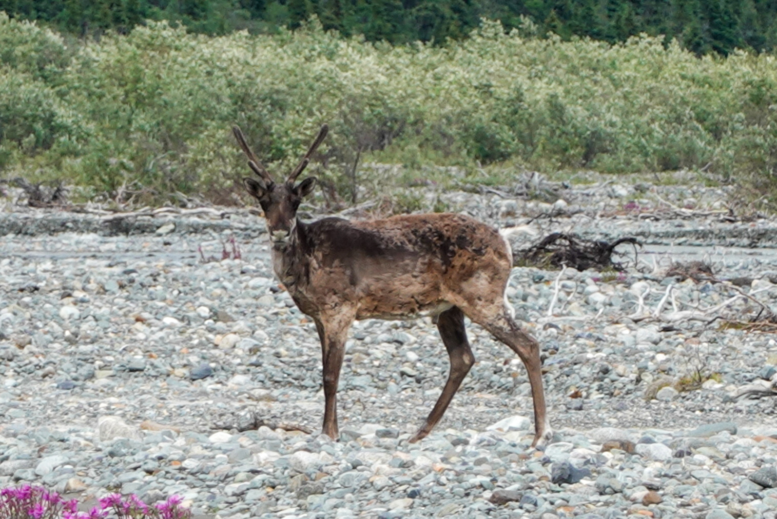
Unfortunately over night Salomé’s back got worse. We applied an anti-inflammatory patch to her back and laid down for another 2 hours in the morning. When we finally left Ricardo carried a lot of her weight, but at least she could continue walking. We found an old bus that someone had used to live in, very similar to the Magic Bus that used to be closer to Denali National Park. The view from there was stunning, but the inside of the bus was so rusted that entering it was not safe. We were surprised to find good trails over Cody Pass where we watched 5 dall sheep fight and saw our first caribou. We camped in the meadow full of wildflowers next to the beautiful Cody cabin, an old trappers cabin. We learned the next day from the owner of the Wood River Lodge that this cabin and the cabins of the Wood River lodge were built by people who initially came around 1900 looking for gold but there was none in this area. Some of them stayed and built cabins from where they first supplied logs to Nenana for the construction of the railway, as wood started to get scarce there, and later supplied meat. Both the logs and meat were brought by horse over Cody Pass towards Healy.
Salomé felt a lot better the next day and we decided to continue our hike and found good horse trails to the Wood River Lodge where the friendly owner invited us to a soda. We then walked up the braided Wood River and enjoyed the sunshine and views on our first glacier. The next day was again pretty similar, going up a river and walking down the braided west fork of the Little Delta River.
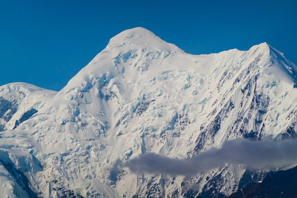
We knew that the weather forecast for our fifth day was not looking good. We were wondering whether to take a weather day, hiding from the rain. However the rain that morning was not too bad and we set off up a river over an alpine pass where we had to navigate a very fresh rockfall and snow on our way down in the now strong rain and cold wind. As soon as we reached easier terrain we were able to warm up again by adding more layers and walking fast. As the rain stopped, we saw a herd of caribou, about 6 females with calves. We later find a good camp spot on a beautiful plateau with lots of wildflowers in front of the tall Mount Deborah and Mount Hess as well as the Gillam Glacier that we hoped to see the next day with better weather.
We dropped down from the plateau to the Gillam Glacier in dense and tall brush, often taller than us. We used our single packraft to cross the west fork of the Little Delta River since it was deep and raging. We had left our second packraft in Seattle to lessen a bit our load. The river was too big to cross again which meant that we had to bushwhack along its eastern shore which was not too difficult until we got to a section where the river was flooding the forest and we had to walk in sponga the last two hours is the day. Sponga is very soft, mossy, swampy and uneven terrain - extremely tiring. Nonetheless, we found some delicious cloudberries, which we had never tried.
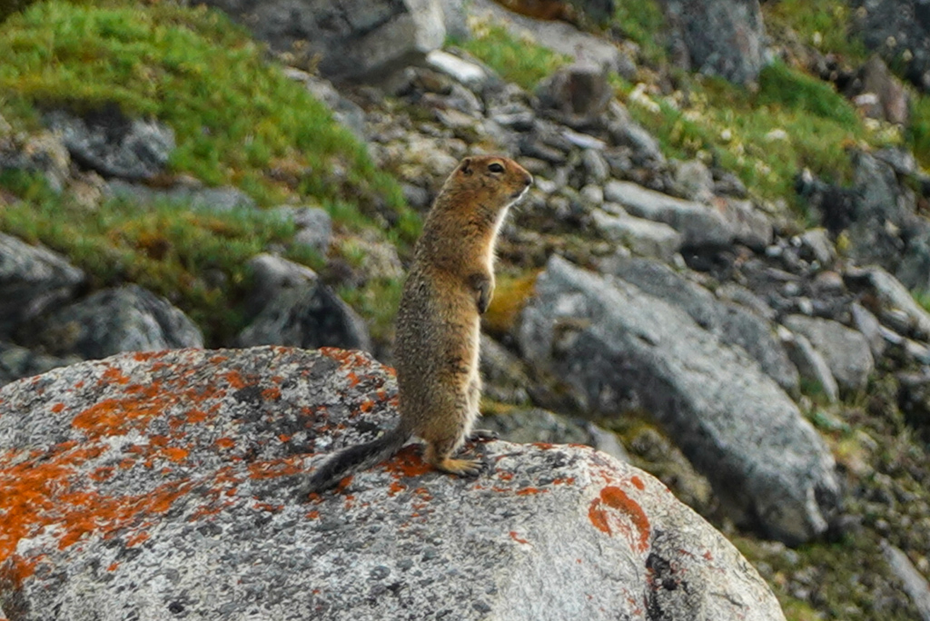
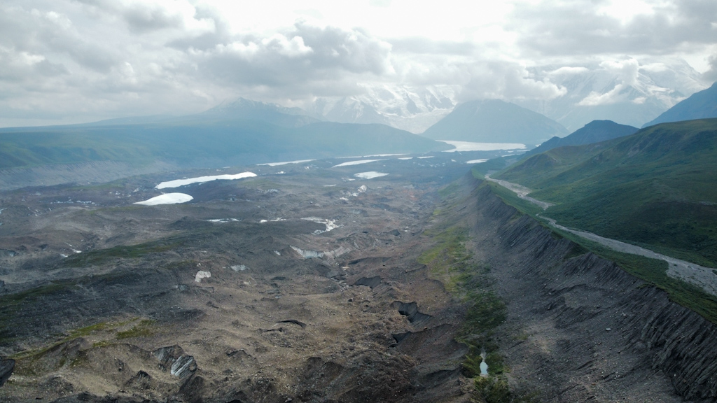
We hoped to cross Whistler creek that night but when we got there it was raging, deep, dark brown and we could hear it move boulders - pretty scary. We did not expect this, this was not a major creek crossing in that section. We decided to camp. It is a mostly glacier fed creek and therefore should be lower in the morning. As expected, the creek looked better in the morning and we found a safe spot to cross before climbing up a slope in dense brush. We experienced for the first time lots of mosquitoes and were very happy we brought our bug shirts. We walked the rest of the day on a rocky moraine of the Hayes Glacier with stunning views on it and its surrounding peaks and watched numerous ground squirrels and a grouse family. The male grouse tried to lure us away from the female and the five chicks.
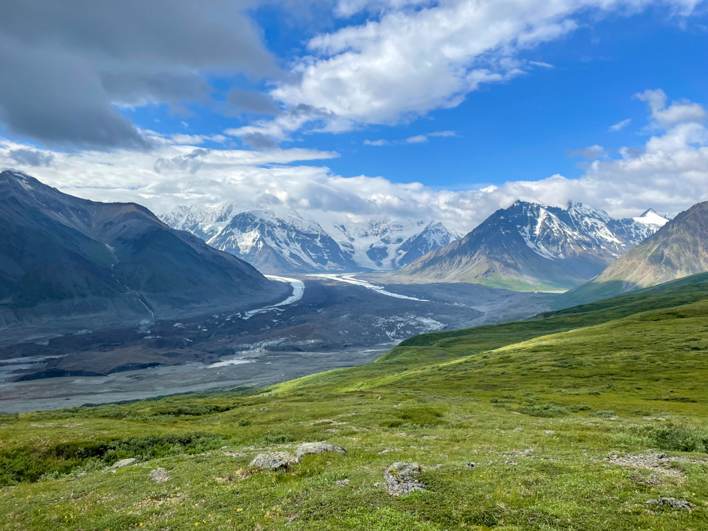
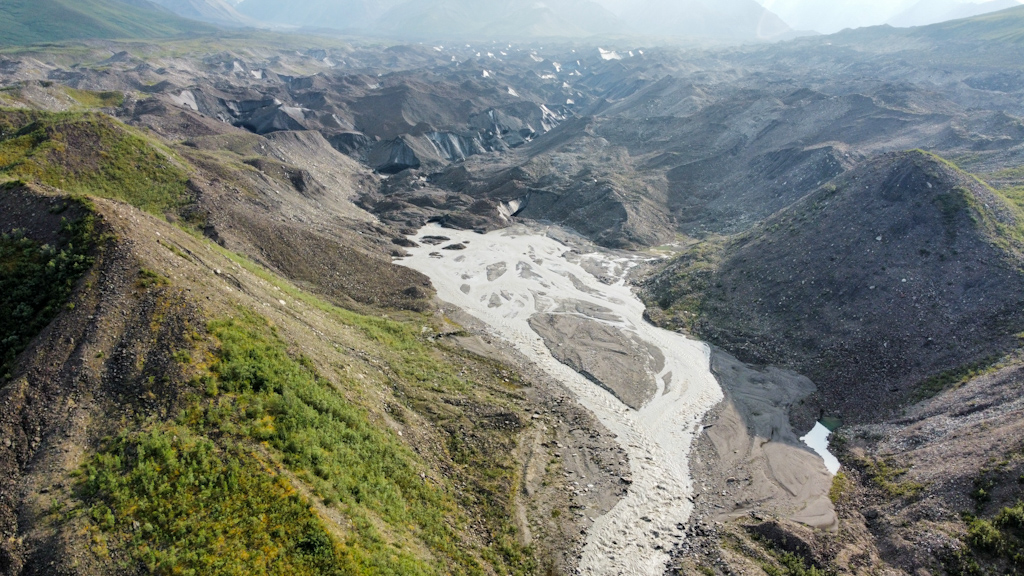
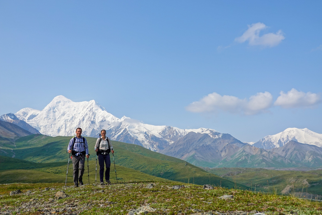
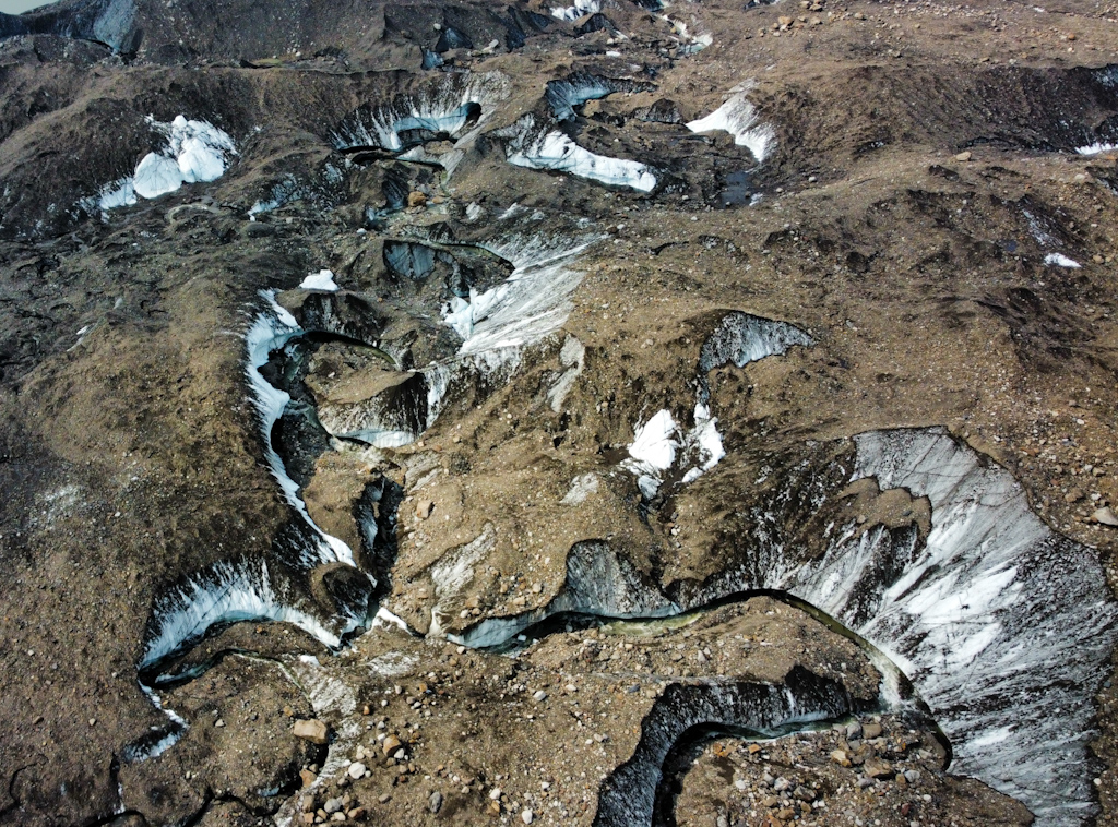
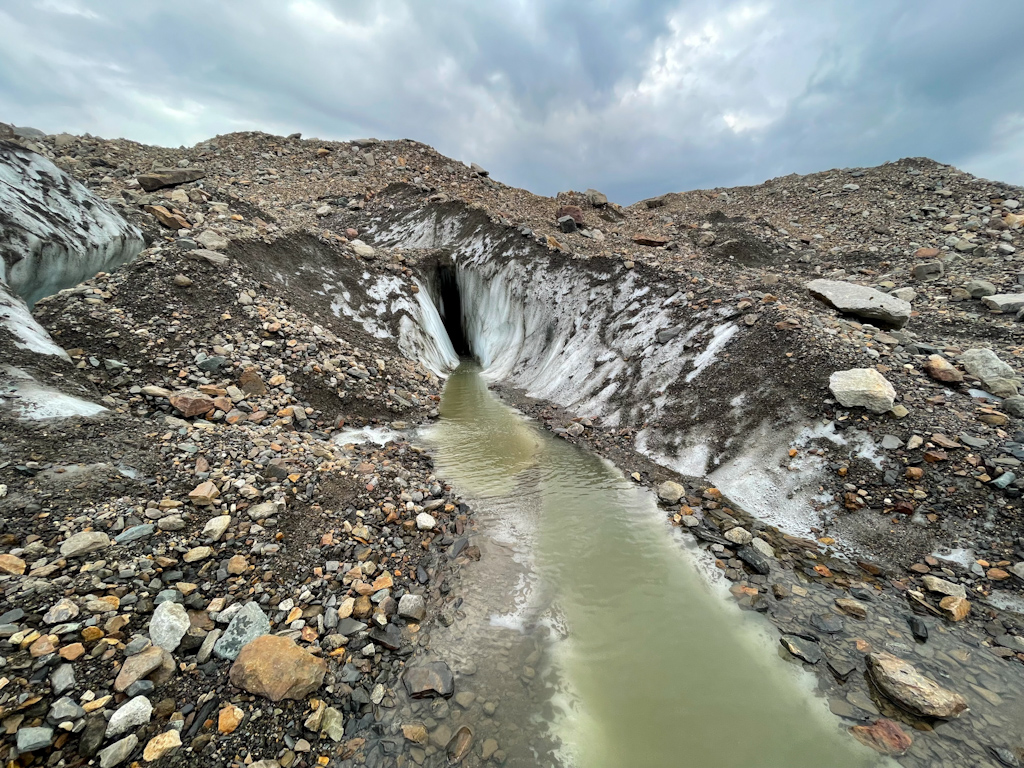
Once we reached the east fork is the Hayes River, the main exit of the giant Hayes Glacier, we knew that we would again face a tricky river crossing. We scouted it with our little drone before making camp seeing that it was easiest to cross at the mouth off the glacier. We headed there the next day under blue skies with amazing views on the beautiful mount Hayes but realized, once we crossed nearly all the braids of the river, that the last one was too deep to ford safely. We decided to go back and caus the river on the glacier but first had to warm up our feet. We climbed back up to a plateau full of wildflowers and stunning views. Salomé had made it her mission to photograph all types of wildflowers she could find on this section which made for slow hiking progress in this beautiful meadow. We reached the Trident Glacier in the early afternoon and decided to attempt its crossing since we had decent weather. We used again the drone to scout a route around crevasses and exposed ice. All went well until nearly the end where we got stuck by a stream on the glacier that had dug a pretty deep channel . We had not brought microspikes and were worried of slipping. Again with the drone we found a way out, we first flew it south realizing that the stream has carved a deep canyon without bridges. Going north a third of a mile, we saw an easier crossing, that ended up working well for us. Before heading to Alaska again we were wondering whether to bring the drone, we never thought it would be that useful.
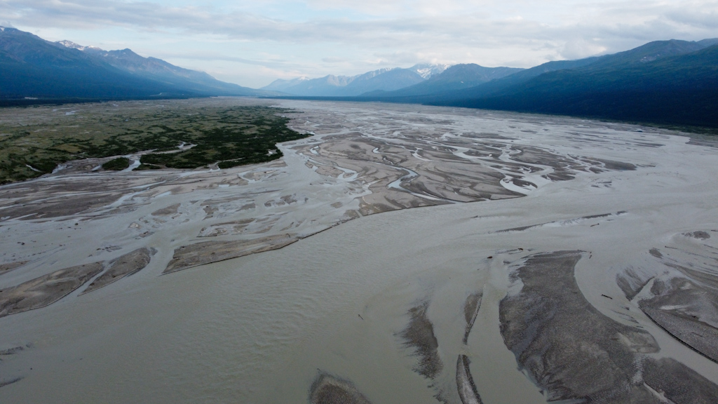
Our last day started in dense fog. We used compass bearings to navigate through a featureless sponge flat ridge, as we were running low on battery on our phones. While having lunch we watched a caribou with her calf and then climbed a last pass before dropping to the Delta River on ATV tracks. The Delta River is a very large and wide braided river. We had read 4 trip reports of which 3 encountered difficulties crossing it and flipped with their boats. We were nervous. We reached it at 9 pm. The crossing looked less scary than we expected and the weather was good. After scouting it with our drone, we decided to go for it. Since it did not get dark here, crossing it so late made sense. After discussing what we’d do in case we flipped, we informed a friend about our crossing with our satellite messenger, readied all safety equipment, stashed our gear inside the single packraft we brought and set off just before 10 pm. Ricardo sat in the back and paddled, Salomé sat in the front with her legs dangling off the boat. She had better visibility and warned Ricardo about shallow areas and obstacles. In the end we crossed without issues and even enjoyed the crossing.
On the other side, we reached the highway easily via an ATV track and hoped to hitch a ride the next town, Delta Junction. We gave up after an hour and we waited over 2 hours the next day to finally find a ride. We thought it would be easier!
We really enjoyed this last section. It had beautiful views and mostly good weather. We also enjoyed seeing so much wildlife and the abundant wildflowers. It had the right amount of challenges that we were able to solve. We look forward to our next section along the Alaska Range.
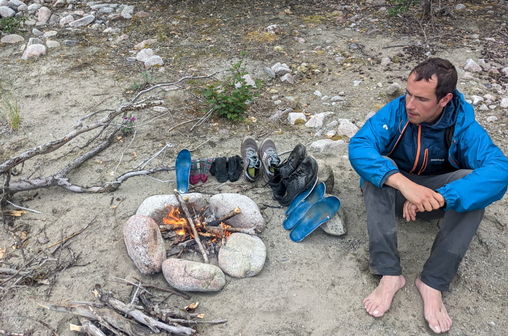
Tonight as we bought some last food items for the next section at the local grocery store, Clint overheard us taking to the cashier about our hike. He invited us to his house where he and his housemates Kevin and Summer cooked a delicious meal for us. We spent a fun evening trading stories. We just love how welcoming Alaskans are!
Comments
Clint Cooper
Hey guys! Thanks for the shout out, it was great meeting you! Keep it up and good luck on your way to McCarthy!