Of Sun And Winds
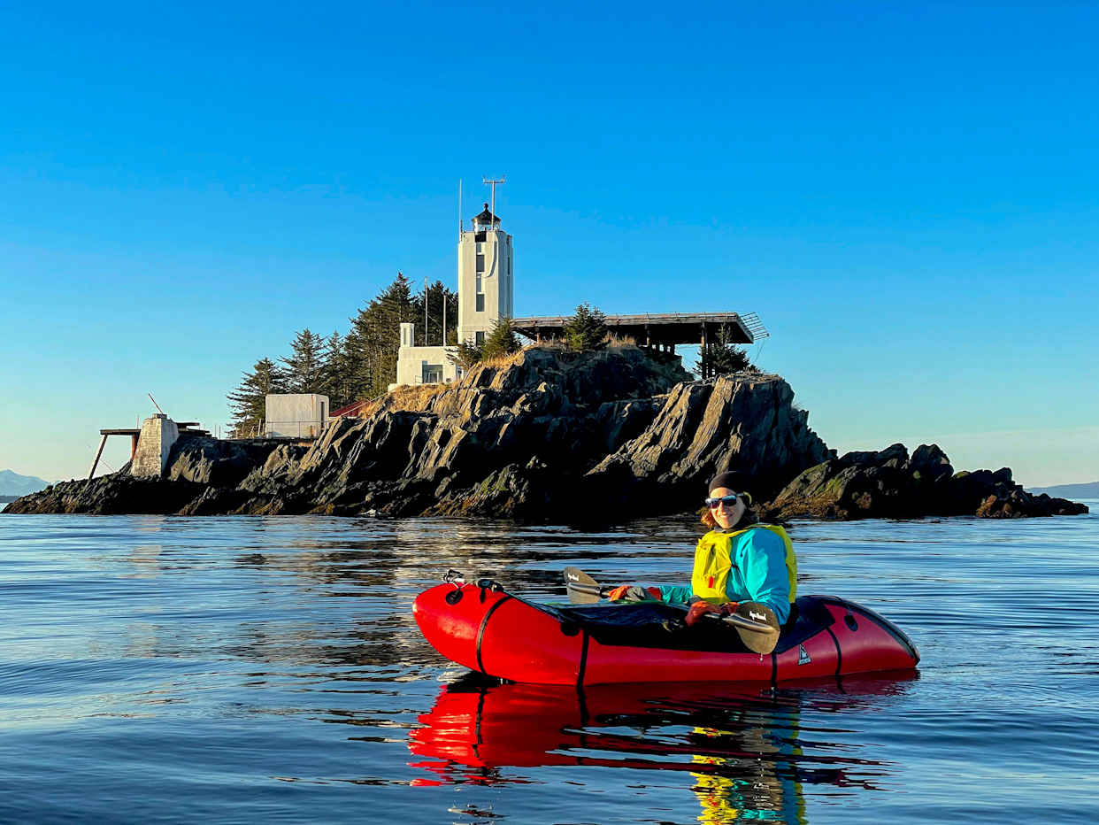
On Monday we left very early the beautiful Five Finger Lighthouse trying to catch low winds and a high tide that would make it easy for us to leave the rocky island where the lighthouse sits. Our goal was to get to the Glass Peninsula of Admiralty Island, whose beaches are easy to walk and could give us some protection from the northerly winds. Although in a straight line it was about 20 miles north of the lighthouse, such a long open water crossing would be reckless, as you would be at the mercy of the ocean for a whole day. Any change in weather would put you in trouble miles away from land. Instead, we island hopped, first to Akusha and then to Sail Islands, the former being an old fox farm that we didn’t get time to explore. After lunch, we did a long 5 mile crossing east, where we hoped to get assistance from the tide, but a massive eddy made the last mile a slog to land. Eddies are locations in a river or a canal where the water recirculates and flows against the main current. They can also be very useful when paddling against the current. This one was the biggest we had ever seen!
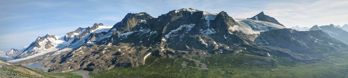
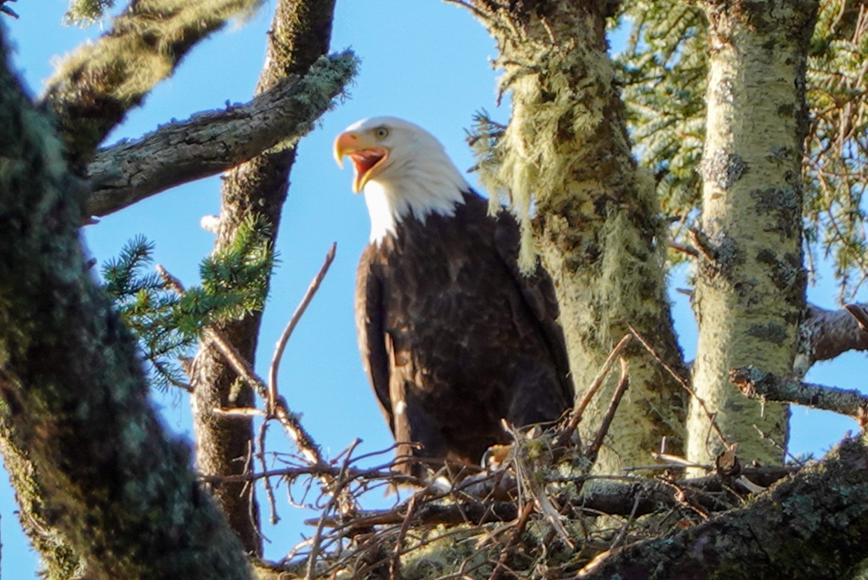
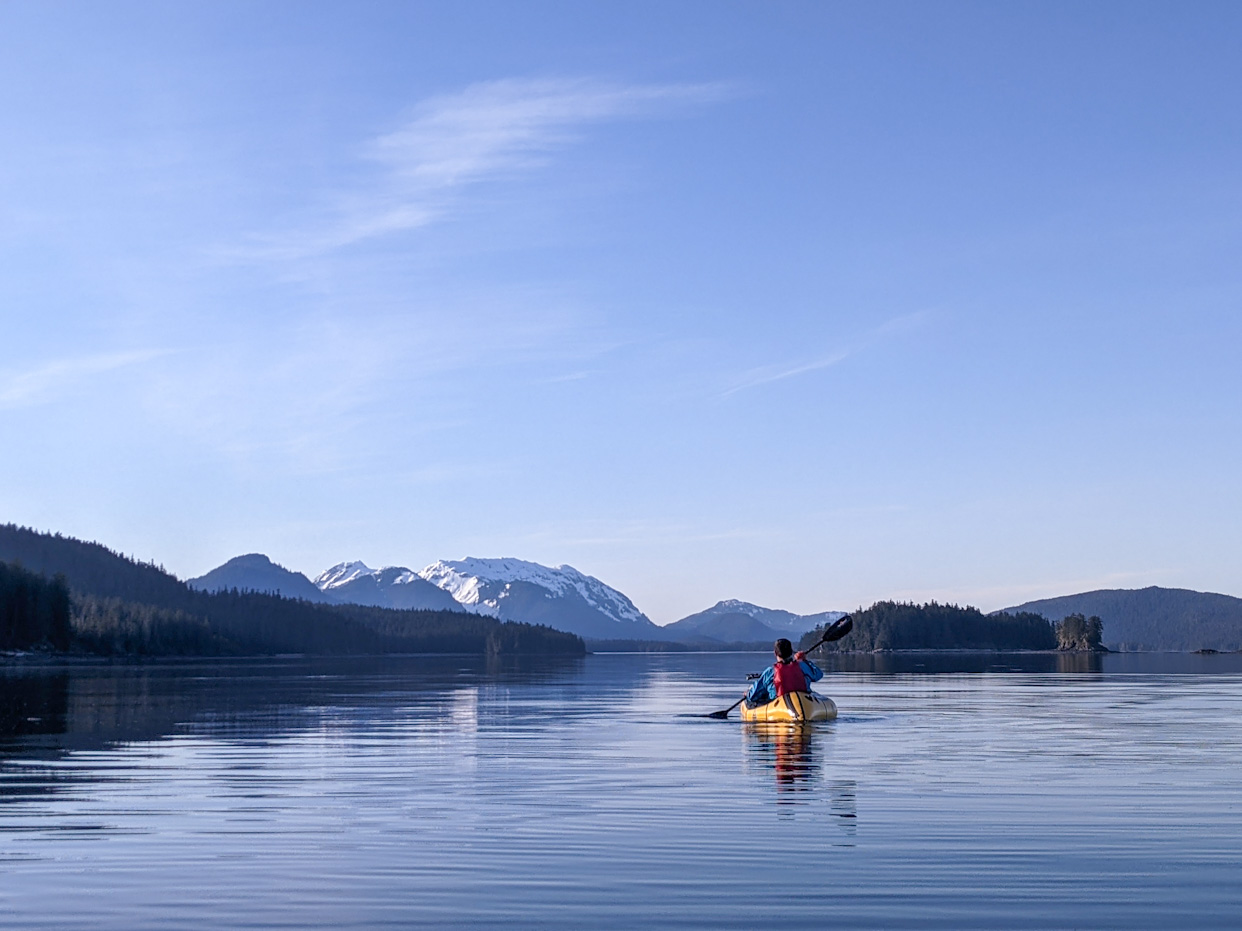
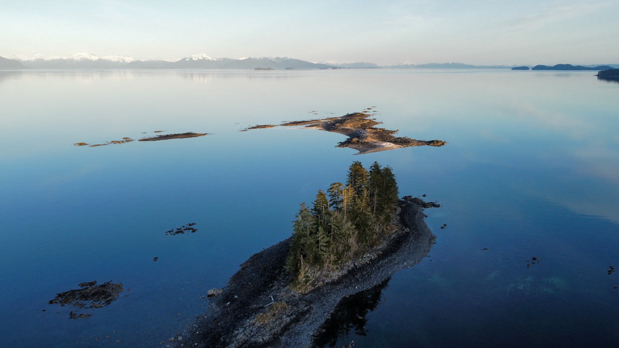
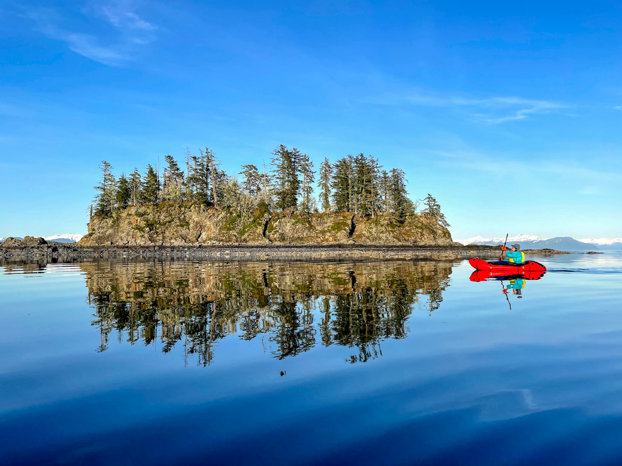
Admiralty Island is famous for its bears. It has one the highest densities of grizzly bears in the world, and has more grizzlies than the whole lower 48! We were nervous about that, as with the warm weather the bears should start to be awake! That’s why on the first night in Admiralty, we continued paddling to the smaller Price Island in Gambier Bay, where it is less likely that bears would be roaming around. Paddling to Price Island was so pretty, the seas were glassy and the sunset outstanding. We watched humpbacks swim by while having dinner. The next day, we paddled north next to rock formations that hosted countless sea stars and anemones. We saw a lot of eagles including two that had just caught a fish and, unlike their companions, refused to fly away from us and stayed close guarding the fish. In the afternoon we crossed over to the Glass Peninsula with glassy conditions that were better than predicted. As we approached the other side, the wind however picked up and started blowing from the north, our left, which put us in a precarious situation where the waves were slightly too big to paddle yet we still had to make a landing. This crossing shook us, and made us start counting the remaining crossings until Juneau. Fortunately, once on the Glass peninsula, we could simply walk the beach if the weather was rough or we had headwinds. On the flipside, northerly winds are also associated with good weather and we had beautiful sunny days all the way.
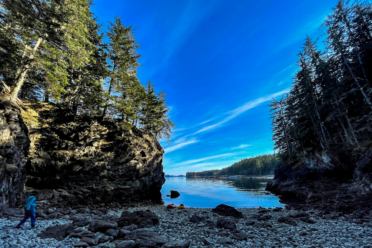
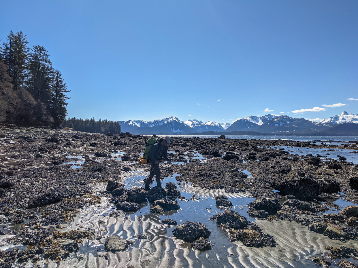
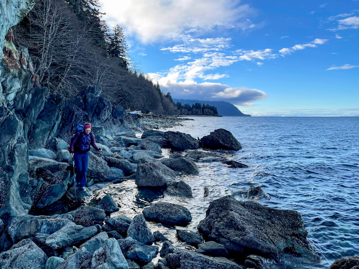
The northerlies stayed for the next few days, so we ended up walking most of the distance to Juneau. Walking the beach was not easy all the time. We had to negotiate a number of headlands which mostly involved scrambling through rocky beaches, but in some cases, we had to hop between submerged rocks in the water. We were lucky except for one spot where it cliffed out onto the sea and we were forced to backtrack and scramble to the forest through a very steep animal track. From there we had to bushwhack through very dense rainforest. We ended up walking over 17 miles that day, both getting blisters from constantly having wet feet and from the uneven ground. We crossed more than one stream per hour, most of which were too deep for a dry crossing. On the positive side, we barely had to carry any drinking water, we simply took breaks next to streams when we got thirsty and drank as much water as we could.
The next day walking was hard, we were tired from the previous day and our feet hurt. We walked on endless rocky beaches where you have to plan every step. We kept ourselves distracted from our sore feet and shoulders by talking about the books we are reading at the moment. Ricardo is reading a book about how to read water (very appropriate), and Salomé about a family hiking the entire coast of Madagascar.
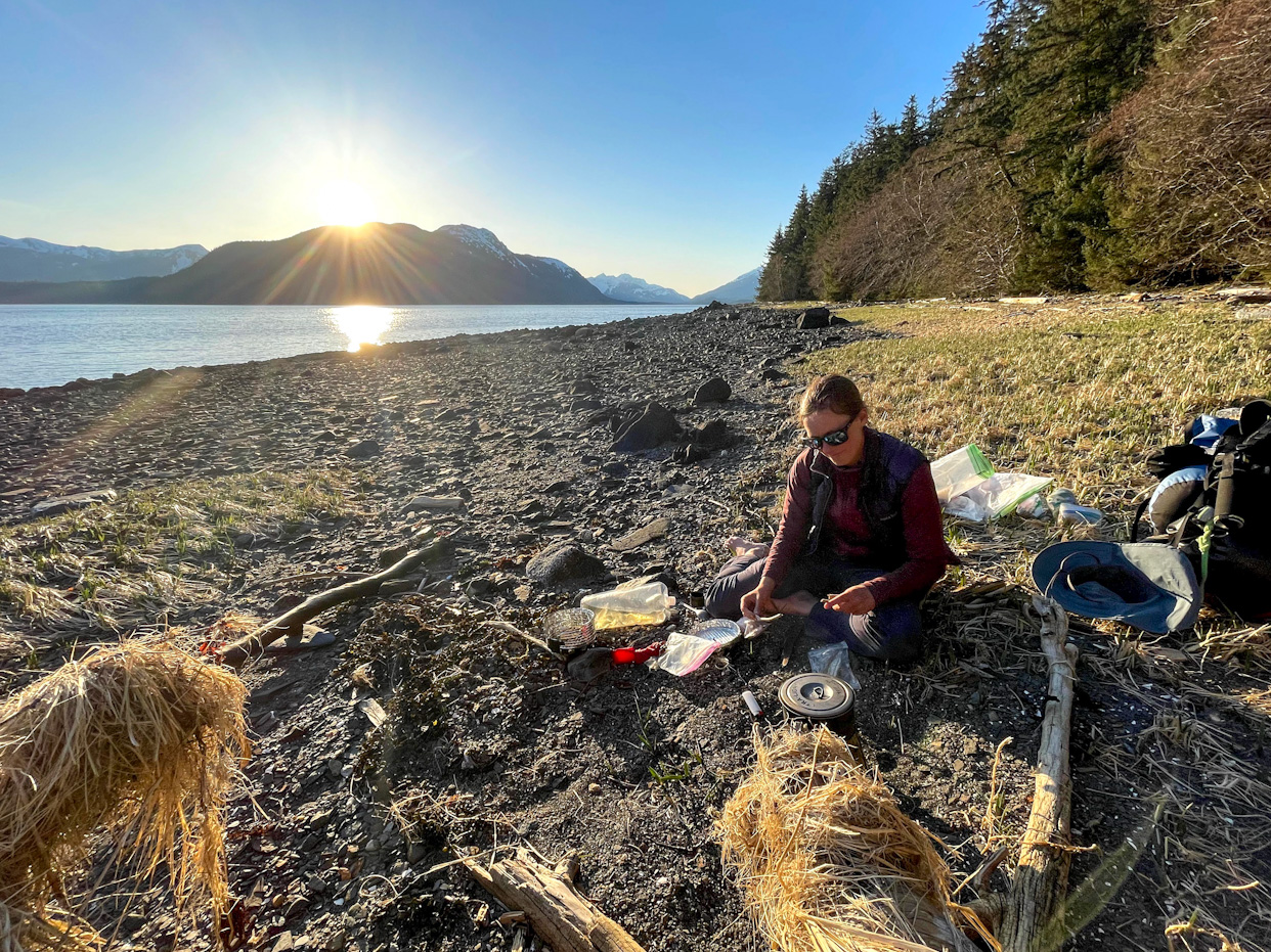
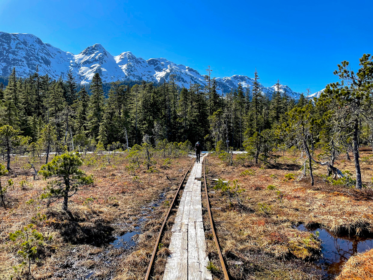
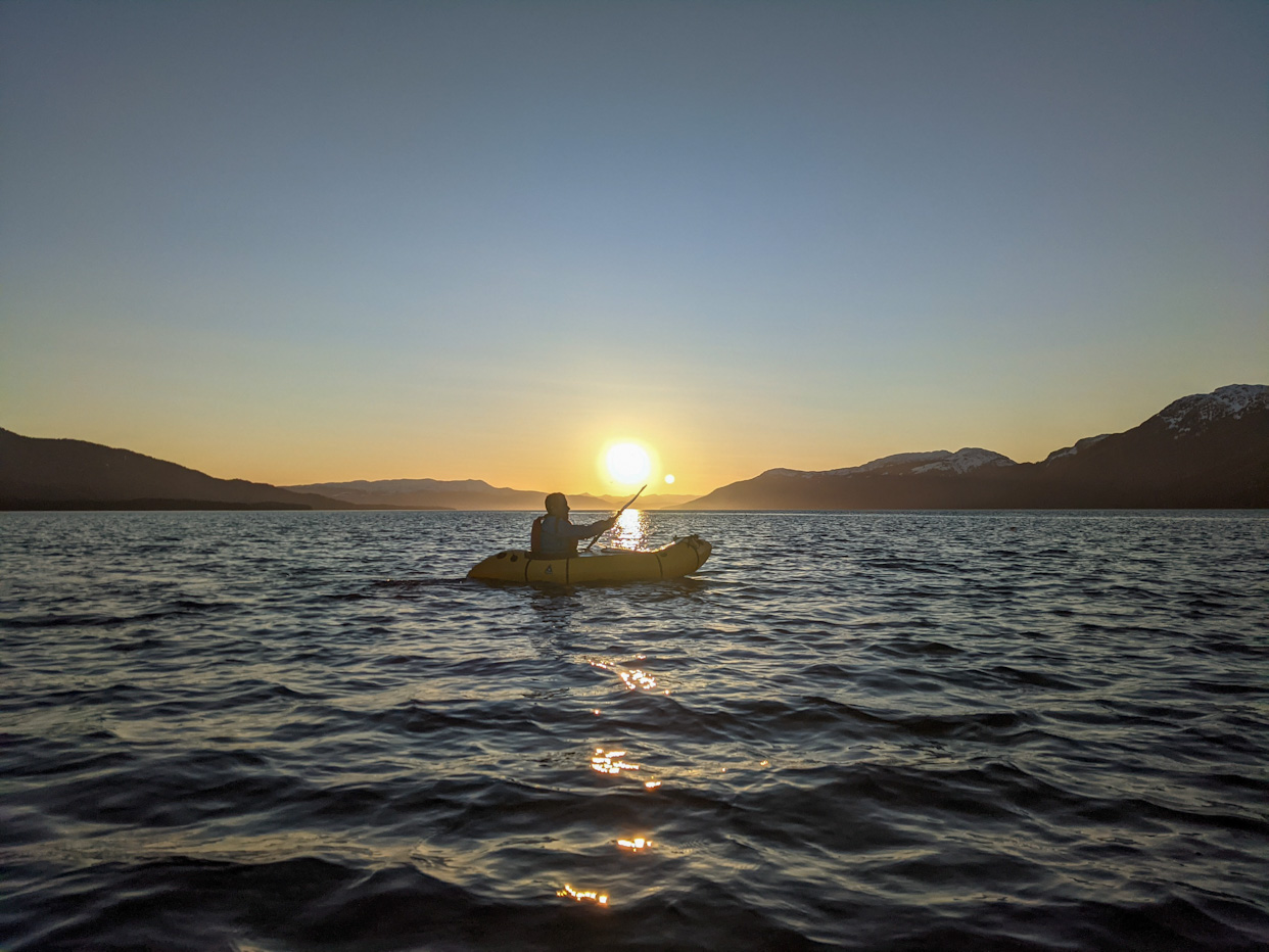
The last day on Admiralty Island surprised us with easy sandy beaches, we quickly walked the 5 miles to the tip of the Glass Peninsula from where we had to cross a large inlet. The wind was again blowing pretty hard from the north but the incoming tide would push us north. In the beginning we made pretty good progress but when we decided to move out of the biggest waves, we did first not realize that we entered an eddy. We now had the wind and the current against us, hence making it very hard to make any progress paddling. We transitioned to walking again and again we were lucky, we could walk on hard packed sandy beaches and only had to cross a couple of fallen trees. We reached a small forest service cabin at the end of Seymour Canal where we took a short second lunch break. We are starting to be much more hungry and a single lunch break is not sufficient anymore. At the forest service cabin there is a little tramway to portage kayaks or canoes to the other side, basically a cart on rails. Part of the track was covered in snow making it impossible to use the cart but its boardwalk made traveling across the muskegs, a bog, pretty easy. We reached our last crossing of the section to Douglas Island at 6 pm. It was windstill and the weather forecast called for strong winds the next two days. We still had some energy left and decided to quickly cook dinner while starting to pack our gear into the boats. We set off before 7 pm and paddled as the sun was setting and bathed the snowy mountains around us in golden and pink light. A humpback whale also swam by and a sea lion came to check on us, it was magical. We were able to complete the crossing before it got dark but had to find a campsite in the dark. It only took two tries, the first beach was full of devils club!
The last day into Juneau was supposed to be easy but felt very long. Some of our maps showed a road or a trail which ended up not existing. Instead we walked most of the distance on the beach. We started meeting people and stopped to chat with them which was very nice, especially as we hadn’t seen anyone in 12 days. We were even offered coffee by a very nice couple as we walked in front of their house on the beach.
In Juneau we are enjoying our first shower in a long time, fresh food and meeting friends of friends. We love meeting locals and learning about the places we cross. Yesterday we met Greg, a friend of Erin and Hig (they helped us plan our trip) who shared with us very helpful information about the next section. Today we met Suzanna, a friend of afriend of Salomé. When she learned that we had not been able to rent bikes to make the 15 mile section to Point Louisa (bike shop closed), she took us to her house and let us borrow her and her housemate’s bikes. This has made it so much easier and faster to cross Juneau to Auke Bay from where we’ll start paddling tomorrow. Tonight we were invited by Diana and Laughlin which we had met on the ferry from Ketchikan to Juneau. We had a lovely evening with good food and good conversations. We are really touched by how nice and welcoming people are in all the towns we crossed.
During this section we lovingly called each other slave-drivers. We are learning that when the conditions are good, you need to get up very early, pack up quickly and do long days. One of us is always more tired or sore, so the other one takes the role in cheering the other one on. These sea sections make us so dependent on the weather! Tomorrow is the last sunny day in a while, and a great chance to cross the Lynn Canal. Go, go, go!
Comments
Bea Stollnitz
I’ve been thoroughly enjoying following your posts! I have a map open on another window where I search for each place you talk about, to really understand your itinerary and the places you visit. I look forward to the next update! :)
Bea Stollnitz
Oh, and fantastic job with those drone photos!
Jeff Erickson
You guys are doing great! I love the pictures and the writing. I like how you are adapting to the weather. Go when it is nice but remember it changes quickly! The beaches are rocky and difficult to walk. Soon that will change to miles of sandy beaches on the pacific coast. Good luck!
Ricardo Martin
Thanks Bea! A map associated to each post would be amazing! Wished I had thought of that before. Most of the time looking at the forest service maps on sites like hillmap.com would be more useful than Google Maps.
Jeff, can’t wait to walk on those beaches. Today the beach are Lynn Canal sucked, it was full of slippery rocks.
Franky Bain
Another exciting leg of the journey. So glad there were some glassy paddling stretches to balance out the hectic bushwhacking section!! Good luck for the next few sections xxx