Crossing the Lynn Canal
We left Juneau towards Gustavus on Sunday. Well, it was really on Monday. Let me explain.
Our plan after Juneau was to paddle towards the very tip of Admiralty Island, then cross the Lynn Canal and rounding Point Couverden towards Gustavus. When we arrived on Saturday night to Juneau, we met Greg, a friend of Hig and Erin. He edited the movie from their big trip that won a prize at the Banff Film Festival. He encouraged us to cross the Lynn Canal at latest on Monday as the weather was about to turn. For us, that seemed really rushed! We still had a lot of things to do in town and the Lynn Canal was 30 miles away from Juneau. Moreover, we had to wait until Monday to pick up a resupply at the post office. And we had just gotten to town after a 13 day stretch!
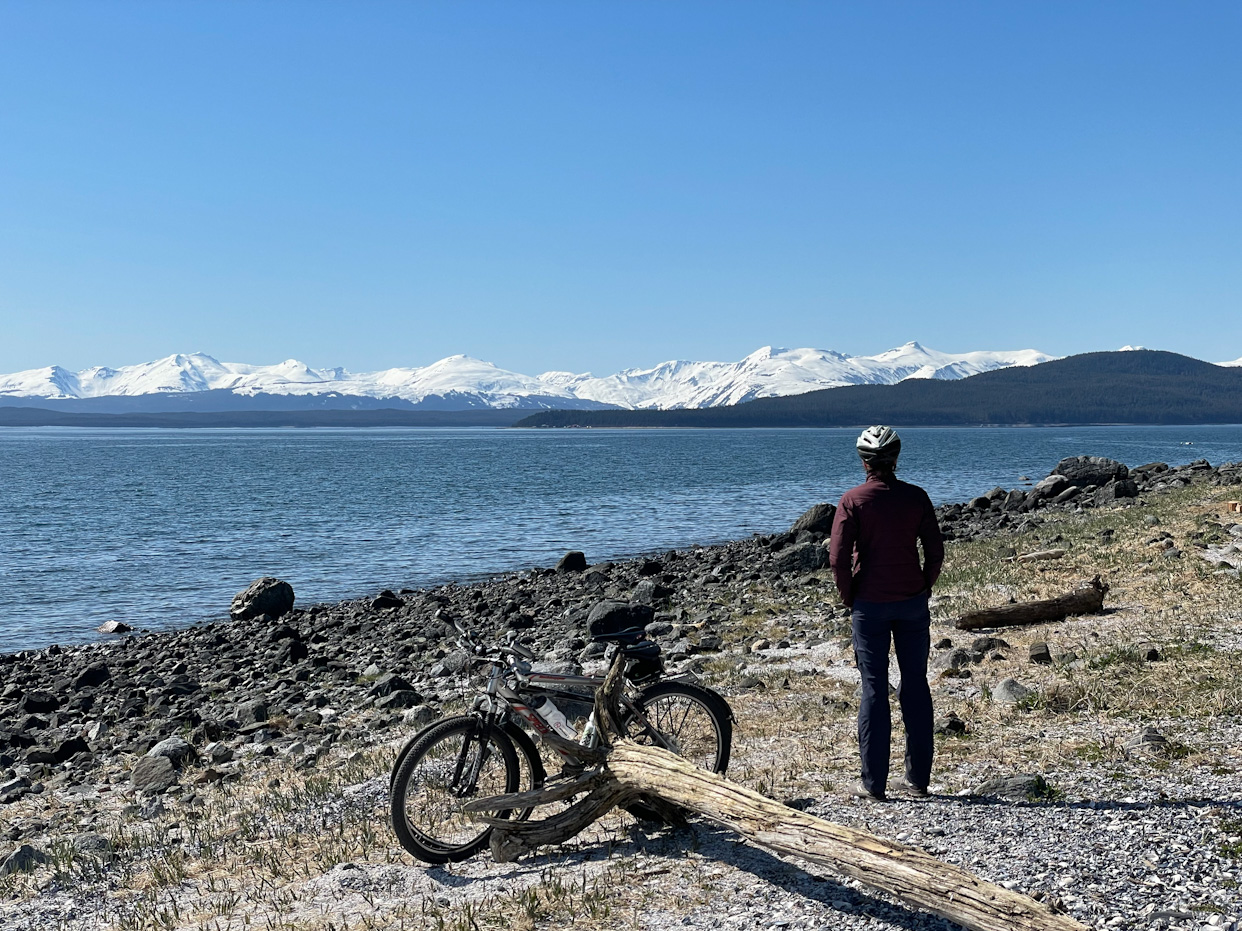
Our plan for the next day was to walk from Juneau to Point Louisa, where we would launch the following day. But that would take most of the day for us! Before starting to walk, we met Suzanna for breakfast, a friend of a friend of Salomé, and once she learned about our plans and that we tried and failed to rent bicycles to do that section, she called her housemate to let us borrow their bicycles to do the stretch! The bike ride was so refreshing, we didn’t carry enormous backpacks nor were we paddling, yet we were being pretty fast. It made us look forward to the haul road section where we plan to bike hundreds of miles.
That night we stayed with Laughlin and Dianna, whom we met on the ferry from Ketchikan to Wrangell as they were moving to Juneau. Not only did the they invite us for dinner, but they let us do laundry, use their sewing machine to do some gear repairs and let us stay for the night.
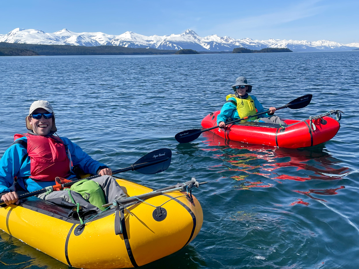
On Monday morning, Laughlin generously drove us downtown to pick our package and dropped us at Point Louisa to start our section! We were a bit nervous, as the late start didn’t bode well with the more than 14 miles we would need to paddle to reach the other side of the Lynn Canal. But the day was gorgeous, we could see countless snowy peaks at the distance and the sea was calm. We went for it! During our first stretch to Shelter Island, the research center where Diana works came into view. We texted her from the water, and she ran out and was able to see us through the binoculars! A bit later, Greg and his wife came to say hi on a boat on their way to their cabin on Shelter Island. We had realized that we forgot to pack toilet paper in the resupply, so we got some from Greg’s boat (phew!).
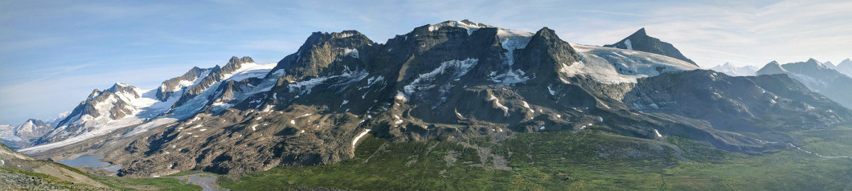
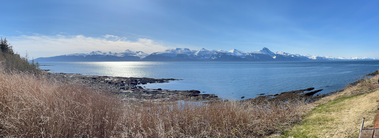
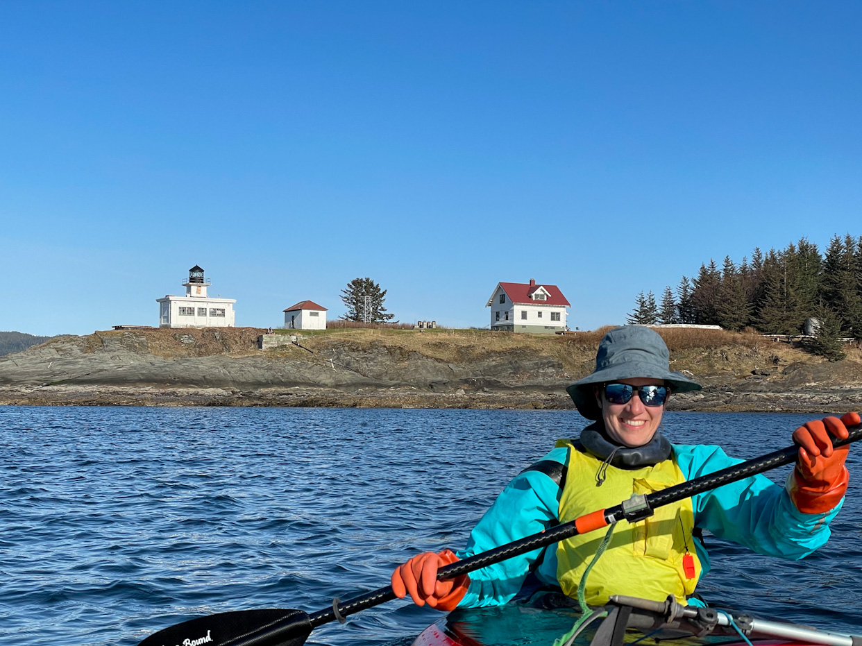
The last stop before the crossing was Point Retreat, the northernmost tip of Admiralty Island, which also had a lighthouse on it. After checking our vaccination status, Joe the keeper invited us to the lighthouse grounds and invited us to some scotch (probably not the best before a strenuous crossing). The lighthouse had amazing views of all the peaks on either side of Lynn Canal, so pretty. We ate quite a bit and finally launched for the 4.5 mile crossing at 5pm, while the seas still looked ok.
Crossings are challenging mentally. On the water, it’s almost impossible to notice any progress. We usually record a GPX track to see which way the current is pushing us, half of the time it is unpredictable! And because the crossings are so long, one can stop wondering what would happen if the weather worsened. It’s nerve wracking. Ricardo compares the crossings to the launching and landing concepts in the corporate world. Launching doesn’t mean anything, and you may need to launch multiple times. Landing is what matters, and we only feel safe after we get on land.
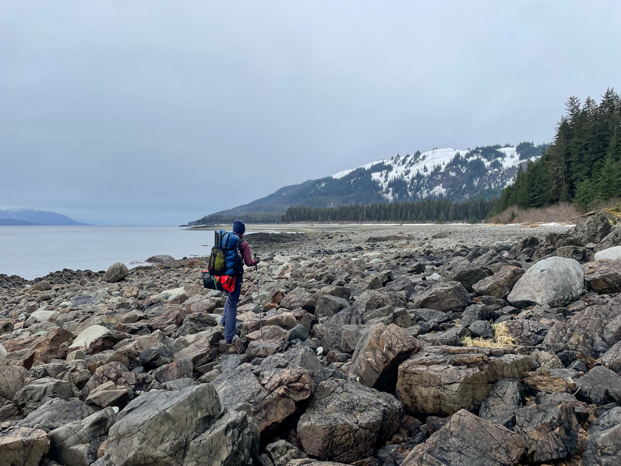
The following day the weather worsened throughout the day, first rain, then wind. We started walking on the beach but it was very rocky and slippery. After several hours walking, we realized that we were being very slow, doing 1.3 miles per hour. We transitioned to paddling and immediately felt the difference. The growing northerly wind started pushing us from the back, and we were doing miles very quickly. But the wind kept blowing faster and paddling stopped being fun as we were approaching Point Couverden, so we pulled over and set up camp, from where we are writing this post. It’s still pretty windy out there. The weather should be better tomorrow, and we hope to arrive to Gustavus in a couple of days!
Comments
Eric Stollnitz
Just caught up with your progress… amazing! Love the stories and the photos! Wishing you the best for the coming adventures.