Rounding the Malaspina Glacier
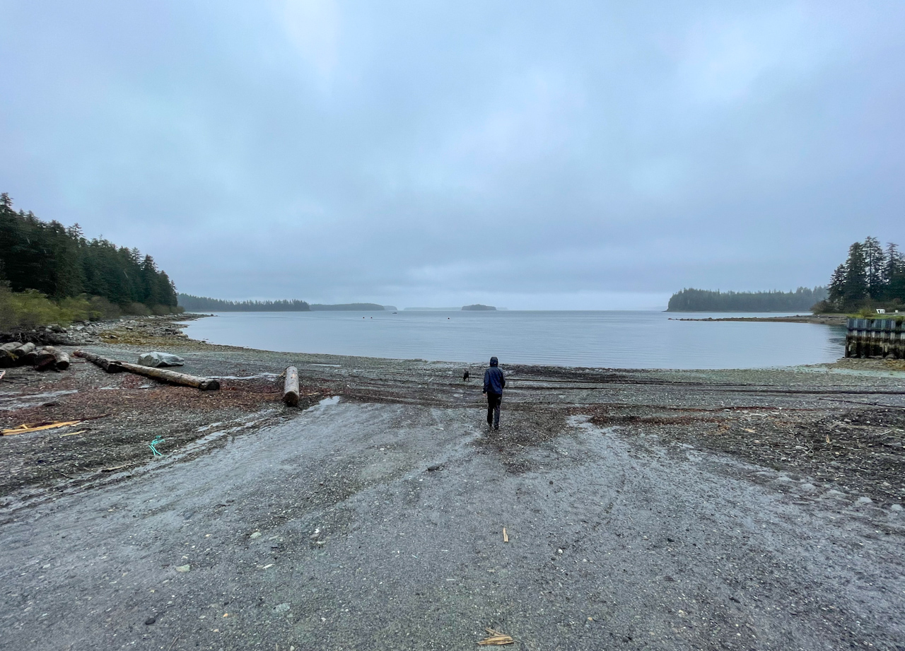
We stayed in Yakutat for 5 days, waiting for better conditions to start the next section. We first stayed at the Yakutat Lodge, a fishing lodge by the airport, where the dress code is waders and one can roll from bed to the Alaska Airlines terminal in less than 30 steps. Its restaurant and bar also serves as the airport lounge. Fortunately, it’s not a busy airport so we slept very well. In fact there were more fishing boats parked there than planes. The day before we had to go around the massive airport, with two full sized runways at a right angle built during World War II. Military presence in the area was still felt, and we saw several military planes and helicopters going up and down the coast.
We then moved to a B&B hosted by Mary Kay, the retired magistrate judge of Yakutat, and Steve. Years ago Steve landed his airplane on a beach north of Lituya Bay, when he lost the engine, and was curious if we had walked the same stretch of beach. Most definitely, we thought. We also met the other guests, like Tariq, who works in the school and had been to Alaska’s most remote communities, and Jacob, a biologist that worked analyzing the catch of fishing boats in the area. We really enjoyed talking to all of them and hearing plenty of stories about Alaska! During our time at the B&B we were able to fix Ricardo’s dry suit, whose neck gasket had ripped completely, and a hole in Salomé’s dry suit socks. We also got a new resupply, with new socks (Salomé’s socks were missing the heel) and new shoes for Ricardo, who had a two inch hole in one of them. The shoes were new when we started the trip!
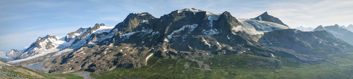
In Yakutat we were also treated to a sunny day, our first in weeks! One could see the mountains from the harbor, including the imposing Mt St Elias, that rises 18,000 feet from the ocean. If only we had had such a day in the previous section, we would have seen the Fairweather Range!
We talked to Ellie and her husband Lewis, who told us that the second gully we had gone up in Boussole Bay was the right one, and we had stopped at the crux, where a big boulder blocked the gully and required climbing moves to go around – we were so close! We also talked to Hig, who warned us of the ice present in Yakutat Bay, which could be observed in radar imagery and was blocking access to the other side of the bay. Great, a new danger! The famous Hubbard glacier sits at the end of Yakutat Bay, and the Turner Glacier, its smaller brother to the west, was surging and advancing very rapidly, filling the bay with lots of ice. If the wind blew strongly in the wrong direction, it could pack the ice against the shore preventing us from landing. And precisely, the weather forecast showed such a wind two days later. We decided to stay in town until the storm passed, which also saved us from a day-long downpour.
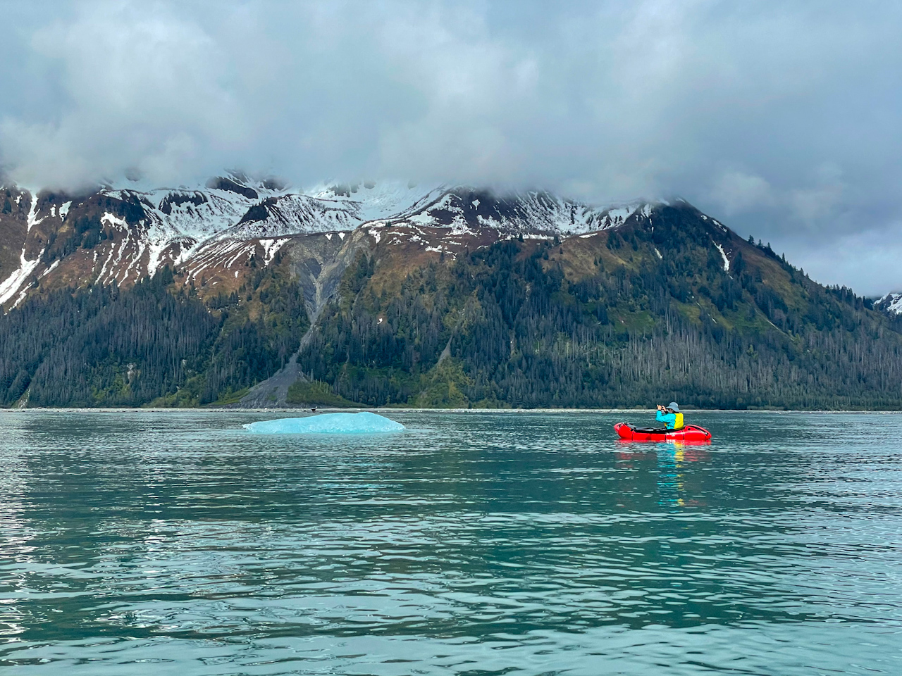
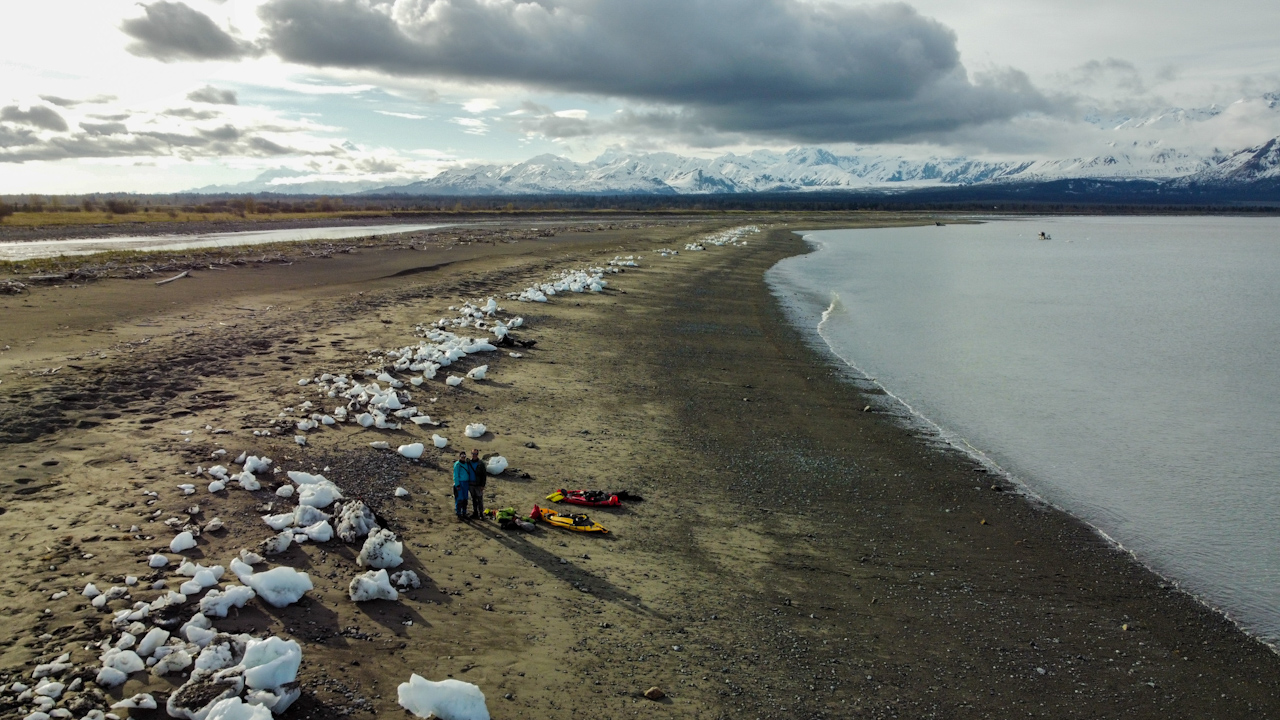
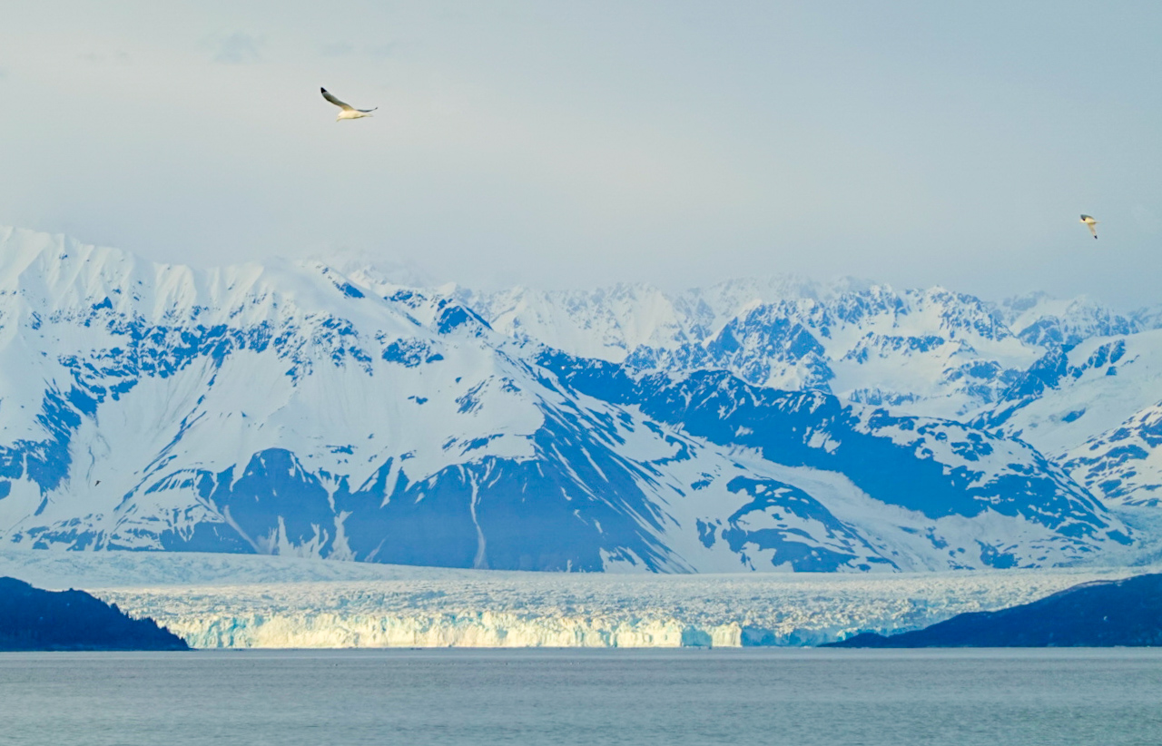
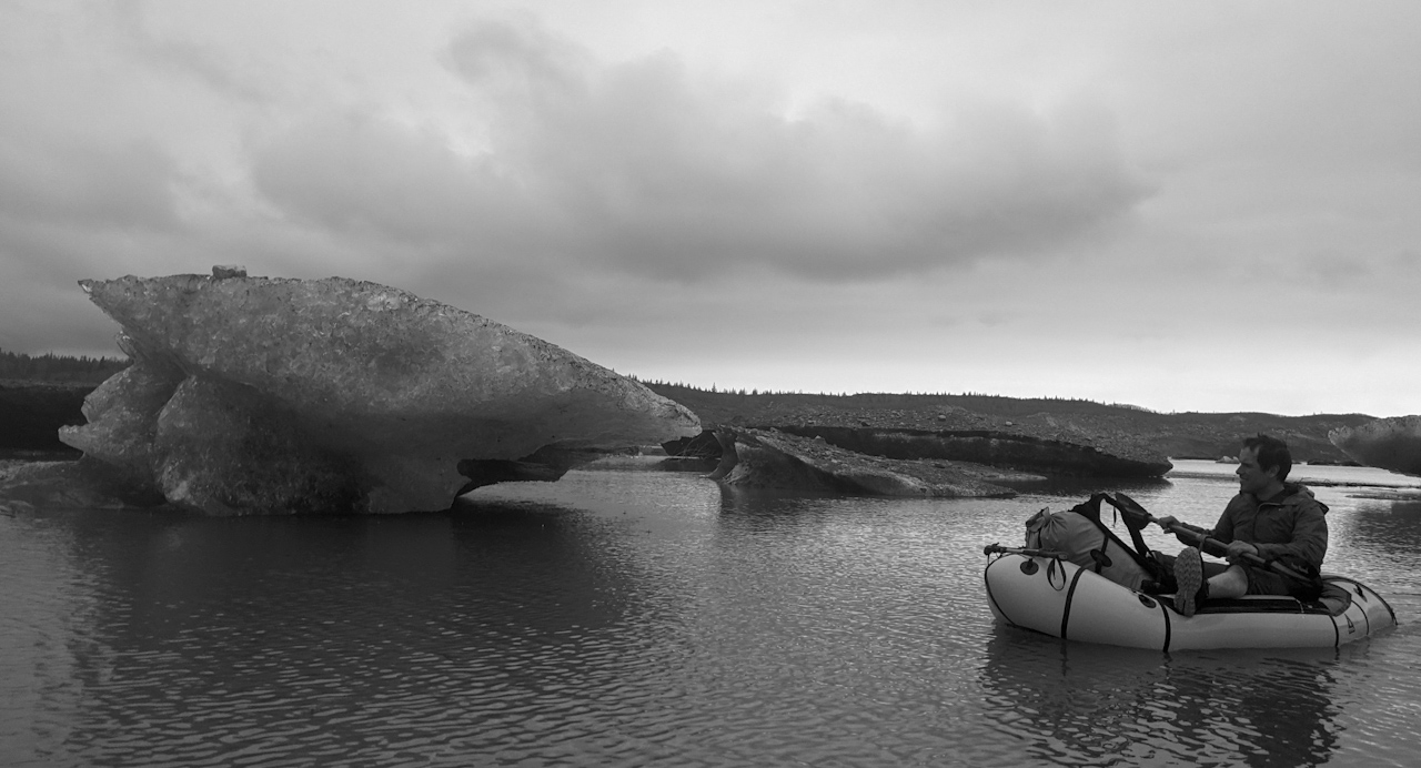
We left Yakutat Bay on a rainy day. It is too wide at its mouth to cross for us in packrafts, so we had to go towards the end of the bay for a day and a half to cross where the bay is narrower. The first day we only paddled which made the rain less daunting. The second day we walked on narrow, rocky beaches, and enjoyed some minutes of sun. We instantly stopped to dry the tent and sleeping bag, and started to plan our crossing of the bay. We waited for the slack tide and then set off for the 5 miles crossing. We chose a spot with lower surf but still had to cross 2-3 feet high (less than 1m) breaking waves. The packrafts are very stable on waves that do not break but going against such high breaking waves was a first for us. It is pretty tricky and we ended up with about 10cm (4in) of water in the boats but luckily did not capsize. We then started the long paddle across the bay, and the beautiful and impressive Hubbard Glacier came into view. We also started seeing more and more icebergs making us nervous about the landing on the other side of the bay. Once we got close we saw that there were icebergs on the beach, brought there by the last high tide but landed without any problem at low tide below these icebergs. It was a magical place, with views on mountains nearly all around, these stranded icebergs on the beach and in the back the Hubbard Glacier. After checking the weather forecast, we decided to set up the tent on the beach and not look for a more wind protected spot away from this stunning beach. We had dinner by a fire drying our shoes, watching porpoises fish in the bay and oystercatchers chasing seagulls. It was without any doubt the most beautiful camp of this whole journey.
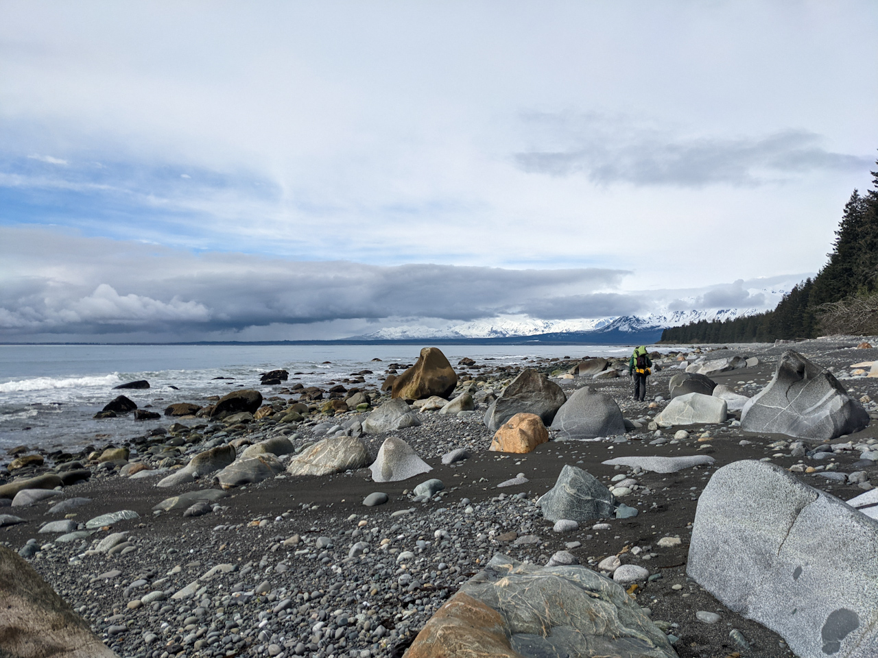
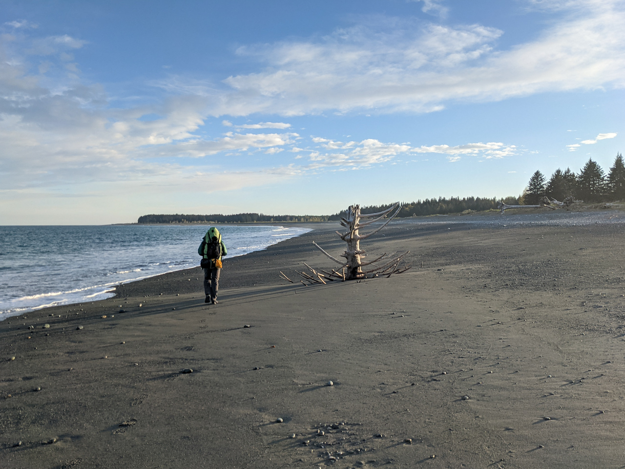
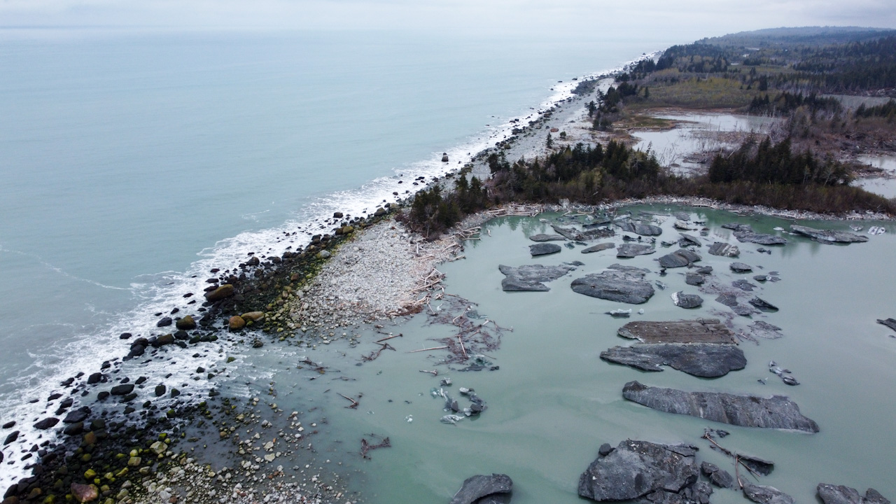
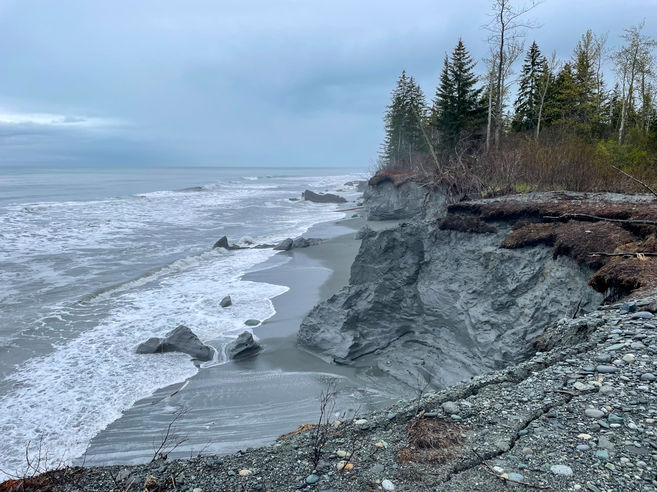
Malaspina Glacier is the large glacier that pushes into the sea between Yakutat Bay and Icy Bay, and it’s the largest of its kind (1,500 sq miles) –looking like a pancake. Our route was taking us on the Lost Coast, a beach around this large glacier: over 60 miles of beach walking, crossing numerous large rivers, most of them large glacial outlets with their frigid and silty water. Some people refer to the Lost Coast as the whole section from Cape Spencer to the Copper River, we are not sure if it’s settled. There is another Lost Cost in California that’s 40 miles long instead of 400. Most of the time we could not see the glacier because it is so flat and because a dense forest grows between the glacier and the beach obstructing any views. This forest is however narrow and likely hosts fewer animals compared to other parts of the coast. This is probably why we saw much fewer bears and found no good bear trails to walk on when the beach got very rocky making our progress very slow and painful for our feet.
All around the glacier it was a challenge finding good drinking water. Most water we found was either silty (which would clog our water filter very quickly) or brackish, mixed with sea water, as a lot of the rivers are tidal as the area due to the terrain being so flat. More than once we wondered why our dinner was saltier than expected and as we took a sip of the water we collected, we realized why. We learned to test water before collecting it and filtering large amounts wherever we found good water.
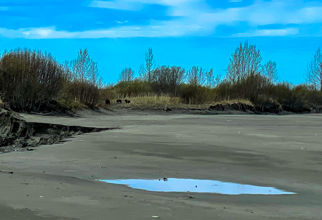
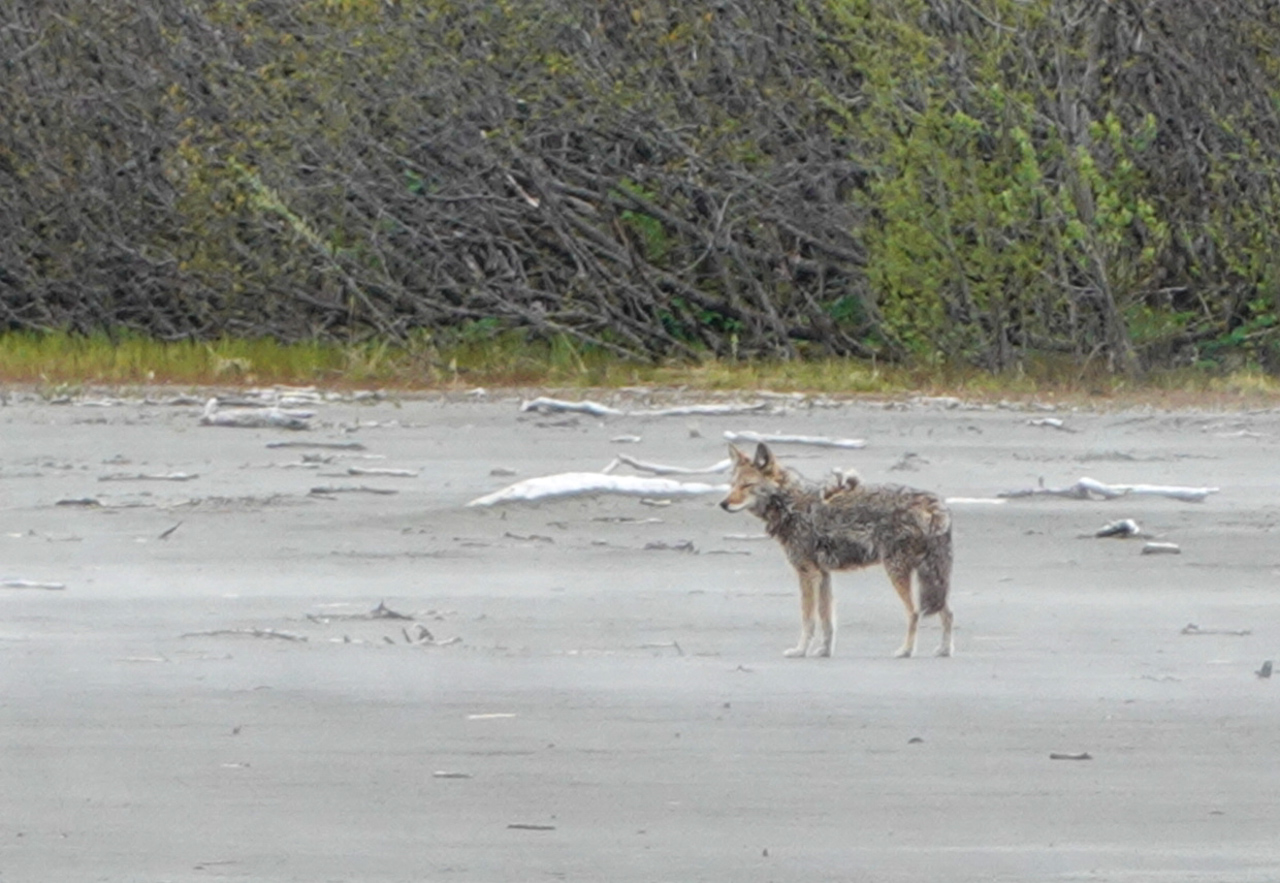
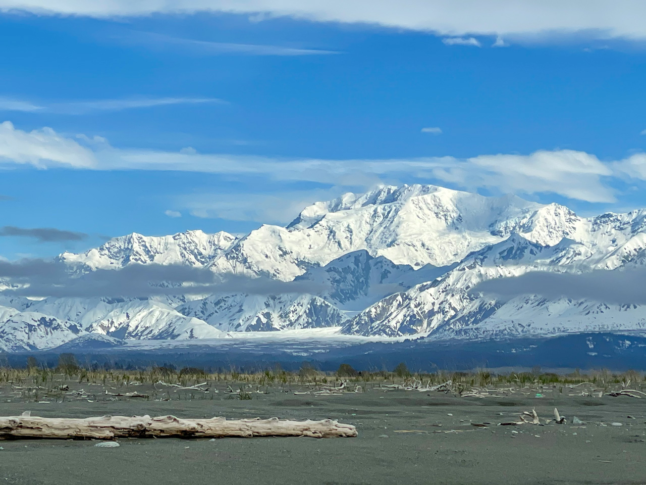
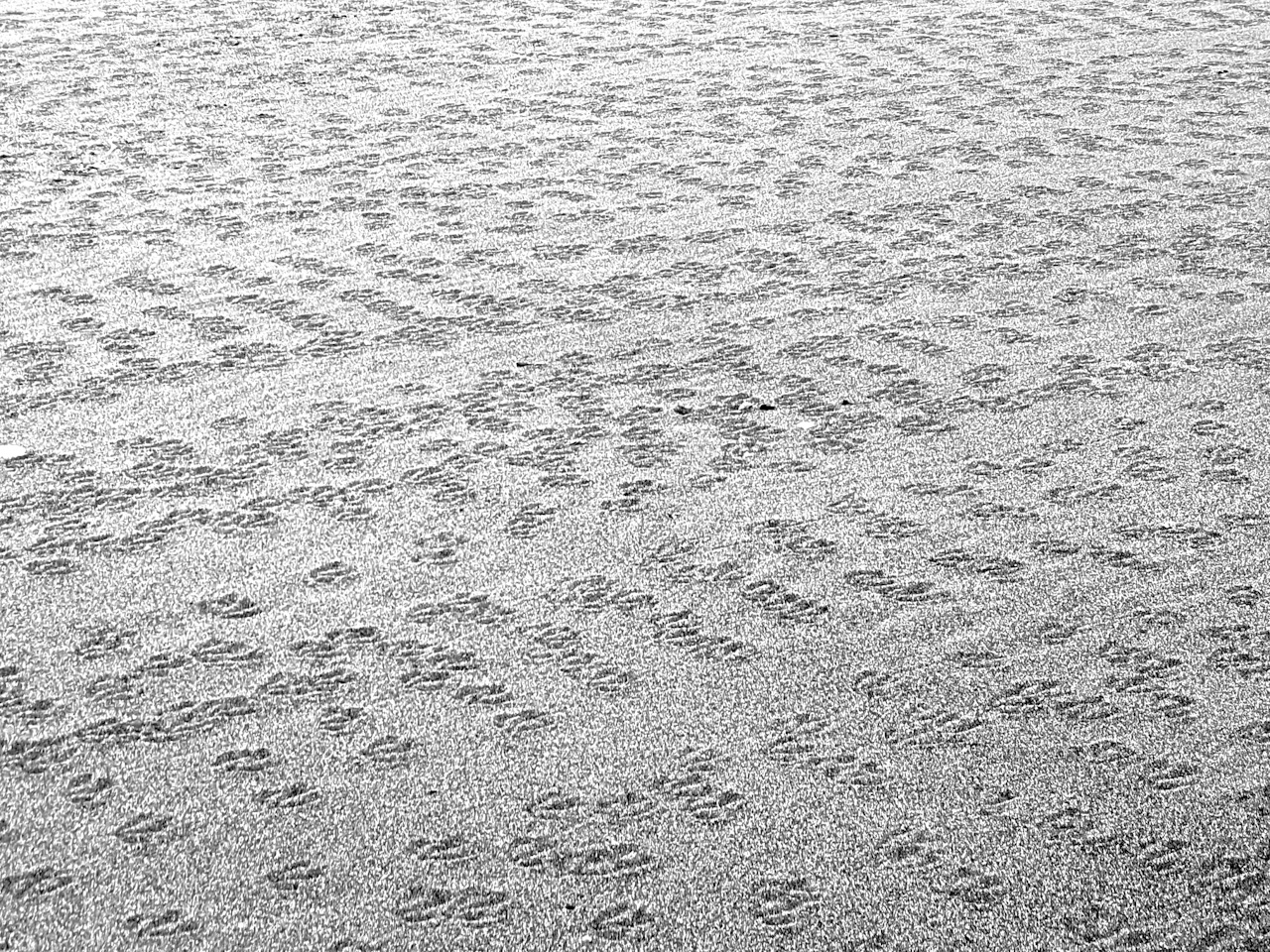
The first day around the Malaspina glacier was sunny, what a treat after so much rain and gray skies. This day we mostly walked on soft sand, which combined with a heavy backpack (we were still carrying 12 days of food in addition to our already heavy base weight due to carrying packrafts) forced us to take breaks nearly every hour. But the stunning views on Mount St Elias, Mount Cook and many other beautiful snow capped peaks, the sun and warm sand turned these breaks into delightful moments. The scenery in the tidal flat was so beautiful that we both pulled out our cameras and started taking panorama photos. We forgot at this moment that only 10 minutes prior we saw a grizzly sow with two cubs down at the river. They had not seen us back then and we have grown so accustomed to seeing bears (while still having a healthy respect for them) that we did not worry much about them. Suddenly Ricardo sees them running towards us, and tells Salomé to stop taking her panorama. As we both face them and pull out bear spray, we see that they are chasing a coyote. The coyote, probably knowing that it was safer close to us, ran behind us, away from the bears, and came to a stop very close to us. Ricardo looks at Salomé: “Should we be worried about the coyote?”. Salomé replies: “No, only if it does not run away after the bears are gone.” We did what you are supposed to do when you see bears, pull out our bear spray, we make ourselves look bigger by raising our arms, speak loudly to show the bears that we are humans and not a moose or other animal that they hunt occasionally. The bears were surprised and at first did not really know what to do. They stopped, stood up on their back legs to better see what to do and then eventually they turned around and walked away. As soon as that happened, the coyote also ran away from us. Phew! The second the animals started retreating, we took out our cameras trying to capture them. Finally, once the bears and the coyote had left the scene, we rejoiced at the spectacular encounter we had just witnessed.
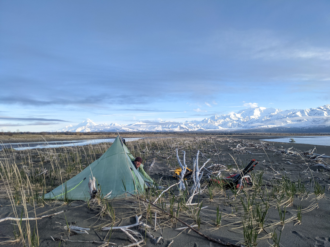
At 6:30pm that day, we reached a stream. Streams here can be anything from ankle deep water with not much flow to an over the head deep fierce torrent, sometimes with seals hunting fish in it’s last few meters before it reaches the sea. This stream was smaller but with a good flow, and it got us– only realizing it was brackish after we had cooked dinner! The water worked out for the dinner but we had only very little good drinking water left. So after we finished dinner while enjoying a small fire that was drying our shoes and socks, we pushed on and continued for two more miles until the next stream. The water was also brackish but much less salty than the previous one allowing us to rehydrate somewhat. This night a swarm of mosquitoes chose our tent as their night quarter. We do not yet have our tent inner net to save weight and only use a tarp and ground sheet. Sleeping with mosquitoes buzzing around our heads all night did not make for a restful night. We first resorted to sleeping with our heads under the quilt but got too hot. We then threw our rain jackets over our heads to keep these little pests away. Getting up the next morning was hard, we didn’t sleep much.
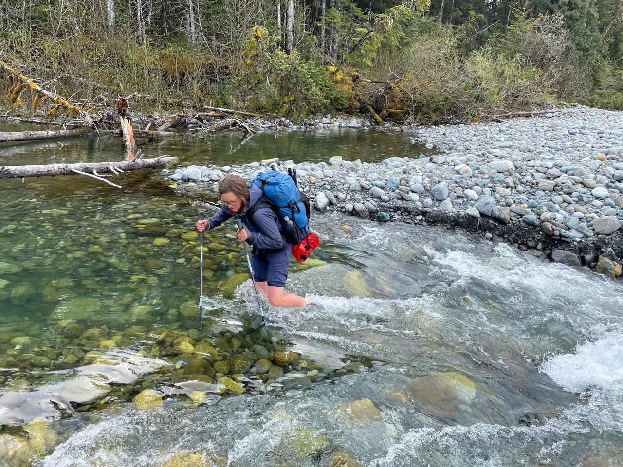
The next day was dry again but only sunny for a very short period of time. We walked mostly on soft sand, our muscles worked hard and we yearned for harder surfaces to walk on. Manby, Alder and two unnamed streams were all too deep and fierce to wade. Four times we inflated Ricardo’s packraft, he first crossed with his backpack, then with Salomé’s backpack and finally came back to pick up Salomé. Even though this is slow, it is still faster than inflating both boats. When we found non-brackish water one mile shy of our 15 miles daily goal, we stopped for the night. Close to the water was a beautiful mossy forest where we could set up camp for the night. We knew that it would be buggy again, but walking with a lot of water did not seem appealing. We made a fire again that we enjoyed while eating a delicious polenta with peppers. As expected our tent filled with mosquitoes making for another hard night.
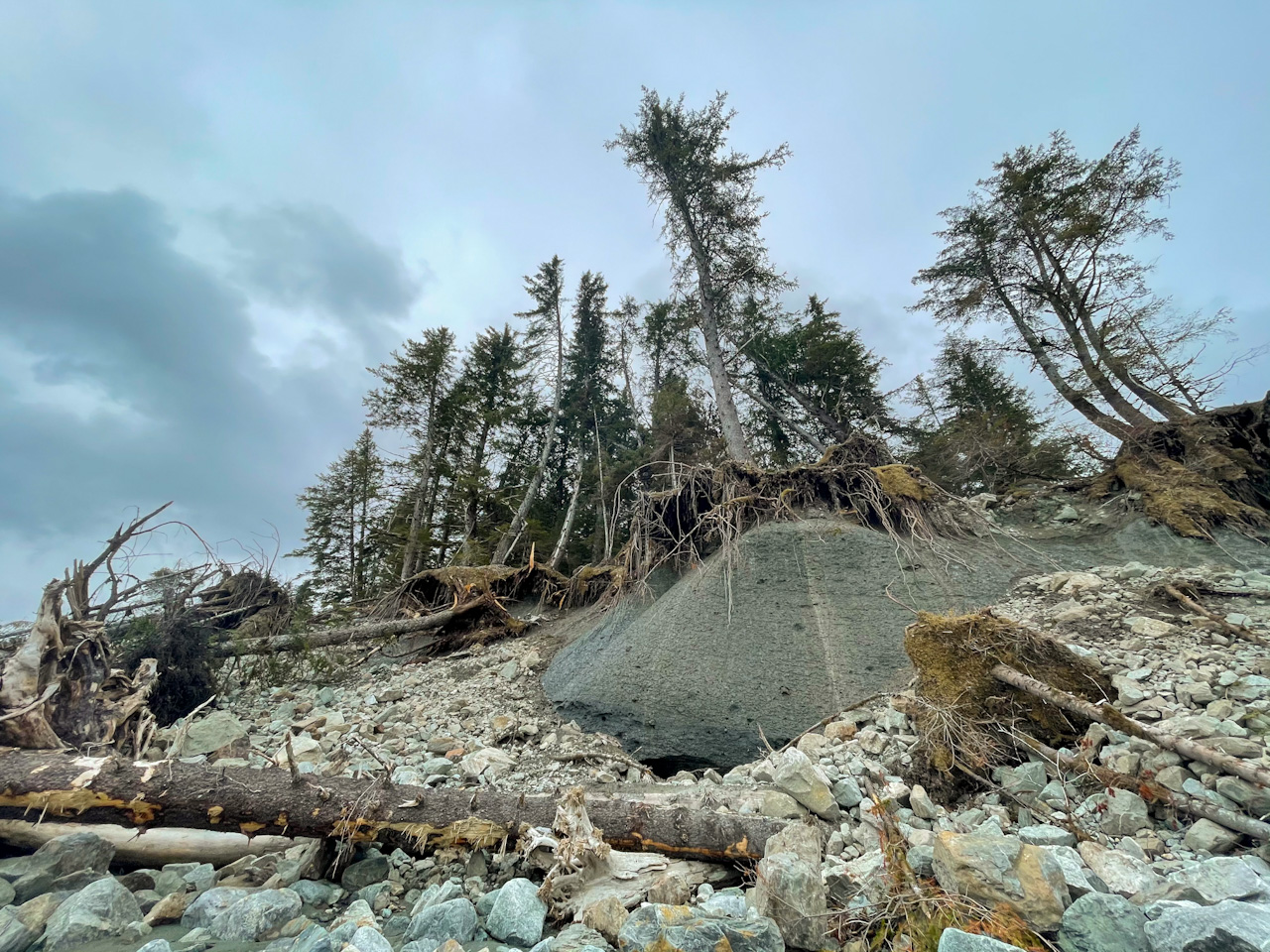
We tried to find animal trails in the forest to escape the next 8 miles of walking on a tricky beach but could not find any good one. There are many different kinds of rocky beaches, some much harder than others. This one was of the hard kind, tennis ball sized boulder piles, round and unstable: we stumbled more than walked. Ricardo lost his balance and fell. He pinched his right foot against a rock leaving him with a large bruise. We worried that he could have broken his foot but decide to continue as it did not hurt him too much. We monitored the injury at every stop for swelling and increased pain. Our progress on these beaches was painfully slow. We however got to see the Malaspina Glacier twice, once when we paddle the lake at its southern outlet, a lake filled with dark icebergs and a second time in a much more surprising way. We suddenly saw large trees with trunks on a cliff that have grown in “S” shapes. We then noticed that the cliff was dripping. The forest is growing directly on the glacier, with very little soil on it! Every time the glacier moves, the trees readapt to grow up towards the sun leaving them with crooked trunks.
In this area maps (most of them drawn 60 years ago) are pretty useless. The coast line in the Outer Coast and Lost Coast as well as the rivers have changed so much. The rivers flow into the sea miles away from the spot indicated in the map. Glaciers have receded so much, and even the coast line has moved by up to a mile. Usually, we rely on much more recent satellite imagery, but we also got some surprises! In those moments we rely on satellite imagery. But for this section even the satellite imagery (at most 2 years old) that we use is inaccurate.
The biggest crossing of this section was the one of Fountain Stream – which actually feels more like a river than a “stream”. From a mile away we saw large, dark standing waves in the ocean, and a mile long brown streak stretching as far as we could see. We were nervous about this beast but upon getting closer we found a wide calm area that was easy to paddle across but required bushwhacking on the other side through a very dense alder forest full of devils club. Once we bushwhacked past the outlet, we realized that our satellite imagery was completely outdated and that there was now a long dead river arm making it impossible to reach the beach and escape this tricky forest. We tried to walk on its shore but it got steeper and steeper and was increasingly obstructed by fallen trees. We had to inflate our boats again, a hard blow as it was getting late and we were looking forward to rest and dinner. Once across and having walked another mile, we realized that the clear stream from which we wanted to gather water for our dinner and to drink was now flowing into this dead river arm, out of our reach and most likely brackish. It was 9 pm when we decided to walk another 5 miles to get to the next source of drinking water. Luckily, we were able to get there by 11pm without using our headlamps!
The last morning before getting to Icy Bay was dry. We had finally reached hard packed sand and progressed quickly. In the early afternoon a slight drizzle set in but still allowing us to partially see the mountains of Icy Bay. We decided to float down the calm Yahtse River, which runs parallel to the beach for 2 miles before it flows into the sea, and then continued walking towards Icy Bay on the beach. Towards its end, the beach became narrower, delineated by steep muddy cliffs, until it completely disappeared even at low tide. We found a gap through the cliffs and climbed on top of the shelf. To our surprise, what was above was a marsh! We started bushwhacking parallel to the coast through alder thickets and spruce trees. We were so close to our goal for the day but this terrain slowed us down constantly. We keep learning the same lesson: Alaska always has a surprise ready for you and the terrain rarely remains easy for long. We peeked at the coast at every opportunity, and eventually the beach reappeared for good, and we were able to downclimb the mud cliffs to it. We saw our first bear tracks in a couple of days and got to Icy Bay in steady rain.
Comments
Annie Mackovjak
You are experiencing the Alaska most people never see. Kudos for your perseverance in the face of many obstacles. And how fortunate to see all the beauty that surrounds you, despite the dangers. Love the photos which allow me to visualize the incredible landscape. Good luck with all those mosquitoes!
Franky Bain
So glad to hear about stunning sunsets and glacier vistas among the mozzies and water adventures. Just love reading each update!
Mary Kay & Steve, Anglers Rest B&B
You are two of the most adventurous people I know! Thanks for letting us know you had crossed over Yakutat Bay safely. Excellent update on your progress.