Mighty Copper River
To get to the coast from McCarthy, we simply needed to follow the rivers all the way down to the coast, first the Nizina, then the Chitina and finally the Copper River. But this section would be very different to all previous ones, as we would rely mostly on floating, or rafting, those rivers instead of walking next to them. The rivers were however scary, including the mighty Copper River, and we had been warned by many people in Alaska about their dangers. We are new to rafting, so we were worried.
In McCarthy we talked to rafting guides about our plans and the conditions on the river. We also met Spencer, an experienced whitewater kayaker and also a backcountry ranger at the National Park who had run the Copper River last year. David from Cordova introduced him to us, while also giving us plenty of advice about the rivers. We made a plan to run the rivers using very conservative decision-making. We would avoid the Nizina Canyon, a narrow class III section, by walking on the road for 15 miles and bushwhacking to the Chitina River, already past the confluence with the Nizina. Once on the Copper, we would then walk the old railroad grade to skip Wood Canyon, a particularly turbulent section of the Copper River where the river runs in a rock canyon less than 100 meters wide. Finally, we knew we could always portage Abercrombie Rapids of the Copper River, as described in guide books. The plan should work, or so we thought.
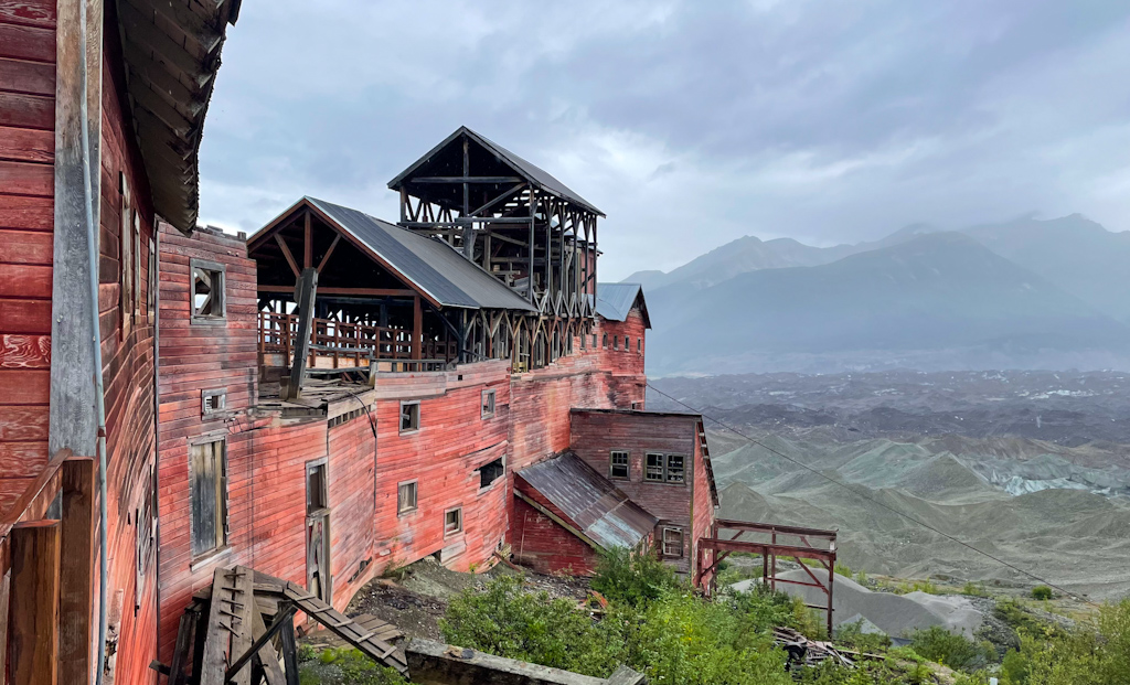
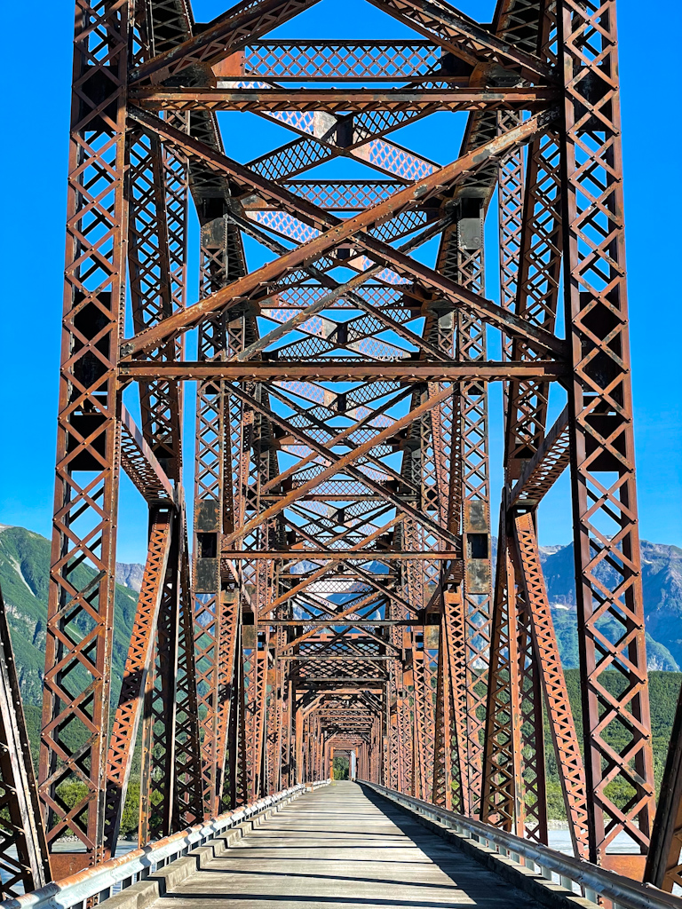
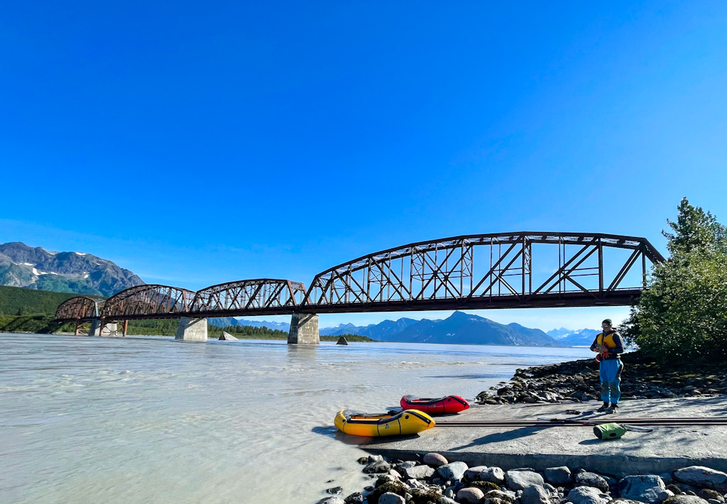
Before leaving McCarthy, we spent a couple of days in Kennicott, the famous copper mine that ran from 1911 to 1938, which was the largest thrust of development in this part of Alaska. To bring copper to the markets, they built a railroad from Cordova to Kennicott through the roughest terrain, including the Million Dollar Bridge, that crosses the Copper River between two glaciers. Parts of the railroad tracks were layed on the glacier and had to be continuously readjusted as the glaciers moved. The railroad was abandoned after the mines closed and only parts of it were reused as roads later on, while the rest was slowly taken back by nature. We would see a lot of remains on our way, from spikes on the road to McCarthy, to old trestles or wooden bridges in various states of disrepair.
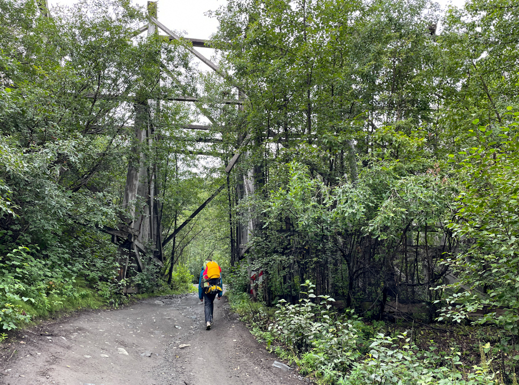
Leaving McCarthy, we walked on the famous footbridge, the only public road to McCarthy and Kennicott. Looking upriver from the bridge you can see enormous glaciers, while on the other side there is a privately-owned bridge for cars, which is closed to tourists. Locals don’t want a road going into town, but are OK paying the toll for the bridge. Once we finally passed the Nizina Canyon, we veered off the road and bushwhacked to the river. The vegetation became very dense as we got close to the river, resulting in us scrambling down steep mudslides to avoid more gentle but densely vegetated slopes. At least the views of the river valley in the midst of the clouds paid off the effort.
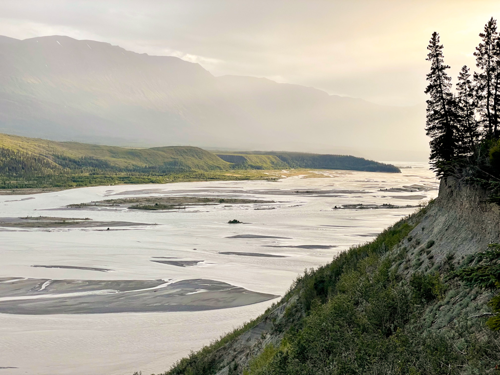
The next day we started on the river. The Chitina is a very silty and braided river, and we don’t have a lot of experience on such rivers, so we took a very cautious approach, constantly looking for rapids and avoiding them. We had shipped more boating equipment two McCarthy, including a second boat, and dry suits. Being on the river didn’t feel as terrifying as when we crossed the Nizina or the Delta river.
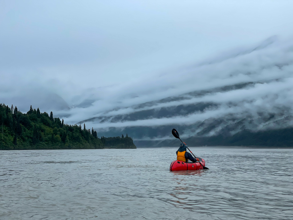
Navigating braided rivers requires constant attention, the river is always pushing you around, but often is not the direction you would expect. There are countless submerged channels that you cannot see that have more current than the shallow waters. We also tried to stay out of trouble, always paddling away from turbulent spots or rapids, with various success. On the first day some fog remained on the river, which made it frightening hearing the rapids before seeing them! Nonetheless, most of the water was quite calm despite moving downriver pretty quickly, often faster than 10 km/h or 6 mph. The water on the river often reminded us of waters we had seen in the ocean, it felt like we were in a constant tide rush.
Half way on the first day, Ricardo freaked out. He was hearing a hissing noise, as if his boat was leaking! We hadn’t had any issues with the boat so far, and we were worried. But then Salomé heard the same noise on her boat. We quickly discovered that it wasn’t our boats, but the enormous quantities of silt moved around by river, hitting our boats and hissing. We could also feel it when placing our paddle in the water, the noise changing depending on how deep the paddle went. Crazy!
After forty miles of paddling in two days, we were approaching the confluence with the Copper River. We recognized it by a steep nose shaped cliff that separates the two drainages. We were hoping to cross the Copper high up, to make sure to be able to take or before the dangerous Wood Canyon. We stayed a bit too far to the side and suddenly realized that we had to run some class III rapids, with a tall 4 foot standing wave that was crashing at the top. The sides of the rapids didn’t look better, so we charged ahead through the middle, getting soaked in the thrill ride. Afterwards, it was surprisingly easy to get across the Copper River, it almost looked small compared to the Chitina.
We decided to stay the night in the town of Chitina, less than a mile away from the confluence. We had landed on an island and Ricardo went to scout to see if any large river braids remained between us and the road. He couldn’t find any, so we packed our boats, removed our dry suits and started walking. However, Ricardo had missed a not-so-small braid at the far side, right next to where the cars were parked. It was not flowing fast and didn’t look deep, so we started fording it. That’s when Salomé fell into the river. One step was knee deep, the next one her feet did not touch the ground anymore, Ricardo ran to help her but also managed to fall into the river. After a few swim strokes, made a bit awkward due to the still heavy packs on our back, we were on the other shore, thankfully. We had let our guard down at the last minute, this braid just looked so easy! The whole day wearing life jackets, dry suits and protecting our phones in waterproof pouches and both of us just fell into the river without any of that! Fortunately, we were OK and only one of our phones didn’t seem to work after the swim. The rest had been well protected in our packs.
After drying and eating very well in the historic Chitina Hotel, we continued the next day on the railroad road towards the river. When we got to the river, a couple of miles down from where we had taken out, the wind was blowing into our faces with an incredible force. We made it to O’Brien Creek, the start of Wood Canyon, and talked to a couple of dipnetters. These are fishermen that stand on the shore holding a large net on a long pole, waiting for salmon to get trapped into it while they swim upstream. It’s one of the easiest ways to fish for salmon, and people often get dozens of fish in a single day, with which they fill the freezer for the whole year. This fishing technique is reserved to Alaska residents, and only for subsistence fishing (personal consumption, not allowed for sale). As we were on the beach, we realized that it was too windy to be on the river, and that the following day would be very rainy in the morning, so we turned around and went back into town. Sometimes you just have to wait.
The next day we left Chitina after noon and made it to Haley Creek following the old railroad, which contoured the steep rock cliffs around Wood Canyon. From Haley Creek we could see a turbulent spot we had been warned about, and the last danger in the canyon. We had hoped we could put it there and avoid running through it, but most of the water was headed its way. While hanging out on the beach, a jet boat showed up, picking up some sheep hunters. The hunters were late, and we started talking to Jon, the captain. He generously offered to show us the turbulent spot and the whirlpools in Wood Canyon in his boat. The whirlpools were the most impressive, as they were the size of his boat and very deep. We were happy to have walked that section. The turbulence on the spot below was scary, so we pressed on with our decision to continue on the railroad a bit longer before putting in. Dipnetting is not allowed past Haley Creek, so the trail along the railroad quickly went from an ATV track to an overgrown animal trail.
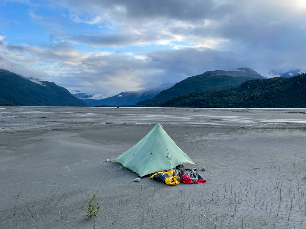
Once on the river, we watched tall peaks and deep valleys go by wrapped in clouds as if we were in the movies. The landscapes looked mysterious. We were still cautious of the Copper, after being warned by so many people, so we took it easy on the river. The river is so fast that we finished the 20 miles we had planned for the day before lunch. Knowing that the winds get worse in the afternoon, and having found an amazing campsite, we set up a camp already at 2pm, a record-early time for us during good weather. We spent the afternoon reading in the sun on the beach and drying out our gear that got drenched in a downpour just as we packed our boats in the morning. Perhaps we should raft more rivers?
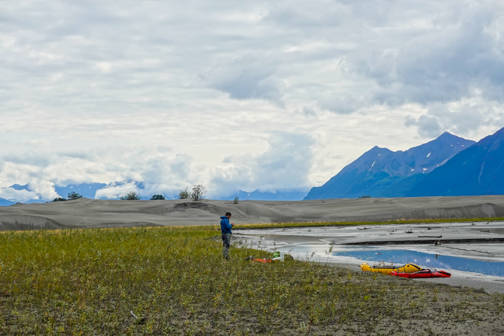
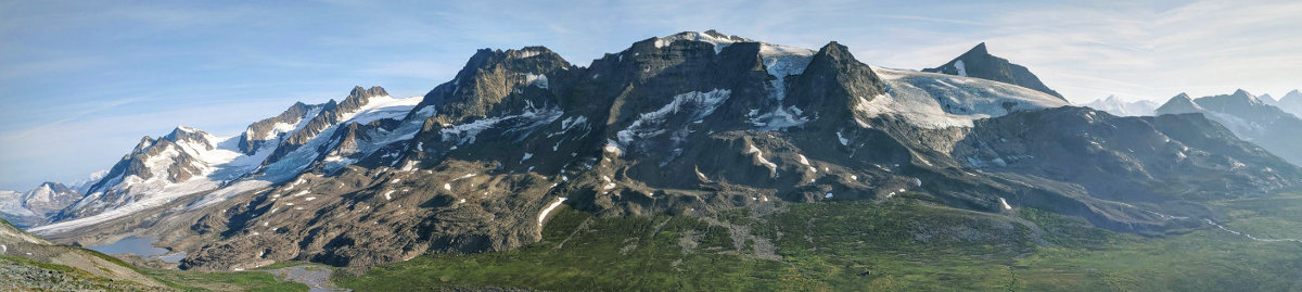
As we continued down the river, we saw more and more glaciers on the imposing mountains around us. The confluence with the Bremner river was a fascinating place. There is a 5-mile stretch of sand dunes in a spit that separates both rivers before the confluence. It’s unlike any other landscape we have seen in Alaska, yet formed by the ever present glaciers. The area is also famous for the sandstorms that blow upriver and are common in the afternoon. We did in fact verify that these happen, as we tried to camp next to some trees in the dunes only to be turned around by the blasting sand. We had to cross the river, which was more than half a mile wide, to find good camping on the other side.
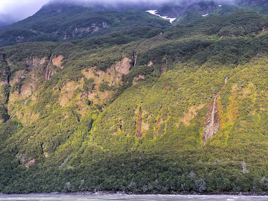
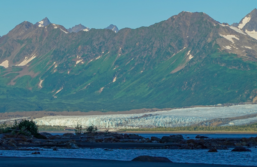
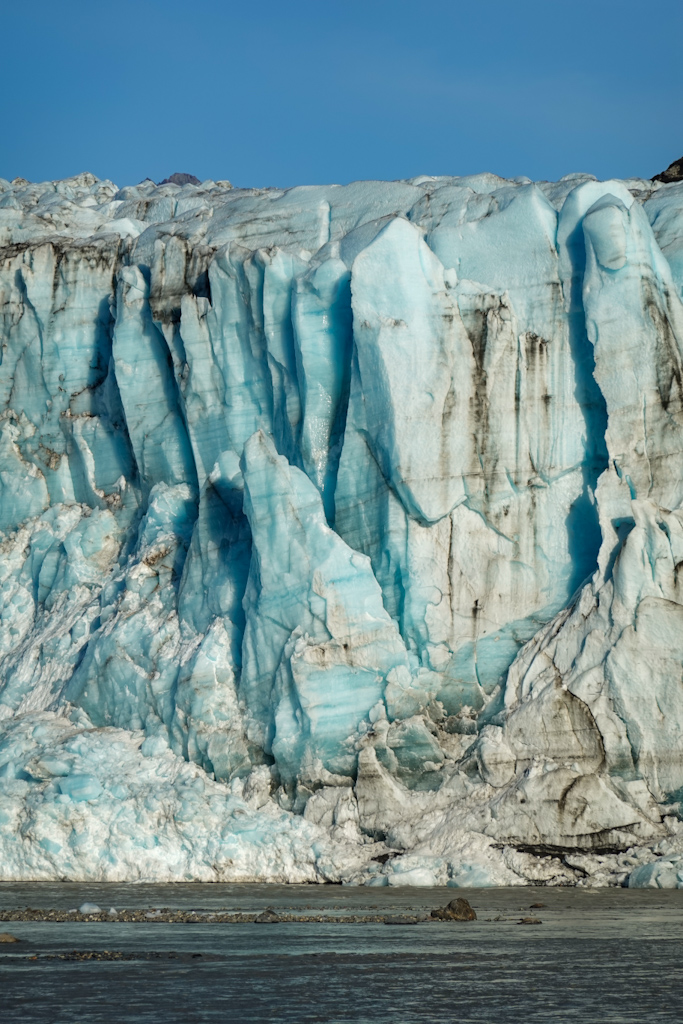
The next day we woke up to fairly strong winds, and we lingered in the tent for a while. When we finally decided to move and packed up camp, the weather got worse. As we were already ready to go, we started paddling to discover it wasn’t a great idea. It just felt like being in the middle of a stormy ocean, there were fairly big waves caused by the wind blowing upstream. We pulled out as soon as we could, and set up camp again for a few hours. When we finally left, we started to paddle the most spectacular part of the river, where the Allen, Miles and Childs Glacier met the river from all sides, constricting it in multiple ways. First the moraine of the Allen Glacier creates the short but spectacular Baird Canyon, by pushing the river against a steep ridge two thousand feet high. Next, the river breaks through the old moraine of Miles Glacier through the Abercrombie Rapids, draining into Miles Lake. Finally, the river exits the lake just in front of the face of Childs Glacier, preventing its advance. From there on, the river becomes very braided and ends in the 50-mile Copper River Delta.
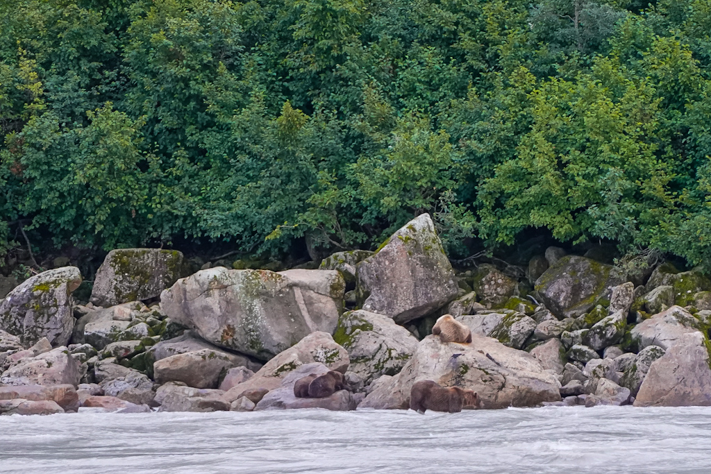
Abercrombie Rapids were scary, with raging waves that appeared and crashed seconds later. Luckily, the action is mostly on one side of the river and we knew that we could pull up on the shore and scout the route. Very quickly we realized we were in bear territory, as they like to fish by the rapids. We saw bear scat and prints everywhere, and even had to be careful not to step on it, it’s very slippery!! (Salomé inadvertently tested it.) We were able to safely go down the river a few hundred feet by paddling from small eddy to small eddy by the shore, and then scouting for the next one. We noticed a large noise, and realized that a bear had come to the shore, only to run away when he realized our presence. We finally got to the crux, a small rapid that made us a bit uncomfortable, as any mistake would bring us to the raging water on the other side of the river. We both felt we could paddle it, but decided it wasn’t worth running it being so far away from help, and portaged our boats over a rocky beach. We were finally done with all the turbulent spots and we could continue our float. But then we realized all the action on the other side of the river. First we saw a bear fishing by the current, jumping on the water when she saw a salmon coming by. Then we realized that two other cubs and another bear were next to her. A couple of minutes later we saw another male walking up the stream towards the group. At that time, we were already bear spray in hand, turning our backs around constantly, there were so many bears! A couple of minutes after we started paddling again, we saw another mom and two cubs also heading to the fishing spot. Definitely the most bears we had seen in an hour in the whole trip. Scary!
We set up camp by Miles Lake, looking into Childs Glacier as the night was falling. We didn’t sleep much though, as a wind storm kept us awake starting at 2am. The wind had switched and it was coming now downriver, but it was way stronger than the day before. In the morning we moved our tent to a more protected spot and tried to sleep a bit longer. At least the weather was clear, making it feel like a beach vacation as long as we were sheltered from the wind. The wind finally waned in the late afternoon and we finally set off at 6pm.
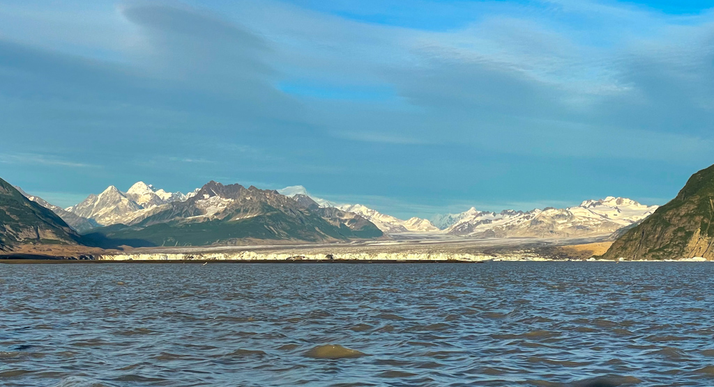
Paddling in Miles Lake was spectacular, as we were nestled between the two massive glaciers around sunset. On the far east end, building size icebergs were floating by the Miles Glacier face. Smaller icebergs drifted towards the middle of the lake and we checked out as many as we could. We continued paddling until the Million Dollar Bridge by the Childs Glacier, and we took out and walked across the bridge to the deserted visitor center and campground. This area must have been very popular before another bridge below was swallowed by the river and never repaired, making it impossible to drive to the Million Dollar Bridge. The Million Dollar Bridge, so called because that was its price tag, is a feat of engineering spanning a third of a mile across the swift Copper River in front of Childs Glacier, where icebergs float continuously past it. It’s hard to imagine how hard it must have been to build it in 1910, in harsh winter weather and with glaciers nearly touching it.
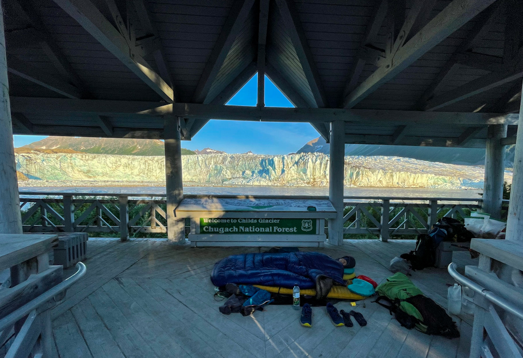
Camping in front of the face of Childs Glacier is not recommended as large waves run up the shore when the glacier calves, akin to tsunamis. We ended up setting the sleeping bags on a raised platform with interpretative signs. We imagine how it would have been very busy back when it was possible to drive here, as it had the best views on the glacier. But luckily we were alone. We got to the platform already in the dark, and we could hear the glacier’s rumblings every once in a while. As we were going to sleep, the moon, which was full, came up shining light on the glacier face. We couldn’t ask for more.
The next day we went back to the Million Dollar Bridge one last time and put into the Copper just below it. We paddled in front of the glacier’s face, hoping that it would not calve. The water was quite turbulent, so we just paddled and didn’t take any photos, we had taken so many from the shore! From the glacier, it was smooth rafting to Cordova. The river was fast, and we averaged more than 6 miles an hour. We took out by the road 12 miles below, where it ends and got a ride into Cordova. In a few days, we’ll come back to the same spot and continue downriver until the ocean, and head east towards Icy Bay, where we stopped our first bout in late May. We will be sad once the trip ends, we are enjoying this adventure so much!