Getting to the Outer Coast
We made it to Yakutat! It was a long 15 day stretch from Gustavus without resupplies, where we saw many more bears than people! Indeed, it was so long, there will be a second part to this post.
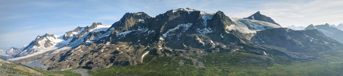
Gustavus is the last community on the Inside Passage before heading to the ocean and is the headquarters of Glacier Bay National Park. Glacier Bay was created in the last two centuries, as a massive glacier retreated more than 50 miles leaving a 4 mile wide bay behind. Massive cruise ships used to go into the bay everyday before COVID.
Our plan was to start from Bartlett Cove, the headquarters of the national park, which was devoid of people as the season hadn’t started yet. Starting from Bartlett Cove also allowed us to avoid the mouth of Glacier Bay, which is known for its tricky currents as the glacier moraine is underwater and stirs up the tide. More incredibly, there is so much outflow from the glaciers that the tide almost doesn’t flood into the bay. We headed to Bartlett Cove on bikes that we borrowed from our host in Gustavus, Ellie. Jim offered to drive our packs in a pickup and take the bikes back, which made the ride much easier! Unfortunately, when we got there, the forecasted light winds didn’t realize, and we could see whitecaps from the cove, not a good omen for a long tricky crossing. We waited out for a bit, hoping for the conditions to improve to no avail, and Jim ended up coming back and hosting us for the night. That night we learned a lot from Jim and Annie about their 6 week adventure in the Brooks Range in the 80s, their Denali climbs in the 70s, and Jim’s books about Alaskan history. Jim also was curious to weigh our packs with 17 days of food, and we saw incredulously how our packs were much heavier than we expected! Salomé’s was close to 50 pounds (23 kgs), while Ricardo’s was 65 (30 kgs).
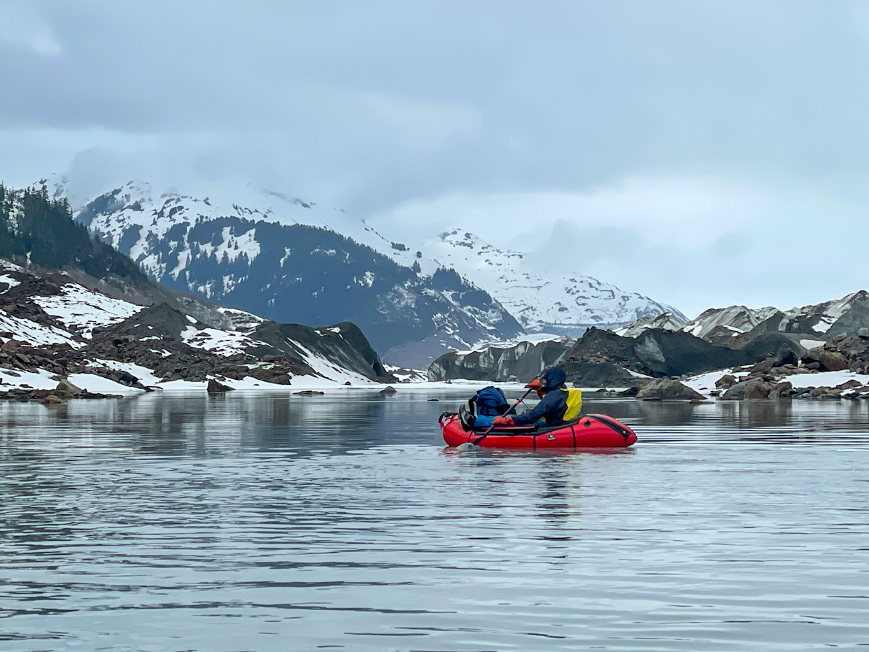
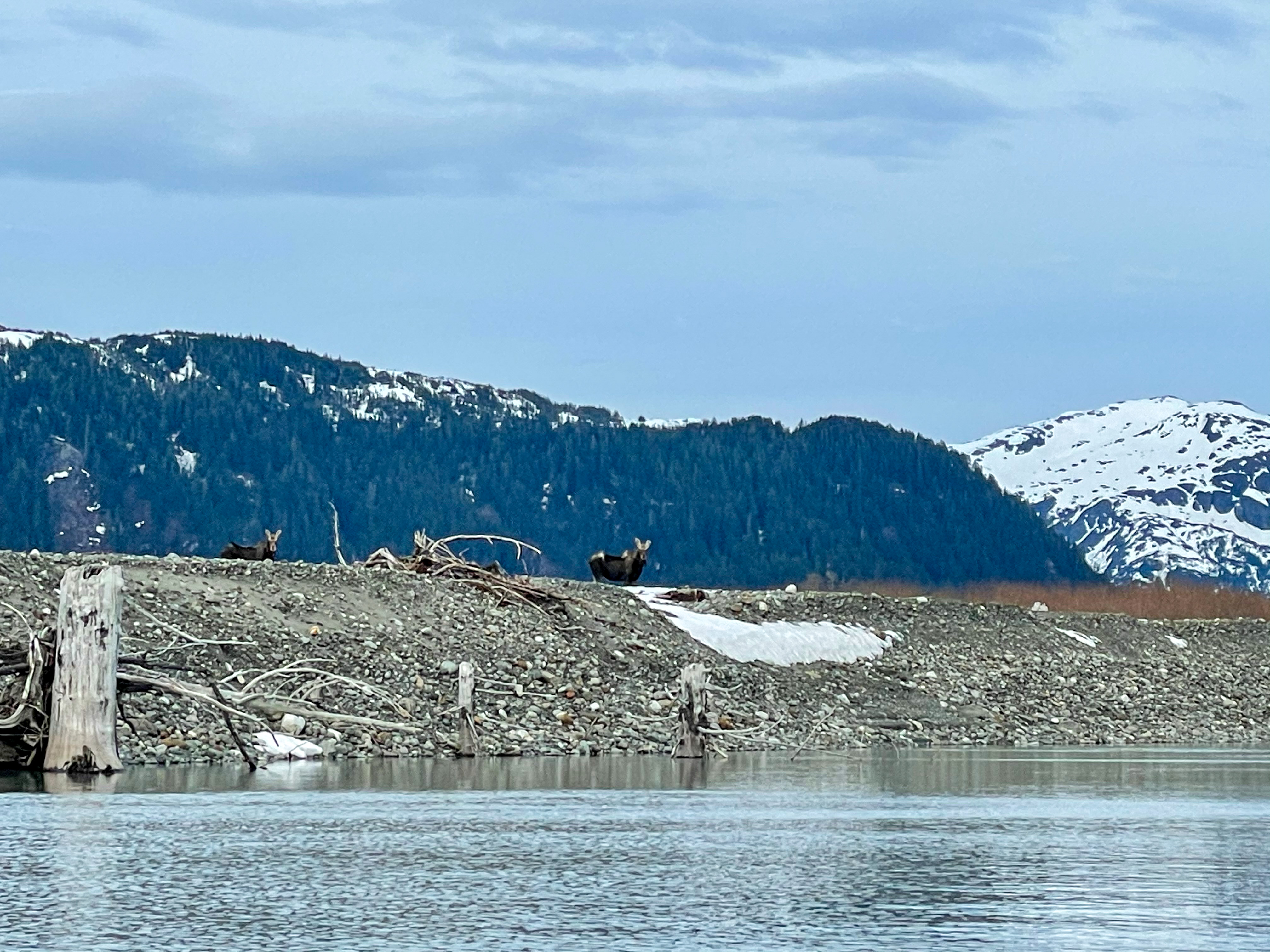
The next morning the weather looked good and we were able to launch! Not even an hour had passed, when we saw a moose and her calf grazing on the beach of an island. Shortly after, we saw a black bear walking down the beach towards them. We were wide eyed as we saw the moose mother chase away the bear, who quickly ran into the forest! Unfortunately, it is so hard to capture these moments with a camera! Crossing Glacier Bay ended up being easy, and once done, we tried our VHF radio to talk to the park ranger we had chatted the day before to tell them we had crossed safely. The ranger was a bit worried and wanted us to camp outside of the bay, as otherwise we would need to get a permit, use bear canisters and watch a training video. The outer coast, where we were headed, is not subject to those regulations – thankfully for us as the bear canisters would add even more weight to our packs!
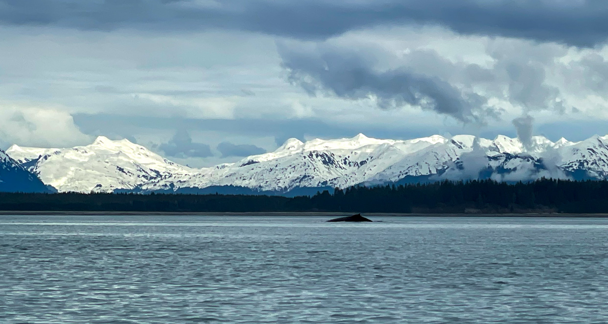
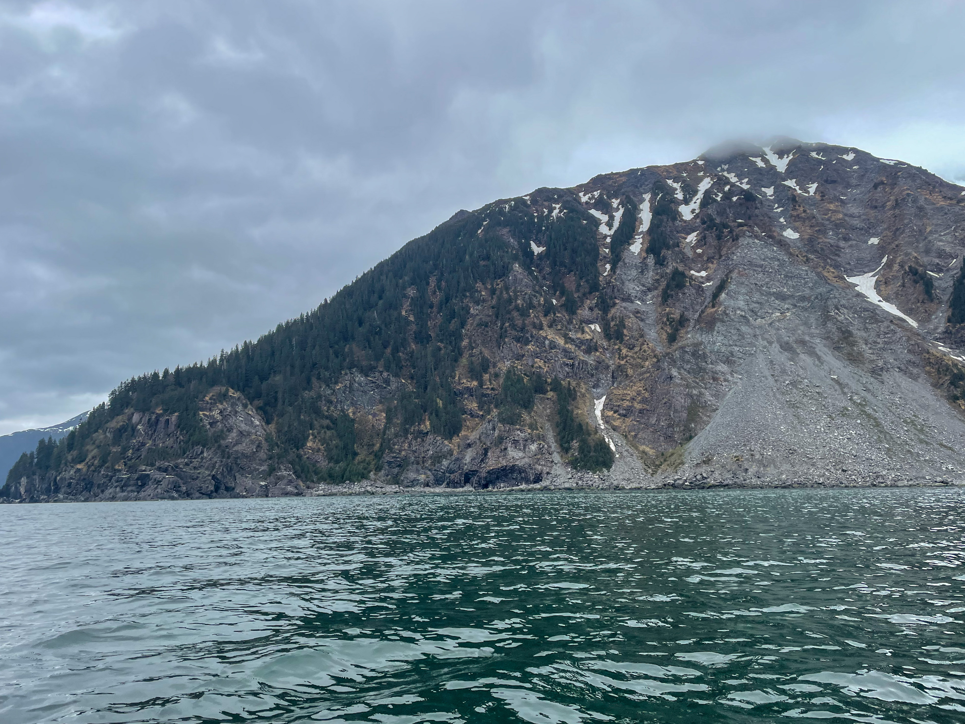
Our route would take us to Taylor Bay, and then on the side of the Brady Glacier onto a pass to the Dixon river, to avoid paddling on the open ocean with its bigger waves and surf. We could already tell we were getting close to the end of the Inside Passage as we started noticing large 5 foot swells. As we approached our last bay of the inside passage, Dundas Bay, we saw 7 orcas swimming by us: first 2 adults with a calf then another group of 3 adults with another calf. We have always dreamed of seeing orcas from close but had a hard time realizing that it was really happening. The sea lions, usually pretty boisterous, got very quiet and hid behind our packrafts. It was truly a magical moment.
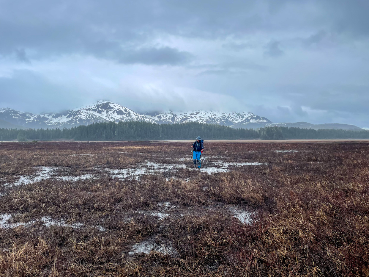
We continued fighting the swell and tricky waves to get to Fern Cove, the last bit of paddling in the Inside Passage! Hooray! The excitement didn’t last long though. But landing in Fern Cove and transitioning to walking then ended up being a mistake. And the first bit was hard mostly because our packs were so heavy. We saw a lot of geese and sandhill cranes as we entered the wetlands. We walked in the wetlands for hours, with our feet constantly in water. On top of that it started raining too and the bushes got very dense making progress very slow and frustrating. We desperately needed a place to camp but could not find a dry place large enough to set up our tent. We ended up bushwhacking and wading hip deep streams to a little forested hill where the only place where we could set up our tent was right next to a small spring turning the flattish area into mud. With all the rain that fell over night, the water progressed towards our tent but luckily never reached it.
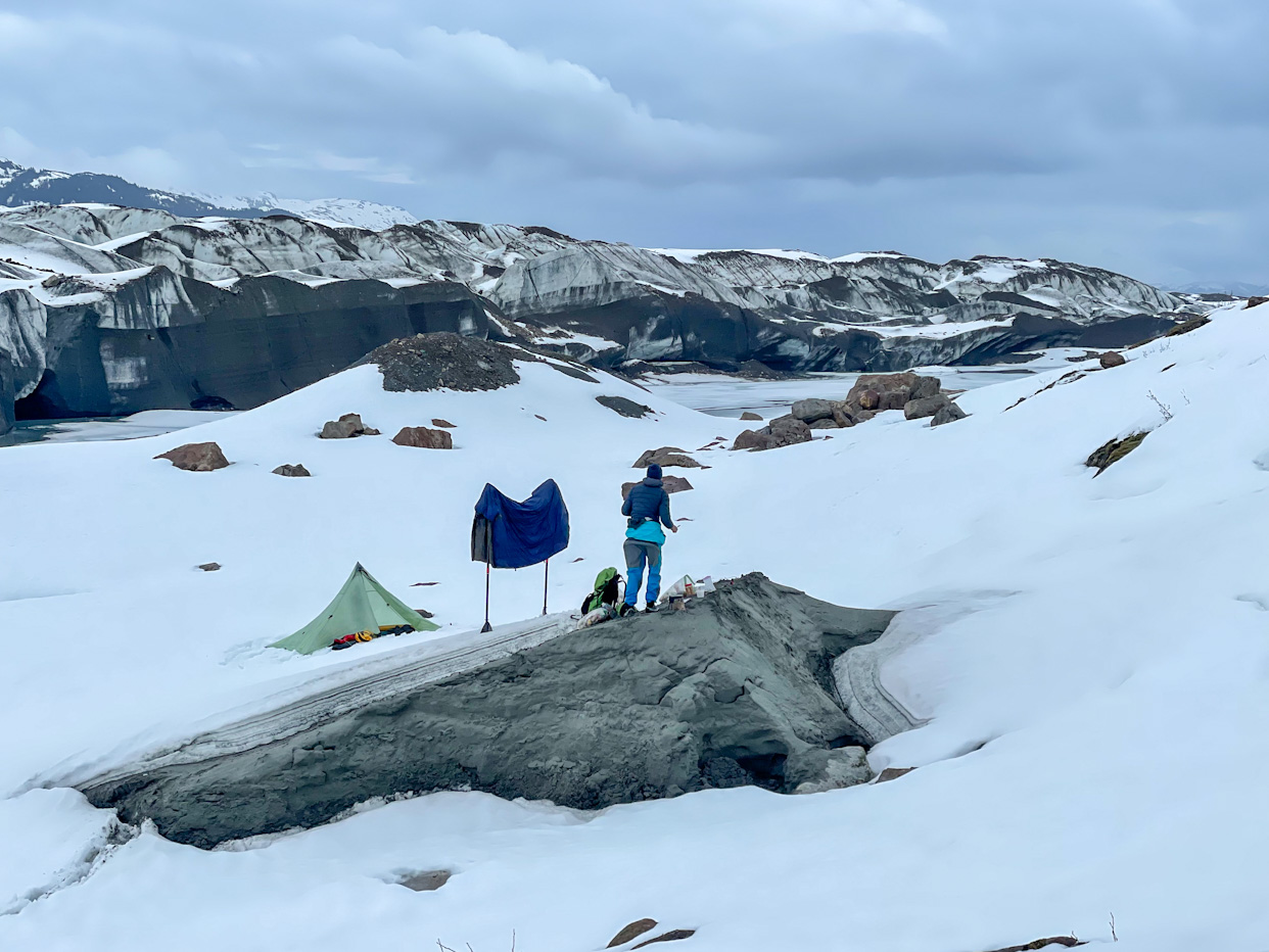
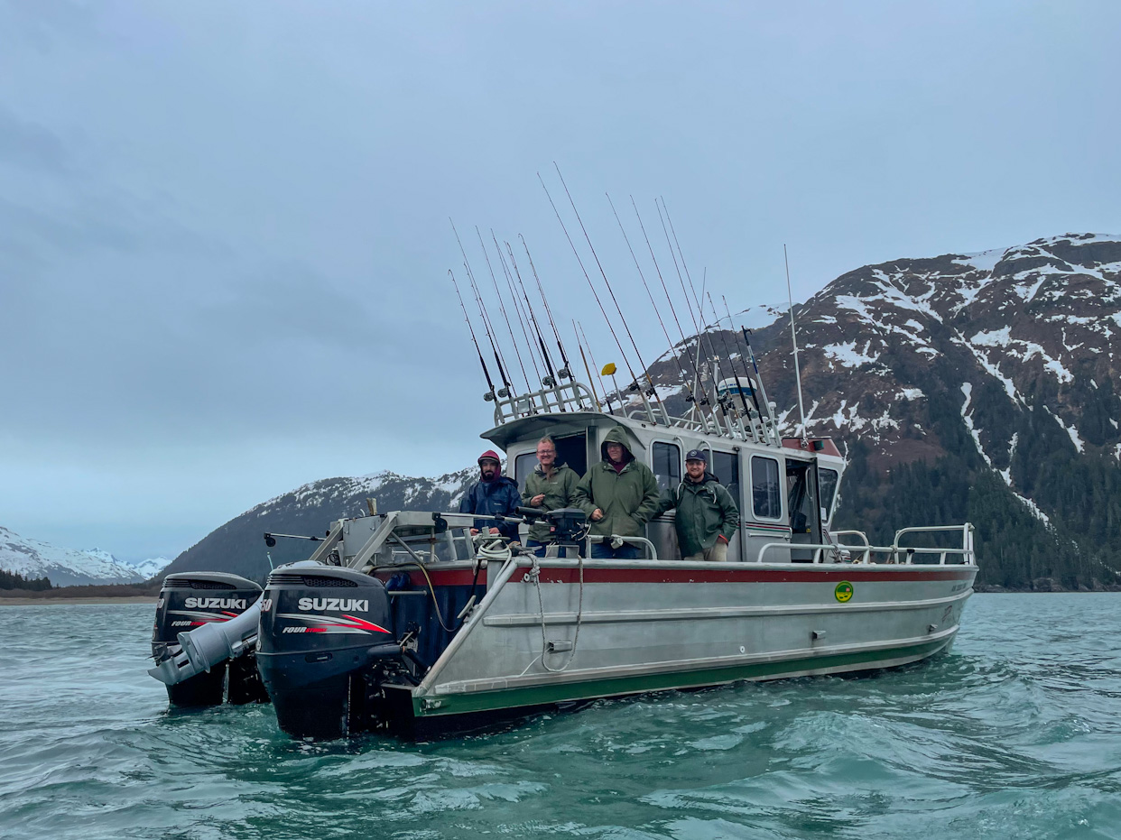
We thought that bushwhacking through the forest on the hill would be faster than walking through the wetland but this turned out to be wrong. We backtracked to the wetlands and walked increasingly in snow, fighting our way through pretty dense alder bushes. Reaching easier terrain at the mouth of the glacier felt like a triumph. We now had to cross the glacial lateral outlet, a stream that we decided to paddle upstream due to its low current. This turned out to be the easiest section of the da and it was so special to paddle next to this large glacier. As that stream iced up, we packed up our boats and started walking in the snow. First we made pretty good progress but more and more we were postholing up to our hips all the time making our progress very slow and tiring. Postholing is when you step in snow and you suddenly sink in, sometimes making it hard to pull your foot out of the hole. We decided to make camp early and come up with a strategy for the next day: build snowshoes. Ricardo went to cut willow branches while Salomé tied them together with the paracord we were carrying. We had never done this before and were trying to remember instructions we saw online. We set out again after a cold night in the snow. The snowshoes worked pretty well for Salomé after a couple of adjustments but they were just not big and strong enough for Ricardo. At the speed we were moving, we’d need at least 30 hours to make out of the snow. By that time we’d have eaten too much food to be able to make it all the way to Yakutat. We decided to turn around and try to get a boat drop us in Dixon Harbor, the bay we had hoped to reach by walking along Brady Glacier, and traversing to the Dixon river. Ellie, our friend in Gustavus, had to the same a few weeks before as their charter plane couldn’t land there anymore as the beach had changed, and they chartered a boat from Gustavus. We put Ellie in contact with Catherine, a friend of ours that agreed to be in the ground team that helps us with logistics when we are away from civilization. Catherine was able to find a boat from the nearby Elfin Cove Resort that could pick the next day and take us around the mighty Cape Spencer! Woohoo! We couldn’t have done it without their help, thanks! We backtracked and now paddled downstream the glacial outlet having to portage our heavy boats several times. The river flowed through a section of the forest that was covered by the glacier at one moment, cutting large trees at about 4 feet height leaving the stumps sticking out of the water.
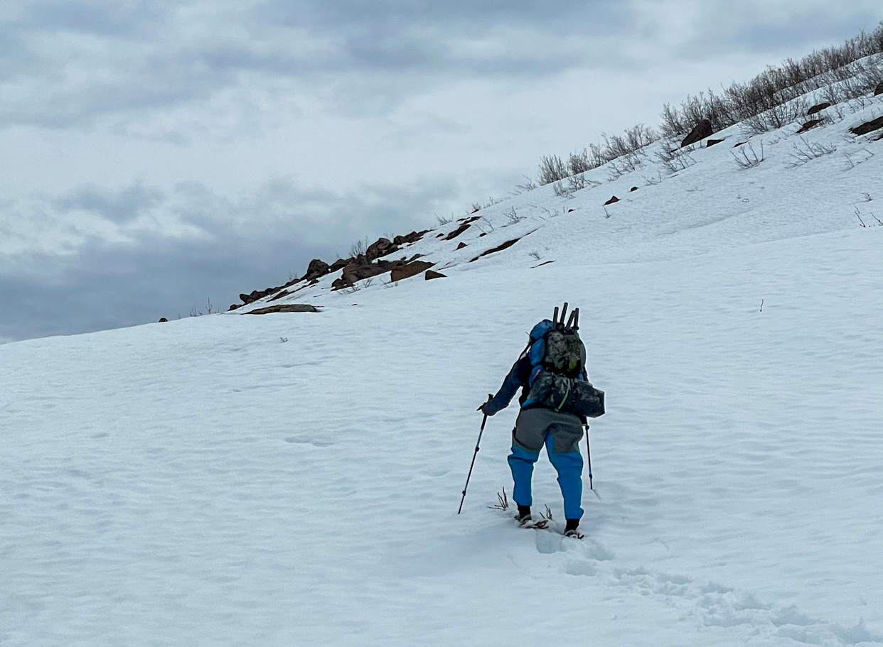
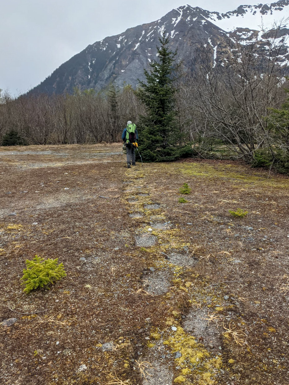
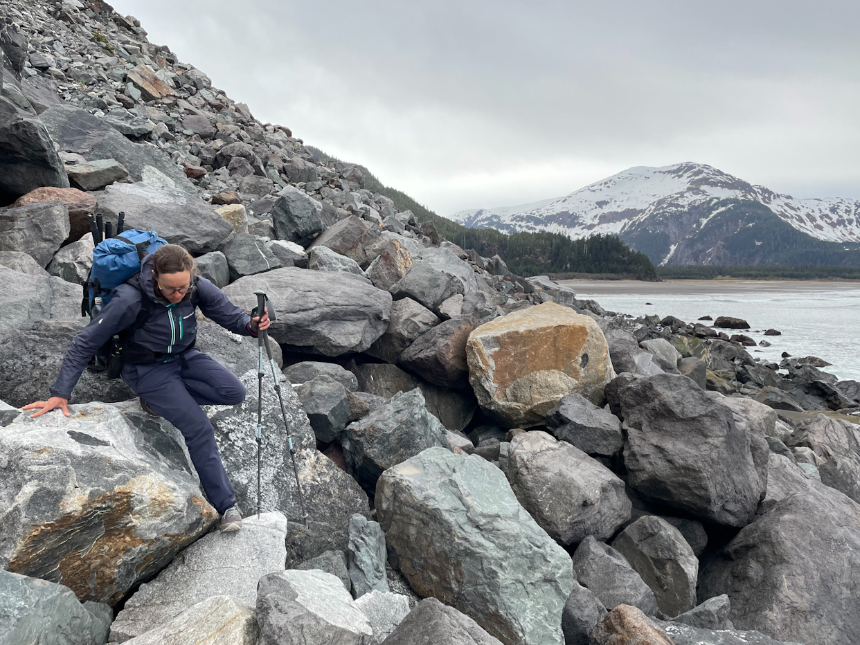
The next day the boat arrived 30 minutes before the agreed time, making for a rushed camp breakdown in the rain. The bay where we camped was too shallow for the boat to come close, so we had to paddle to it. The very friendly crew helped us get on board, which wasn’t easy from the packrafts. The fishing boat only had a small cabin where we all huddled away from the rain while traveling through many rock outcrops in bad weather around Cape Spencer. We were definitely happy to not be on our small packrafts there! Once we reached Dixon Harbor, the crew waited until we safely reached shore before heading off. Right as we landed the rain stopped and the sun even came out for a short moment allowing us to dry our gear. We found the animal trail, which was nicknamed the Wolfalator (wolf + elevator? It was quite steep definitely!) and quickly made it to Astrolabe Bay and then to Boussole Bay. We were so excited to start hiking, as that’s how we feel most comfortable and things were going very well. We decided to continue out and push for the tricky bushwhacking section around Mount DeLongle at about 5pm. Here the beach disappears making it necessary to walk across a tricky boulder field and then climb up the mountain side around the steep section. We made the mistake of climbing up a very steep scree chute, holding onto alder branches making us feel unsafe. Whenever we finally were able to top off the chute and make it to the forest, we were shaken and scared. We decided to stop and camp for the night on a tiny ledge in a steep forest. This was a hard decision as we only had half a liter of water left, but we thought it would be more prudent than continue moving tired and distressed. That night we didn’t cook and tried to eat the food that would make us the least thirsty, crackers with butter, some dried apples and a spoonful of Nutella. Fortunately that night it rained quite a bit and we were able to collect a lot of water off the tent. We inspected the way forward from the bit of forest, but it felt it was too steep to continue. Perhaps we understood wrong what Ellie had told us, and we went up one gully too early. In the morning, we carefully down climbed a steep forest (much better than scree!) and started climbing a gully that felt more promising. However, after an hour of climbing, we reached an impasse. A rock was in the middle of the gully and it required climbing moves to go around. We must be in the wrong spot again! We used our satellite communicator to contact Ellie and Hig to get tips, Ellie has traveled through there two weeks before and Hig did it many years back. Ellie thought that we went one gully too far, whereas Hig thought that there should be a route from the trees where we had camped the previous night! We were again back to square one and very tired from the steep and sketchy climbing, and decided to cross the boulder field again and go camp at Bussole Bay, having to cross the complex boulder field once again. We were about to quit at that point, after having failed to do the snow crossing and now the first complex climb on this section! Ellie continued to encourage us to persevere and we decided to try it again the following day with more detailed route description.
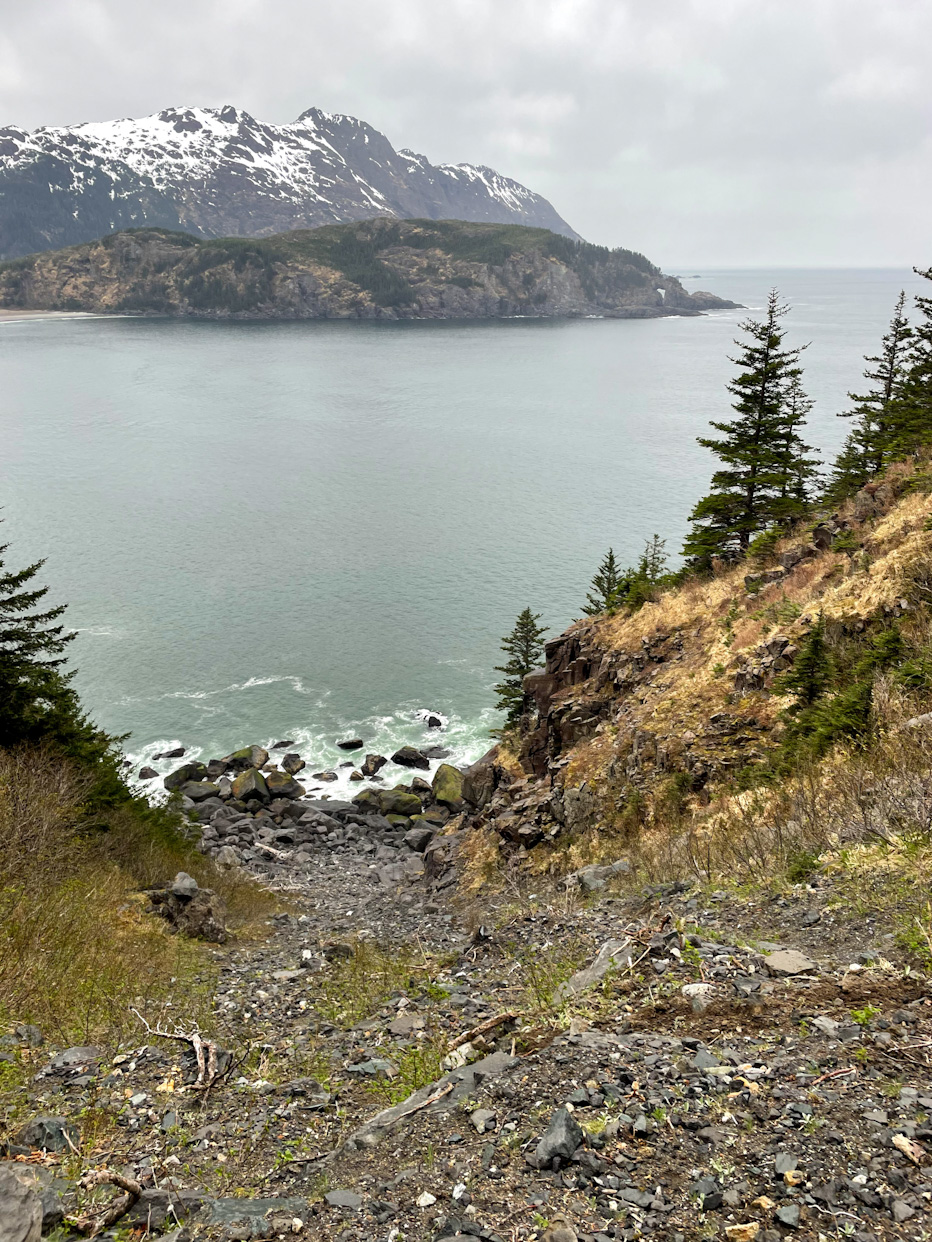
And on the following day we finally had some luck. As we packed up camp in a field of willows and headed back to the beach towards the boulder field, we saw that the seas were calm with only very small waves! Let’s paddle instead! The whole point of climbing around the side mountain was to avoid the headlands, but we would be much faster if we just went on the water! We quickly transitioned and started paddling. Looking at the mountain from the water, we could see our mistakes, and yet we couldn’t fully figure out the exact gully that Ellie meant! It didn’t matter anymore as we were sailing by. It felt a bit like cheating, but at the same time we were so happy to have the mountain behind us! The seas stayed calm, so we decided to continue to the next Bay and skip another bushwhack above some headlands. We were by Icy Point! From now on, we could mostly walk the beach to Yakutat! We can make it! We were so happy and relieved.
Looking back, we are still tuning our skills to Alaska. We definitely made mistakes reading satellite imagery when planning our route around Taylor Bay and its wetlands. Ricardo also followed his climbing instincts from the Cascades, where climbing on scree gullies is common and missed easier routes in the forest. As well, the very deep snowpack this year made our route much harder than we expected (Alaska received record snow amounts this year)! We regret not having read more about building snowshoes in the field, we didn’t think we would need it at sea level in May! But in the end we only skipped a 10 miles stretch out of a 200 miles section.
Comments
Lewis C Sharman
Well done! Glad you persevered! - Lewis & Ellie
Julia heinz
So much fun to read your blog and see your photos . Thanks! I was one of folks on Ellie and Lewis’s trip this year. Fantastic you made it..I wouldn’t have been able without Lewis , Rowan and Ellies knowledge of the trail
Franky Bain
That was some hard going Salomé and Ricardo! So glad you got to paddle around the mountain bit! Really incredible to read