Connecting the dots at Icy Bay
We made it to Icy Bay! We got to the same lodge where we took shelter when we decided to pause the trip last May. Thus, we closed the loop from Ketchikan to Healy, from Alaska’s southernmost city to the border of Denali National Park. We are so glad we continued our trip in Alaska, as we really enjoyed this second part of our adventure. We were able to thoroughly enjoy the traveling in the coast this time, partially thanks to better weather compared to this spring.
It wasn’t easy to get to Icy Bay. The day we got to the Alaska Expedition Lodge, by the Tsiu River, we learned about a storm coming in the next day with winds up to 50 mph. Jason and Leslie, the lodge owners, let us wait out the storm at the lodge. What a relief! The next night, the cabins shook all night in the strong winds. We would have not been able to move much with such weather, especially that most of the time we would be walking on the beach without a forest close by to take shelter. We were also delighted to stay longer at the lodge, as the food in the lodge was superb! By far the best food we had had in Alaska, and in such a remote setting! We also met the other people staying at the lodge, a group of 4 from Washington State fishing and duck hunting, and Jamie from New Jersey, who was there to hunt a brown bear and a moose.
It was hard to leave the comforts of the lodge. The weather had not fully cleared, it was raining lightly, and there was still a breeze, which became stronger when we got back to the beach. It got very bad, strong winds and rain, as we got to the mouth of the Tsiu River. We found a group of 4 fishermen fly fishing in the wind, and we crossed the river in one raft just below them. They seemed very successful, in the few minutes we were there, they got at least ten silver salmon. It might be right what they say that the Tsiu is the best spot to fish silvers. One of the fishermen came to talk to us, he was from Alaska and told us where to find the lodge. We were starting to soak through our rain gear. Perhaps we could dry out there. We continued on ATV tracks on the other side, and got to the lodge an hour later. They were very unfriendly at the lodge and their manager kicked us out as fast as he could. It was shocking experience, as we had gotten used to Alaskan hospitality and kindness. In remote places we find that people are usually very helpful to each other and normally you would be invited in and offered at least a warm drink. This negative encounter left a bitter feeling in our hearts for a couple of days. We started to wonder what kind of welcome we wind received in Yakataga and Icy Bay.
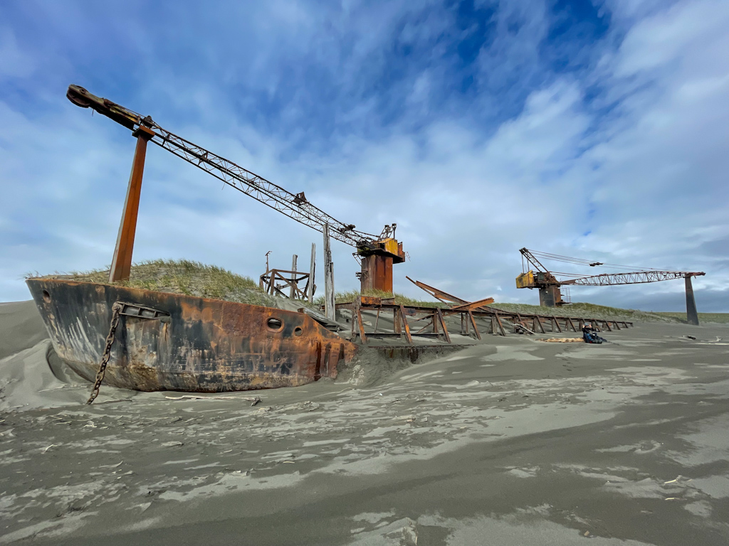
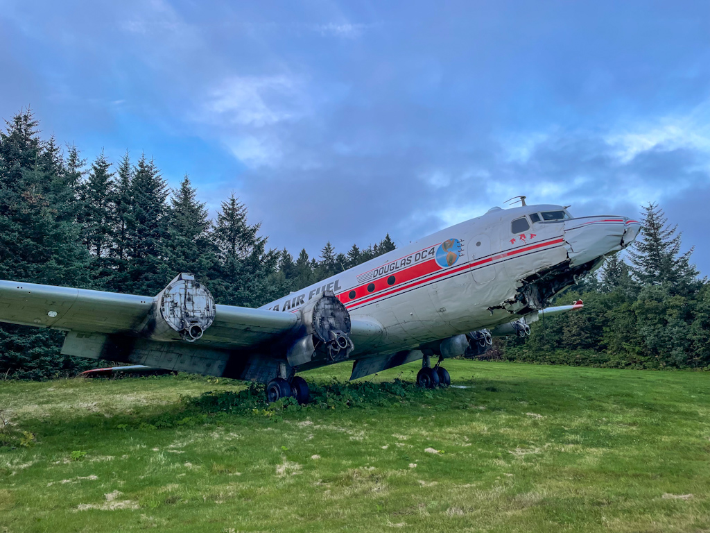
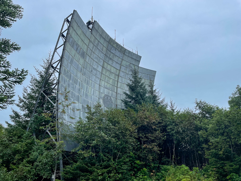
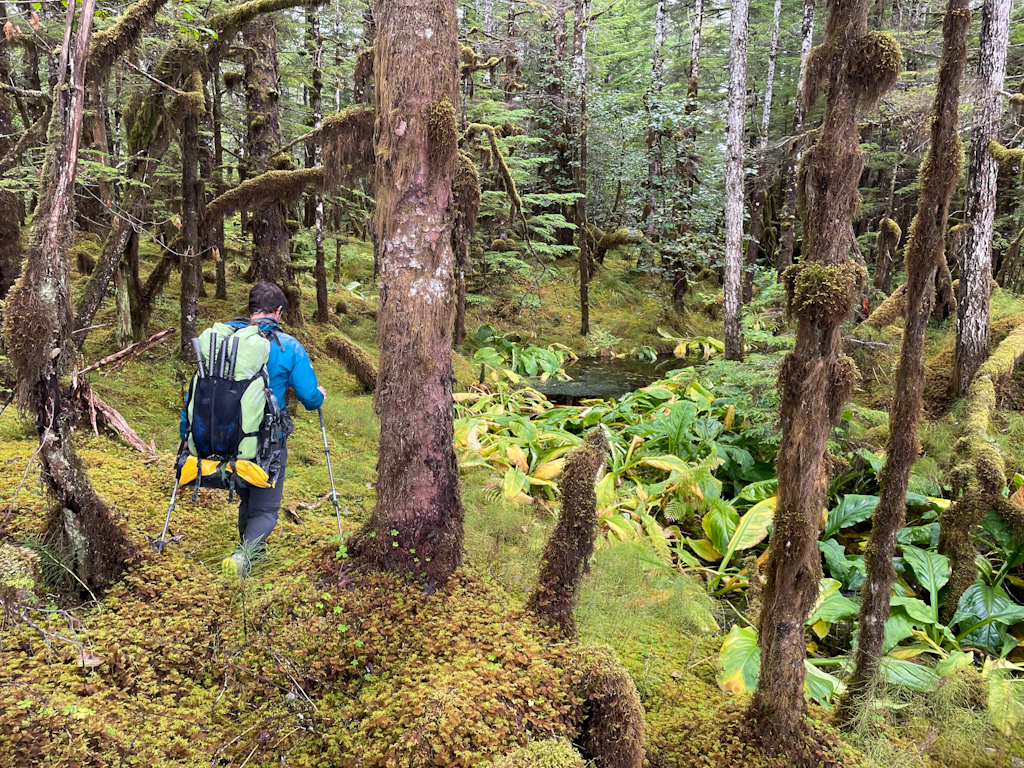
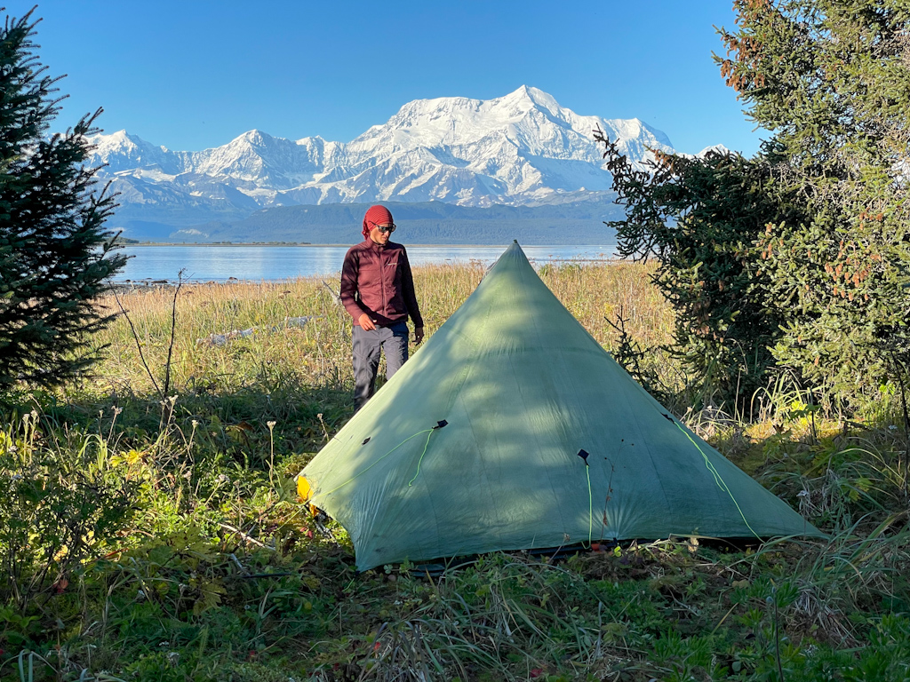
We found a protected camp spot among spruce trees and strawberries plants that are turning red. Ricardo climbed down the steep sandy river bank that was about 20 meters high to the Kaliakh River to get drinking and cooking water. We then took shelter in our tent. We kept all our wet clothes on and waited for them to dry, not very pleasant, and made a tea to keep us a bit warmer. The next morning it was still raining and we decided to wait. We did not want to soak through again. We listened to an audio book and started to make plans for what to do after we reach Icy Bay. At noon it stopped raining, we packed up shaking off the many slugs that were on our tent and gear. We started by climbing down the steep river bank, inflated our boats and crossed the Kaliakh River. By the time we were across, the sun came out, what a pleasant surprise. We saw far away a beached cargo ship, whose cranes were sticking out of the sand, and rusting away. The beach to the Duktoth River was easy, hard packed, letting us make good progress. We crossed the river and got to the Yakataga airstrip, a massive grassy strip made for jets to land. Cape Yakataga used to be a military radio station back in the day, and there is still a civilian radio facility. We explored a bit around the airstrip and found a wrecked DC-4 fuel plane, that apparently crashed last year due to muddy conditions on the runway. We followed the small road system after the airstrip and found several dilapidated cabins. We considered sleeping in one of them but ended up being so grossed out being inside of it that we camped in the garden. The next day we met Richard on the trail, a gold miner that has lived in Yakataga for 14 years, and was on his way to cut firewood. There is only one other mine in town, and both of them make a good living out of it! It was so refreshing to talk to such a nice and interesting person, and we finally let go of our bitter feelings from our last encounter with fellow humans.
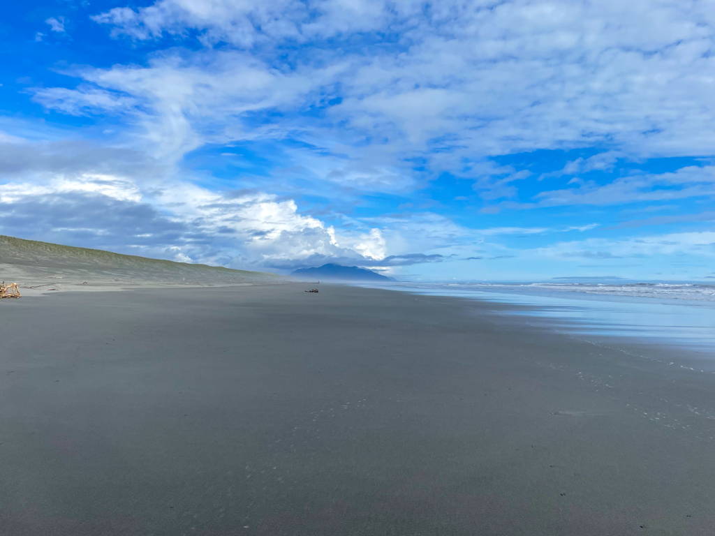
We continued on the beach for a few miles. We could have followed an old road to the White River, but the road looked heavily overgrown on the other side of the river, and we would have had to bushwhack a few miles to the beach from the road. A front came in throughout the day, and we got quite wet again. We took advantage of the few breaks in the rain to stop and eat. The old logging road from Yakataga to the Alaska Mental Health Trust lands, that are frequently logged (trees pay for therapy in Alaska), seemed to restart after a few miles, but we couldn’t find it from when we went to look for it, so we continued on the beach. The walk was easy, it was not worth dealing with bushwhack on an uncertain road. We finally camped in a mossy strawberry field dotted by small spruce trees.
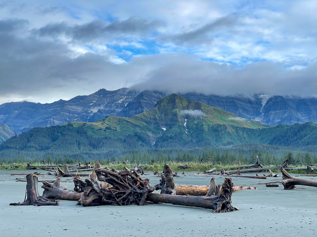
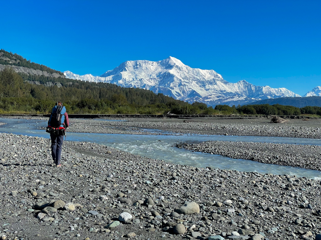
The next day we continued on beach towards a big airstrip used for the logging camp. We made good progress on hard packed beaches, thanks to a very low tide. The landscape changed however, when we crossed the Big River. The beach became narrower and steeper, and the forest closed in on muddy cliffs. It reminded us to the same muddy cliffs we saw on the other side of Icy Bay, more than two months ago! We were getting close to our destination!
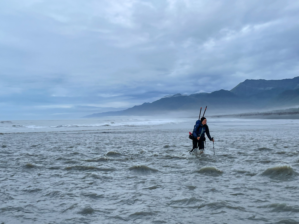
The tide was rising quickly, and the beach disappearing at the same time. We raced forward, hoping that we could get to the other side. But it quickly became clear that we were going to get stuck. We turned around and tried to find a spot to climb over the cliffs and continue on the forest. Ricardo started climbing up a short gully, while a wave ran up the whole beach, getting Salomé wet. The first few steps were easy, but it quickly became very muddy. Ricardo tried grabbing a root from a fallen tree, and pull himself up the mud, but failed, and got himself stuck in the mud, way above his knees. Salomé downclimbed and waited for Ricardo on the ever disappearing beach. Ricardo tried to dig himself out, but the mud was very sticky and it was hard to even scoop it up with his hands. We had been wearing rain pants and his were now covered in sticky heavy mud, and falling off his butt, making it even harder to move. Salomé was worried, as there was no way for her to help him now. Ricardo finally managed to get one foot unstuck, then the other, then the first one, that had gotten stuck again, but not as badly. When he finally got to the bottom of the gully, a small avalanche of mud came down with him and he slowly slid with it, resting finally on the beach with his back on a sticky mudpile. He was thoroughly covered in mud.
We couldn’t do anything about it then, we had to get it out of the incoming tide. We walked back, Ricardo holding his incredibly heavy rain pants, which just wanted to drop down. By the time we found a small creek breaking through the mud cliffs and protected from the surf, Ricardo’s pants had broken from where he was holding them. He stripped down, and we cleaned all his clothes in the stream. Only his t-shirt was mostly saved from the mess. Finally we were ready to get going again, and we easily climbed over the cliffs by the stream. The forest above was actually not very dense, and easy to travel. We should have never continued on such a beach! Easy to say now…
We identified a logging road a bit less than a mile away, next to large clear cuts in the forest, from where we could reach the road system and save us from extra bushwhacking. It was hard to see how this spectacular forest was being logged, but at the same time, almost no one ever comes here. We continued on the labyrinth of logging roads and made it to the big airstrip. From there we took a well maintained road that would take us to Icy Bay in 6 miles. Half way down a car came by. Ricci and Dorette were heading to the end of the road to fish, wondered what we were doing there and offered us food. We didn’t need any, but couldn’t say no to their offer of smoked salmon. They drove back to their camp and gave us two frozen packs of smoked salmon. We could have them the following night, on our last night of the trip, if everything went well!
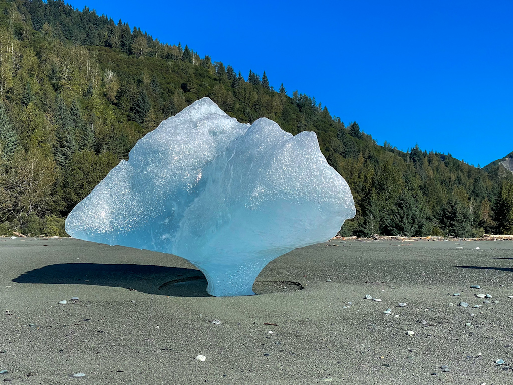
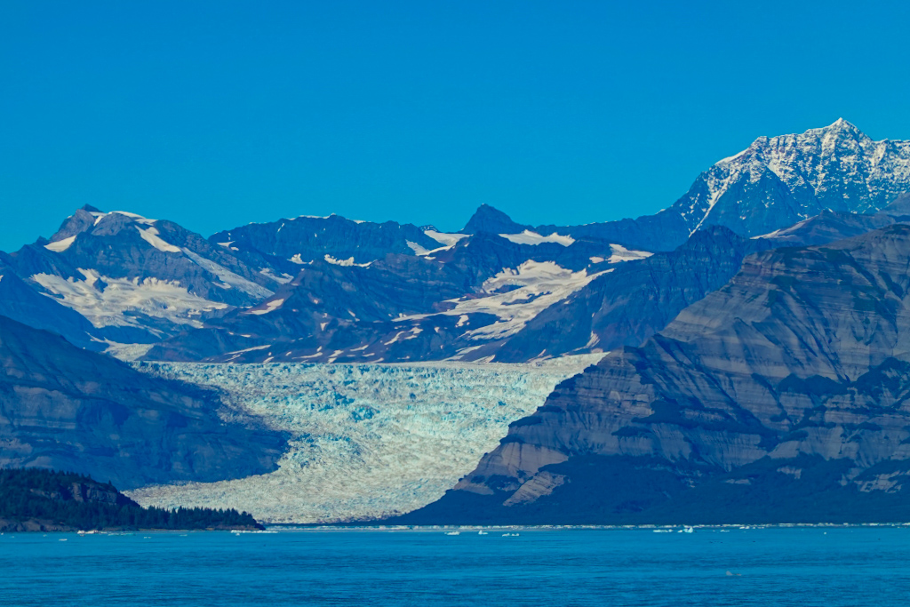
We finally made it to Icy Bay, and what a difference the good weather made compared to what we saw in the spring! We could see the Malaspina glacier and the massive Mt St Elias! It was beautiful in the evening sun. We could also see the other side of Icy Bay, where we were in May and our destination for the next day. We continued on the beach, that was littered with small icebergs, and camped on a small grassy spot, where our tent was barely visible in the chest-high vegetation. Hopefully the bears walking down the beach wouldn’t see it either.
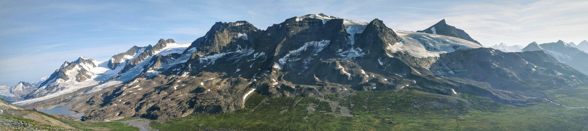
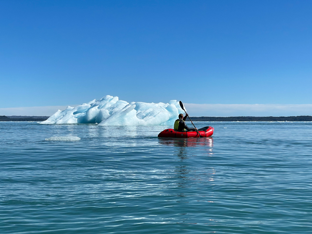
In the morning, we decided to continue further down into the bay. We could have started the crossing of the bay from where we were camped, but we were hoping to get better views a bit further in. And we did. First we saw a large peak, bigger than the ones we had seen before. Seconds later, an even taller peak started appearing behind the close by ridge. We had been wrong the night before, and this was our first sighting of Mt St Elias! It was so tall, and fully covered in glaciers. It’s 18000 ft / 5500 m high, and yet only 12 mi / 20 km from the ocean. And the weather was stunning. We couldn’t be happier. We made it a bit farther, and prepared for the crossing. It was 4.5 miles to a first island, and then 1.5 miles to mainland, where we would be within a half mile of the lodge. The water was surprisingly clear, and cold. The sun was out, and we started sweating inside our dry suits. Too cool off, we would just dip our feet in the icy water. We headed towards a large iceberg in middle of the bay. We thought it was close, but it ended up being so far, that we had to take multiple breaks before reaching it. We are also not used anymore to such long paddles, it’s been a long time since our last long crossing in Yakutat Bay. It’s so hard to gauge distances in the ocean: iceberg ended up being enormous, at least the size of a house sticking out of the water. We didn’t get close, as they can tip or break up any second. We finally made it to Gull Island, and after a quick pee and snack break, we continued onto the mainland. We decided to camp on the point, where we would have views of Mt St Elias, the Malaspina glacier, and many more peaks.
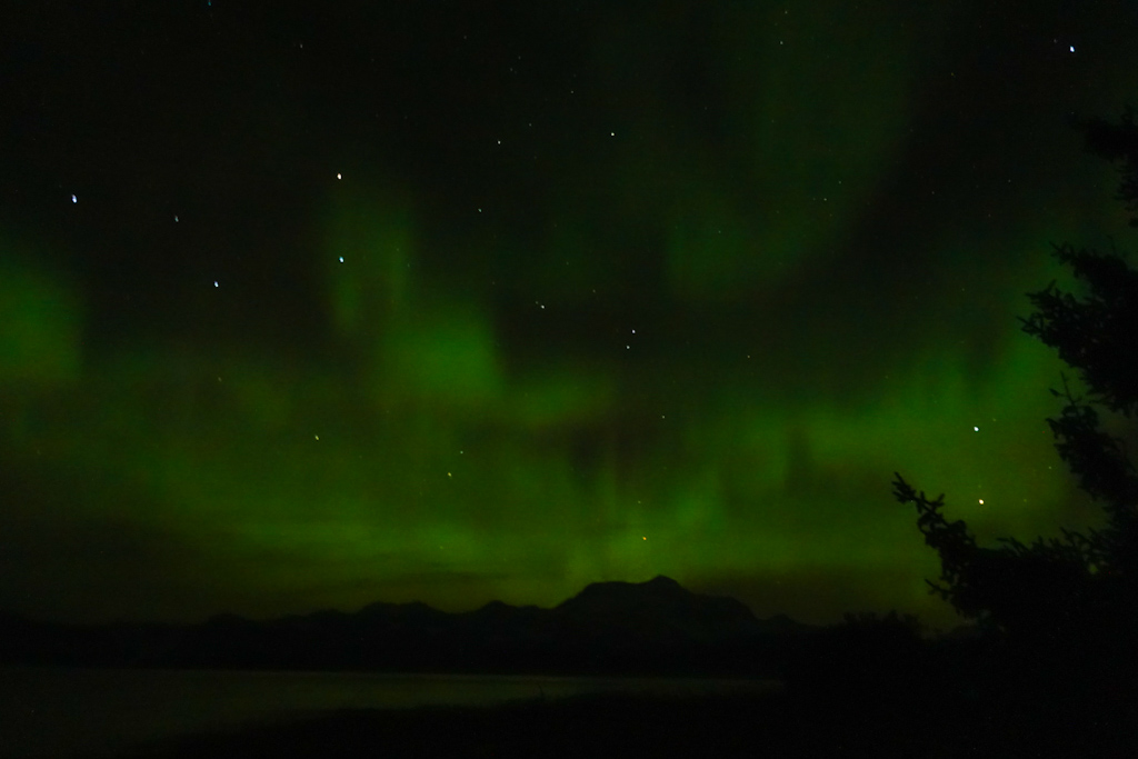
We couldn’t ask for more on our last night of the trip. We made a meaty mushroom soup, and smoked salmon pasta, cannibalizing several of our homemade packaged meals, that we had grown tired off. We made a big fire and enjoyed the views until dusk. At 2am, Salomé woke up to discover there were faint clouds above us, that seemed to appear and disappear in a snap. It was the Aurora Borealis!
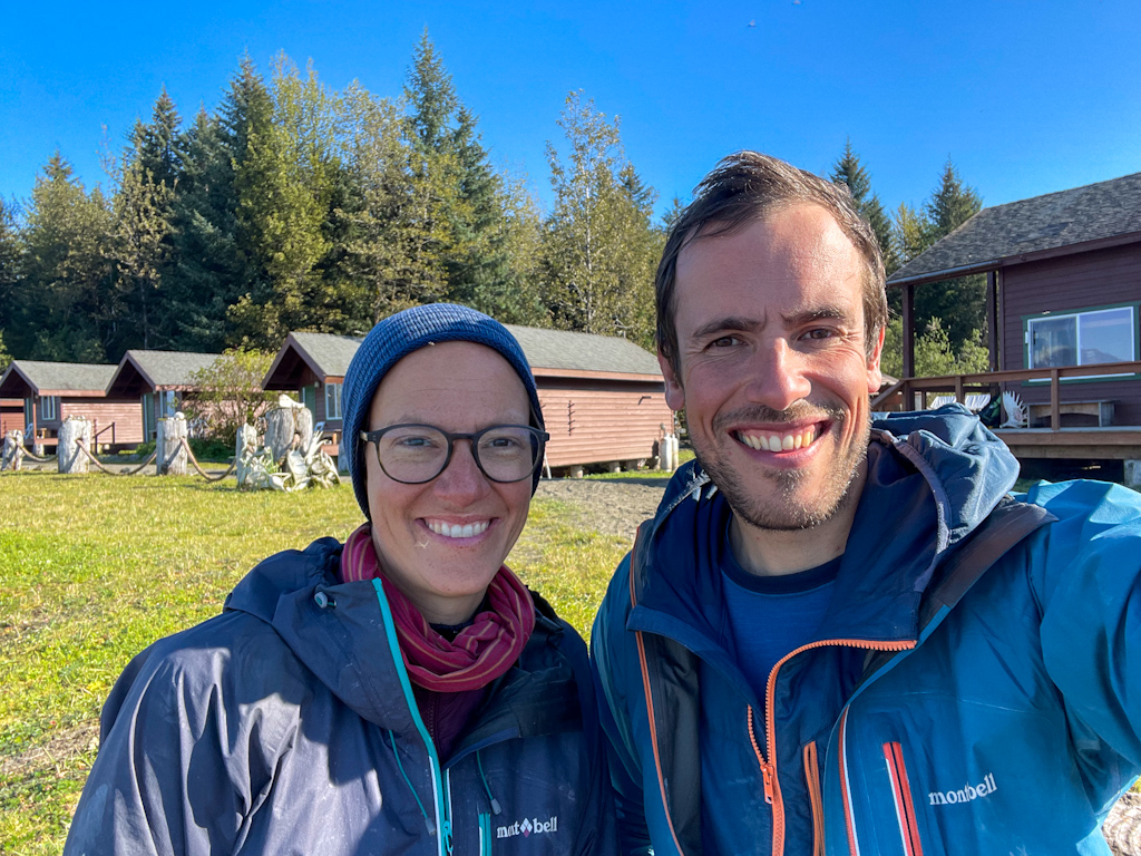
The next morning we enjoyed breakfast with similar views until a front of dense fog came into the bay. Steve, our pilot in Cordova, was supposed to come pick us up, but he wouldn’t be able to do it if the fog didn’t lift. We walked to Icy Bay Lodge that was just around the point, and its staff was extremely welcoming. We had already stayed there two nights waiting to get picked up by Steve in May, so we recognized the place. This time however it was bustling with activity, with multiple clients on their way fishing, a busy cook, and others doing repairs. As we waited to hear from Steve, we realized that he wouldn’t be able to land on the beach like he did last time, and Lori, the lodge manager, generously drove us to the airstrip a few miles inland. Steve came an hour later, and off we went to civilization. On the flight back we watched sand hill cranes making their way south, similar to what we will be doing in a few weeks. We also marveled at the massive Bering Glacier, and the stillness of the Copper River Delta.
That night in Cordova, Lauren invited us back for dinner, local oysters that we shared with her, and her son and partner. The next day, Arthur, whom we met on our way to McCarthy a month ago, would pick us up from Cordova in his small airplane and bring us to his cabin in Chisana.
Parting thoughts
With this section, our trip came to an end. We connected Ketchikan, Alaska’s southernmost city, and Healy, just north of Denali National Park over a bit more than 4 months with a month break in the middle. What a trip!!! We started back in late March, and it has been a rollercoaster of the most amazing wilderness experiences, the most miserable travel conditions, and everything in between. We’ve also met tons of amazing Alaskans, that have shown us many different ways of living, and taught us so much about Alaska’s history. We couldn’t be more grateful of the time we spent here.
When we set out of Seattle, our goal was to make it to the Arctic, hence the name of our blog, north2arctic. We also hoped to make continuous footsteps, without skipping sections due to boredom or because they were harder, similar to the trips of Erin and Hig, or Caroline and Pat. We occasionally had to give up on continuous footsteps for safety reasons, when we realized that we didn’t feel confident crossing overland in Yes Bay, as the winter lingered far longer than we had thought. We also had to boat around Cape Spencer, as the inland crossing was extremely hard due to tricky snow conditions. But giving up on our initial goal of making it to the Arctic was harder.
We had initially planned a trip with minimal stops in town, having a rest day once a month or so. But that was unrealistic for us, after many of our sections we were beat, we needed several days to rest, organize our next section, write this blog before we could get back on trail. During those rest days we were also able to meet so many amazing people, and those encounters gave as much color to the experience as the time we spent in the wilderness. They just don’t translate into pretty photos for the blog or Instagram, but into friendships that we look forward to cultivating over many years. Our initial plan also didn’t leave much space for waiting out storms. The weather can be really terrible out there, specially in the shoulder seasons that we traveled in. We learned to wait out the fiercest storms in town, or in forest service cabins, you don’t get extra points for suffering.
Finally, the crux of our planned route was going upstream the Copper River to McCarthy. As we researched that section, several experienced Alaska travelers warned us against it. It’s not impossible, after all, that’s the way the explorers went to discover copper in Kennecott, but it would be extremely brushy and difficult. Other alternatives were not easy either. We could have paddled from Cordova to Valdez for a week and then walked the road, or by somehow get to the Wernicke Glacier and travel for miles on the glacier to the St Elias Range. As we were in Icy Bay in May, the complexity of that crux also weighed on us, plus the inclement weather on the coast to reach Cordova as well as Ricardo’s for injury that needed some rest to heal (it rained hard for a week straight and before that we did not get a fully dry day in 2 weeks).
All in all, we feel very happy with the decisions we made, and with how our trip came to be. It’s always good to have a plan, but it is even more important to adapt as you go. When we started this adventure we had a lot of backpacking experience but hardly any Alaskan and packrafting experience. We knew we’d learn along the way and we managed to do 4 out of the 6 big sections of the trip, and missing out mostly on the Brooks Range section, which we were both looking forward to do. However, neither of us was very excited about biking the Haul Road to the Arctic, with 18-wheelers zipping by and throwing rocks at you for miles non-end, so maybe it’s for the better.
Alaska’s wilderness is of such a different scale than anything we have experienced before. It is both harder, wilder and more rewarding. We go back home with so many lasting memories and feeling proud if what we achieved, just a little bit sad that this amazing experience and dream had come to an end. We doubt it won’t be long until we come back to Alaska to continue exploring! And crossing the Brooks Range is at the top of our list.
We are writing this blogpost from an off the grid cabin in Chisana in the Wrangell-St Elias National Park, a place you can only fly in with bush planes. One, of the many friends we made along the road has invited us to spend some time there and this couldn’t be a better place to end our Alaska journey: good food and conversations in a stunning place. We’ll describe our time in Chisana in a future post!
Comments
Ellie Sharman
WONDERFUL to see your smiling faces in Icy Bay. CONGRATULATIONS! I knew you’d like the Lost Coast. Glad Saint Elias didn’t disappoint.
Annie Mackovjak
Congrats on making the loop by foot and paddle. What a grand adventure! Such great photos! We look forward to seeing you back in Alaska - our door is always open.
Eric Stollnitz
Congrats! What an amazing journey! So glad you enjoyed this section and shared your wonderful stories and photos with us.
Josh Levine
Damn those are some beautiful photos! Can’t wait to hear all about it in person once you’re back!